


Good Tuesday morning! The remnants of Hurricane/Tropical Storm/Tropical Depression Idalia are spinning to our south this morning. It’s not currently being monitored by either the National Hurricane Centre in Florida or the Canadian Hurricane Centre in Halifax. This means, at this point, both organizations are looking at it like it is a standard low-pressure centre, which it is at this point.
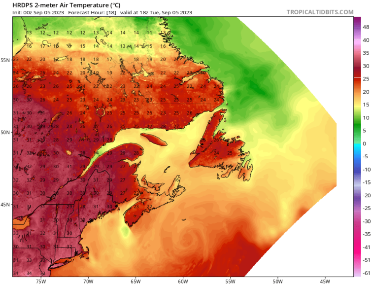
You can see the circulation spinning, clearly, in the waters south of Newfoundland and Labrador, and it’s backing into the Maritime Provinces. This setup will primarily drive easterly flow across much of the region today. Which will result in cloudy skies and cool temperatures for most of the Island, east of the west coast and south of the GNP. Those 2 areas should see sunshine today, along with much of Labrador.
High today will be into the teens to 20, even with the easterly flow into the region. The HRDPS model does a good job of showing that.
Something else of note is that there will be high waves along and near southern shorelines of the ISland for the next couple of days. Waves just offshore are predicted to be 2 to 3 meters. This may result in higher than normal tides and locally high water for some communities.
The high waves will last through Wednesday before subsiding on Thursday.
Have a great day!
/Eddie
-

Your Latest Forecast!
Click here to visit the NTV Weather Centre to get your latest forecast!
-
Eddie’s Forecast; Some slight improvements for Friday, more noticeable this weekend
The area of low pressure that has driven all the wet weather across much of…
-

Eddie’s forecast; May starts like April ended
May starts like April ended… cold and damp for much of the Province. Eddie has…
