


A HEAT WARNING IS IN EFFECT FOR MUCH OF NEWFOUNDLAND AND PARTS OF LABRADOR
The hot and humid weather we’ve seen for the last few days across much of the Province will continue for the next several days, with little relief in sight for many of us. The reason for this is twofold. There is an area of low pressure well west of the region and a high-pressure region to our east. The counter-clockwise flow around the low and clockwise flow around the high act in unison to pump hot, humid air into NL from the south. The animation below from Windy.com shows this very well.
This weather pattern looks to remain in place through at least Wednesday in its current state. This will keep temperatures into the middle and upper 20s, to lower 30s across the Island and portions of Labrador through the time frame.
There will be exceptions to this, however. Areas of southern Newfoundland, from the Port aux Basques to Cape Race, are in the onshore flow. This onshore flow is driving fog and drizzle across nearly all of the Island’s south-facing shorelines. Temperatures in this area are also cooler and struggling to reach 20ºC. This pattern, too, looks to stick around through mid-week, and possibly well beyond. The satellite image below shows this rather well. The light blue cloud is the fog and drizzle as seen on the afternoon of July 17, 2023.

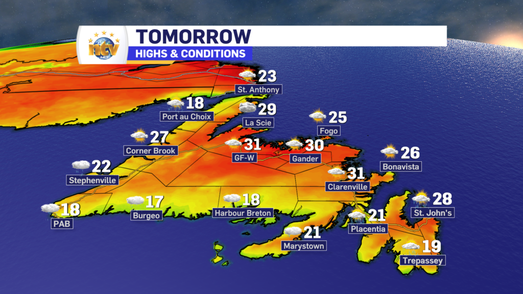
The Forecast: Newfoundland
Tonight across the Island will generally see partly to mostly cloudy skies. There will be some areas of drizzle along south-facing shores. There is a chance of showers late for the entirety of the Burin and Avalon Peninsulas. Even the Metro may see a sprinkle early Tuesday morning. Lows around 20º and winds will be relatively light from the west or southwest.

Tuesday will see highs in the upper 20s to near 30 (or higher) for much of the Island’s West Coast, Central, and northeastern areas, along with northern sections of the Avlaon / Metro. The GNP will also be in that boat. Expect partly cloudy skies. Areas south will be more cloudy, with fog patches and drizzle. Highs will be nearer 20º the closer one gets to the south-facing shorelines.
Wednesday will see some showers in the south and they will creep up the West Coast and bit farther. Highs will be in the mid-20s to near 30. Thursday will see a few more showers across the board and Friday may bring some rain to Central. Highs to close out the week remain in the mid to upper 20s. There is a chance of rain Saturday as well, but the forecast is well-aligned so that’s all it is for now.
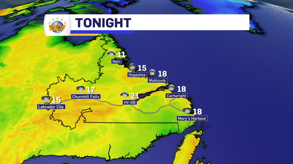
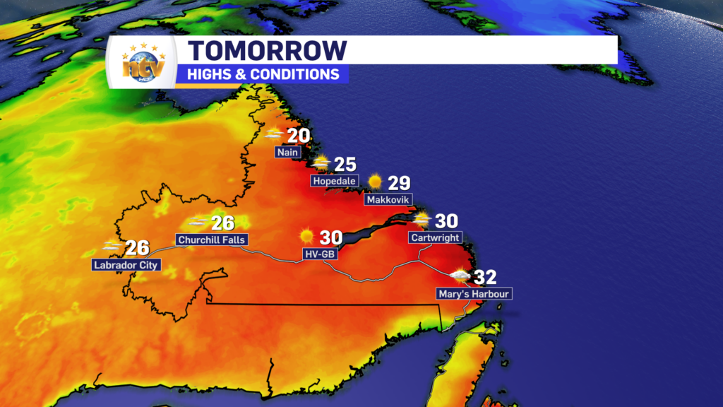
The Forecast: Labrador
Partly cloudy overnight across the Big Land, with lows of 15º to 20º. Risk of showers in the west.
Tuesday will see more sunshine and warm to hot temperatures. Expect highs in the mid-20s to near 30, or a bit higher. The warmest readings will be in the southeast, where of offshore flow will bump things up a bit more compared to inland counterparts. Winds are from the west and will gust as high as 50 in the West.
Looking ahead to Wednesday, expect some showers in the east by afternoon. Highs again in the 20s to near 30. More in the way of unsettled weather makes a return for Thursday, Friday, and Saturday. Highs will be cooler, in the upper teens to lower 20s, and shower chances will be numerous.
Tropical Depression Don
Tropical Depression Don has been swirling out in the Atlantic for the last few days.

At this point in time, this storm poses no threat to N.L. weather. The forecast has it making a loop and making its closest approach to the Island by Saturday. Done may reach Tropical Storm status by Thursday or Friday.
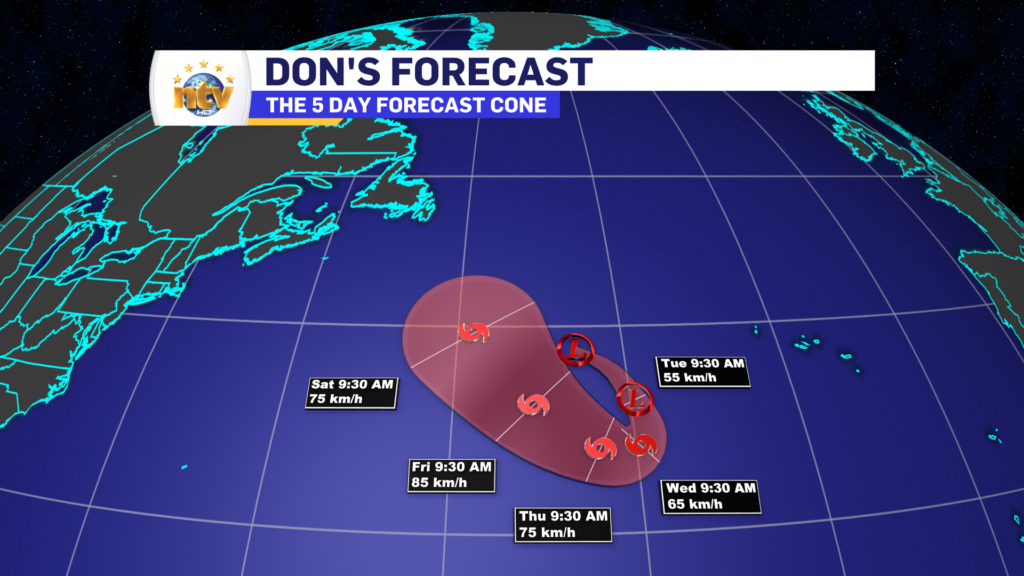
Thereafter the forecast takes the storm well southeast of the Avalon as it turns back toward the northeast and begins to lose strength. Anything close to the Province needs watching, but at the moment forecasts are well-aligned that this will not have any meaningful impact on our weather. The spaghetti plot below shows that Don should remain well southeast of the Avalon as it makes another turn after Saturday back toward the northeast.

-
Enjoy the “cool” weather Saturday because a hot stretch of weather starts Sunday
Our Saturday will be a lovely summer day across much of the Province. Expect blue…
-

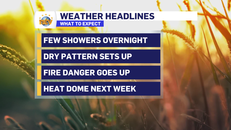
Rain returns for Friday, but a Heat Dome is looming for next week
A ridge of high pressure, also known as a Heat Dome, will set up shop…
-

The warmth lingers into Thursday, but showers arrive in the Big Land late
The weather acros the Province remains generally dry and warm for the next few days,…
