


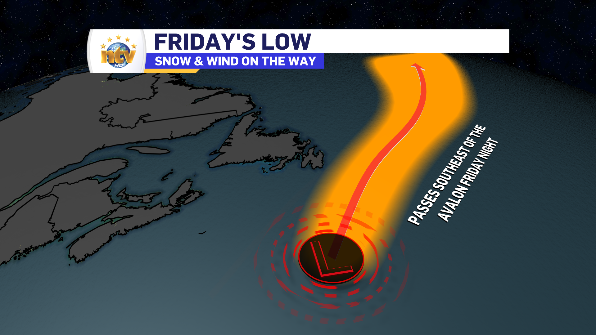
An area of low pressure currently developing well east of the Northeastern United States and well south of Newfoundland is going to bring the first heavy snowfall of the year to much of eastern Newfoundland on Friday.
This low is going to rapidly intensify as it passes southeast of the Avalon Peninsula Friday and Friday night, and this rapid intensification is going to drive heavy snowfall across much of the region. The snow is going to begin Friday morning in the south and quickly spread north, arriving in the Metro, northern areas of the Avalon, and back west into almost central by midday. Ahead of the storm, the Environment and Climate Change Canada Weather Office in Gander issued a winter storm warning and a winter storm watch for eastern sections of the island.

Winter Storm Watches and Warnings are issued when multiple types of severe winter weather, in this case, snow and wind, are going to occur at the same time. In this case, blizzard-like conditions will be found over parts of eastern Newfoundland on Friday afternoons and evening during the most intense snowfall and as the wind speeds increase. Wind speeds will gust in the 60-80 km/h range in the warned and watched areas. Unlike the last few systems, the agreement in the modeling has given me a high sense of forecast confidence.

The timing of this will vary based on location, but generally, the snow will arrive in the south Friday morning and spread north quite quickly. Future Radar shows this very well and will time out the snowfall for you, hour by hour, from late tonight through late Friday and early Saturday.
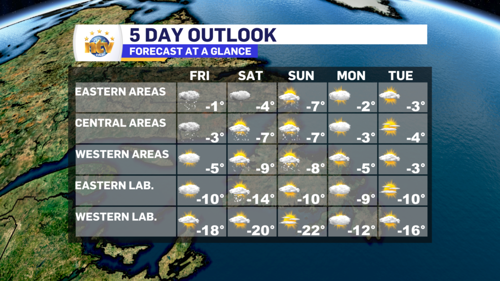
Snowfall rates over eastern Newfoundland will rapidly increase Friday afternoon and stay relatively high into the evening before slackening somewhat and ending after midnight. During the most intense snowfall, I expect rates between 2 and 4 centimetres per hour. This will last for 6 to 8 hours, and this is when the bulk of our snow will accumulate. Snowfall amounts will be highest on the Avalon and lower to the west. I expect 20-30 cm on the Avlaon, with locally higher amounts possible in the east and southeast. The Bonavista Peninsula to the Burin Peninsula will see as much as 20 cm, with areas west of Clarenville see as much as 10 cm until just passed Gander, where less than 5 cm is projected to fall.

Temperatures will be relatively mild over eastern Newfoundland on Friday and colder back to the west and into Labrador. Highs will range from the single digits below freezing on the Island to teens below in Labrador. Temperatures will generally turn colder for the weekend as a shot of arctic air swings in behind this weather maker.
-

Threat of wildfires on west coast higher this year, say forestry officials
As residents of the province prepare to head out into the woods for the Victoria…
-

Labrador West MHA wants water bomber back
With wildfires threatening Fort McMurray, Alta., again, Labrador West MHA Jordan Brown wants a water…
-

Province warns residents to be ready for forest fire season as wildfires threaten Fort McMurray
Evacuation orders and alerts remain in effect for Fort McMurray, Alta., as wildfires continue to…
