


-
Your Latest Forecast!
Click here to visit the NTV Weather Centre to get your latest forecast!
-
Eddie’s Forecast; Some slight improvements for Friday, more noticeable this weekend
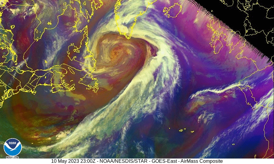
The area of low pressure that has driven all the wet weather across much of…
-

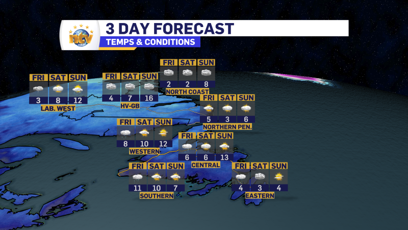
Eddie’s forecast; May starts like April ended
May starts like April ended… cold and damp for much of the Province. Eddie has…
