


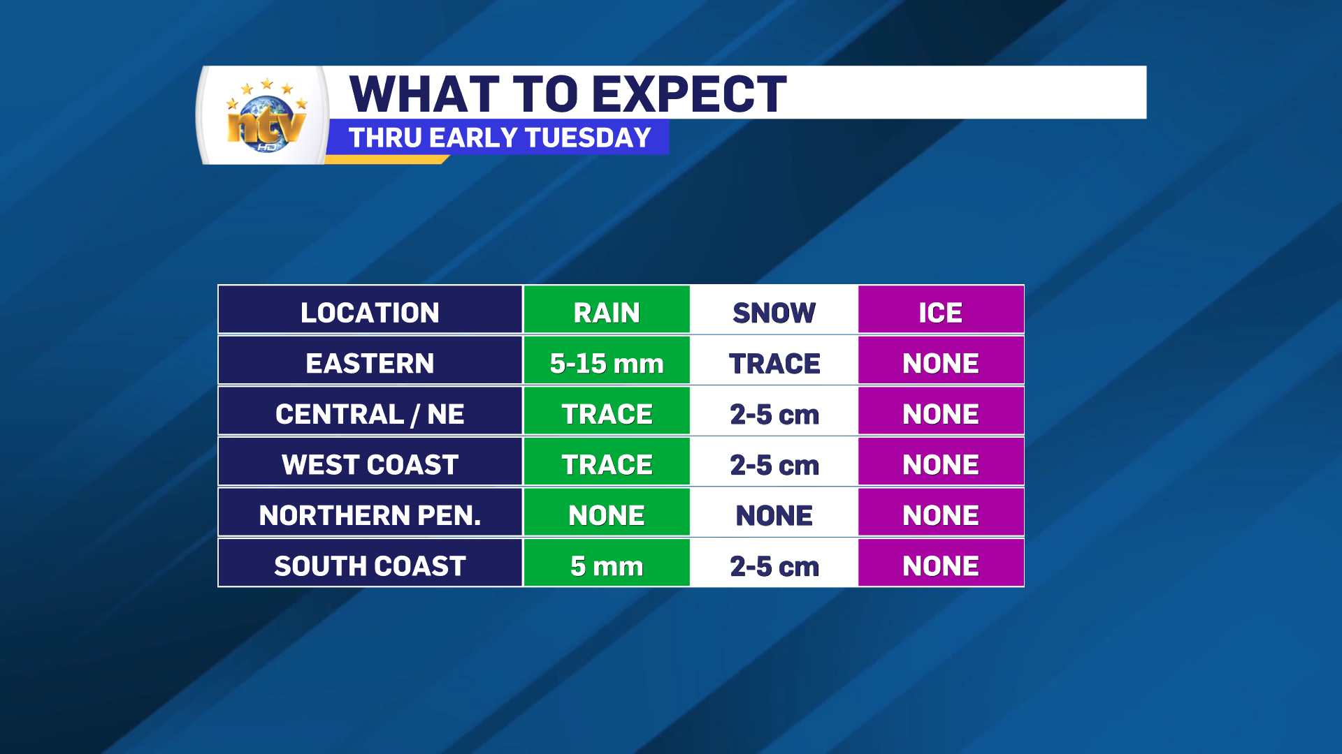
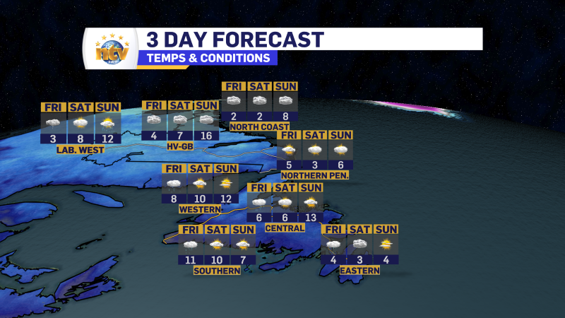
An area of low pressure is going to pass southeast of the Island overnight. This will bring rain and snow to much of the Island, south of the Great Northern Peninsula, through Tuesday morning. Most of what the Avalon Peninsula, Burin Peninsula, and South Coast see will be rain, while areas inland, over higher terrain, and farther north will see some snow. Snowfall amounts, even at the highest, will only be about 5 cm. The map below should give you an idea of where the snow will fall overnight.
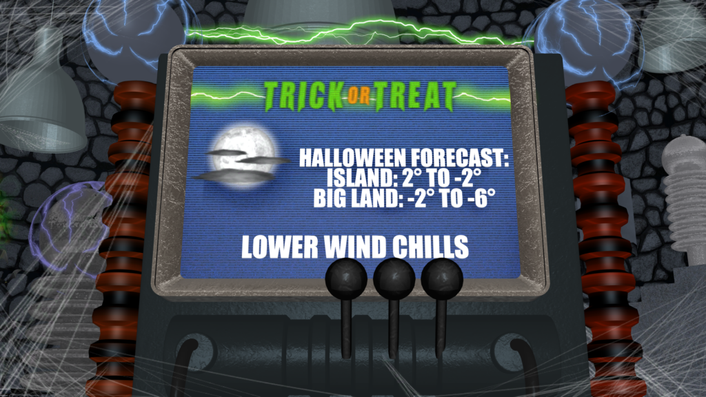
The rain and snow will taper to flurries and showers early Tuesday morning before ending. Skies will clear out across the board during the afternoon, setting the stage for a chilly Halloween for the trick-or-treaters. Highs across the Province range from below freezing in parts of Labrador to 5° or 6° over southern and eastern areas of the Island.
The chilly day on Tuesday will set the stage for a cold Halloween evening for the trick-or-treaters. Snow suites and costumes are going to go hand in hand as temperatures are forecast to be near, or below, freezing Provice-wide Tuesday evening.
The Longer Range
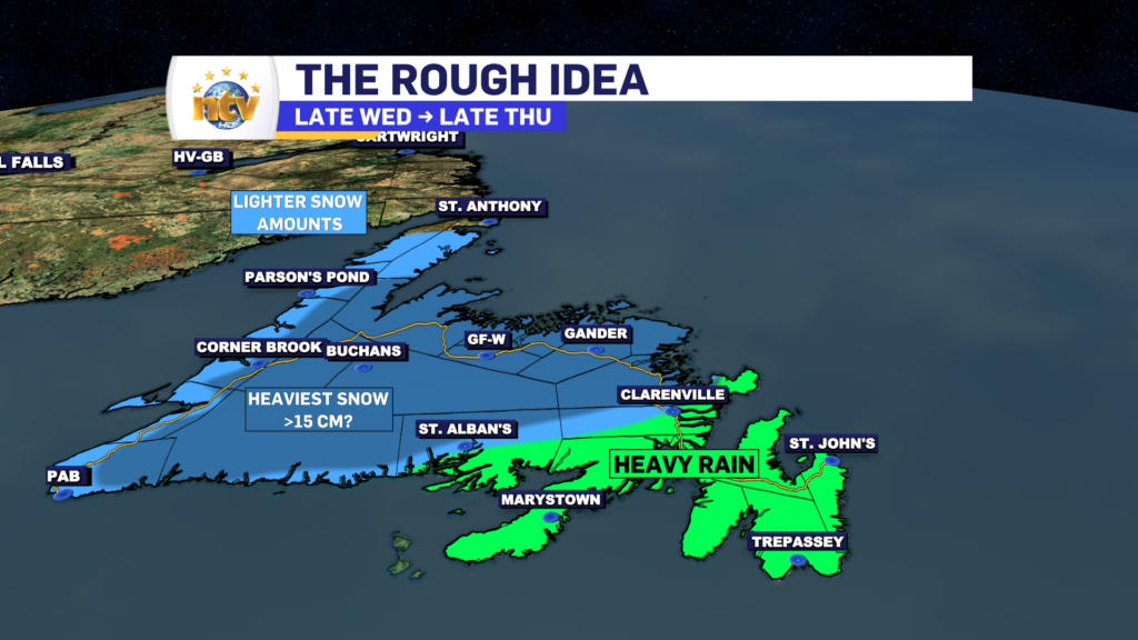
Our next weather maker will move in Wednesday afternoon and will bring rain and snow to the Island through most of Thursday. This storm will be a much more impactful one to the Island, with significant snow possible over parts of western, central, and northeastern Newfoundland Wednesday night into Thursday.
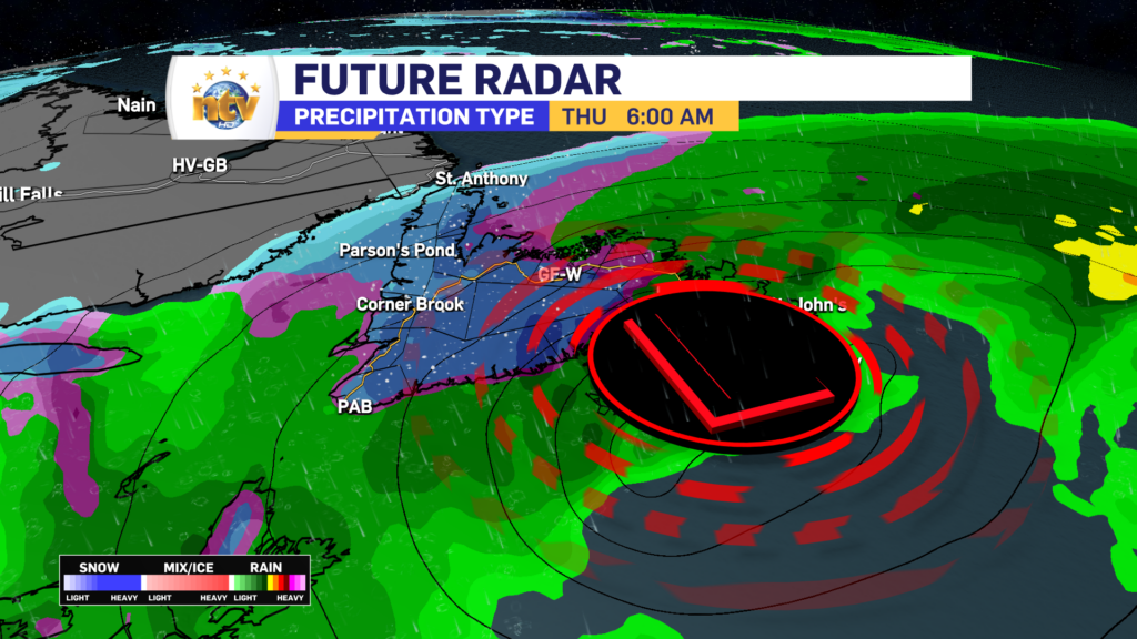
Based on the time of year, and this low’s projected track near or over the Avalon Peninsula, the rain/snow line will setup west of the Avalon and north of the Burin Peninsula Wednesday night and Thursday. There is the potential of heavy snowfall (>15 cm) over large areas of the Island west of the rain/snow line. East of that line, expect heavy rainfall during the time frame. Wind speeds will also pick up Thursday as the low deepens and pulls away from the Island.
Stay tuned for further updates on the next one.
CLICK HERE FOR YOUR 7 DAY FORECAST AND TO SEE OUR INTERACTIVE RADAR IN THE WEATHER CENTRE!
-
Your Latest Forecast!
Click here to visit the NTV Weather Centre to get your latest forecast!
-
Eddie’s Forecast; Some slight improvements for Friday, more noticeable this weekend
The area of low pressure that has driven all the wet weather across much of…
-

Eddie’s forecast; May starts like April ended
May starts like April ended… cold and damp for much of the Province. Eddie has…
