
Forecast Discussion
Two low-pressure centres are going to track across the Province between tonight and Thursday morning. The first will move thru tonight and this will bring either rain or showers to southern Labrador and most of the Island. The Northern Peninsula and southern Labrador will see some wet snow from this. Projections indicate that a rough 5-10 cm will fall from over that area. Amounts will likely be lower for locations near sea level and higher for those inland, and in higher terrain.
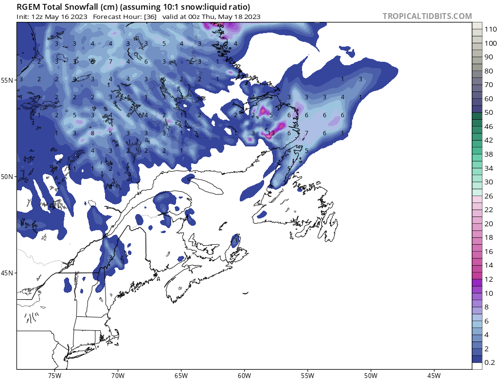
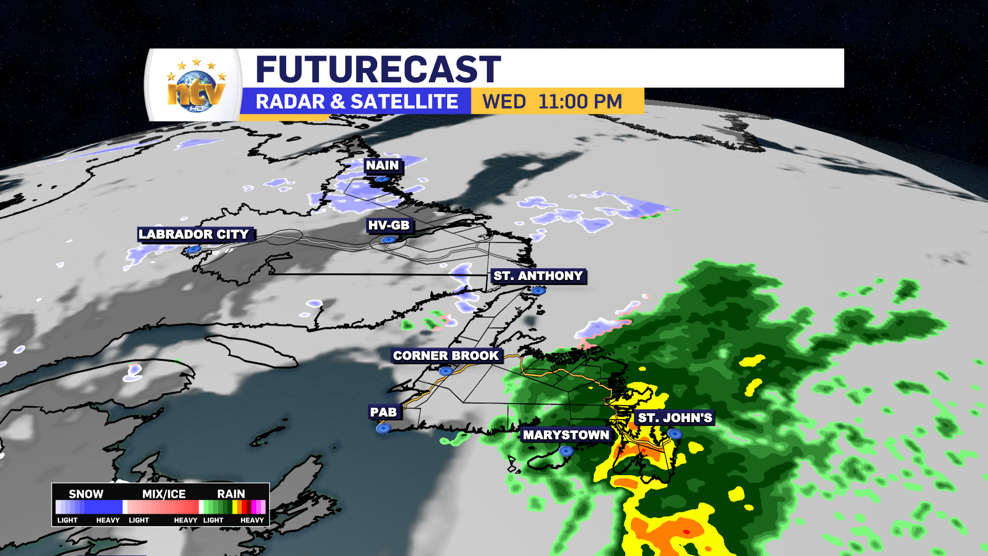
Wednesday will see a lull in the precipitation for much of the day over the Island, with scattered showers on the go for many areas and scattered rain and snow showers for parts of Labrador. The next low moves in Wednesday afternoon and will spread rain over the eastern 2/3 of the Island by evening. The rain will fall heavily at times Wednesday night before ending Thursday morning. Some parts of central and northeastern Newfoundland will see the rain end as wet snow Thursday morning. Very little accumulation can be expected. Futurecast will give you a good idea of what to expect.
Long Range Discussion
Once past Wednesday night, the weather looks to improve, big time, for much of the Province as we go into Thursday, Friday, and Saturday. At the moment it looks like Sunday may see rain across much of the Province, with clearing conditions for Monday. Temperatures will also be warmer, as the warmest air of the season is set to move in, just in time for the May Long Weekend. Here’s a look at the current forecast for the holiday!
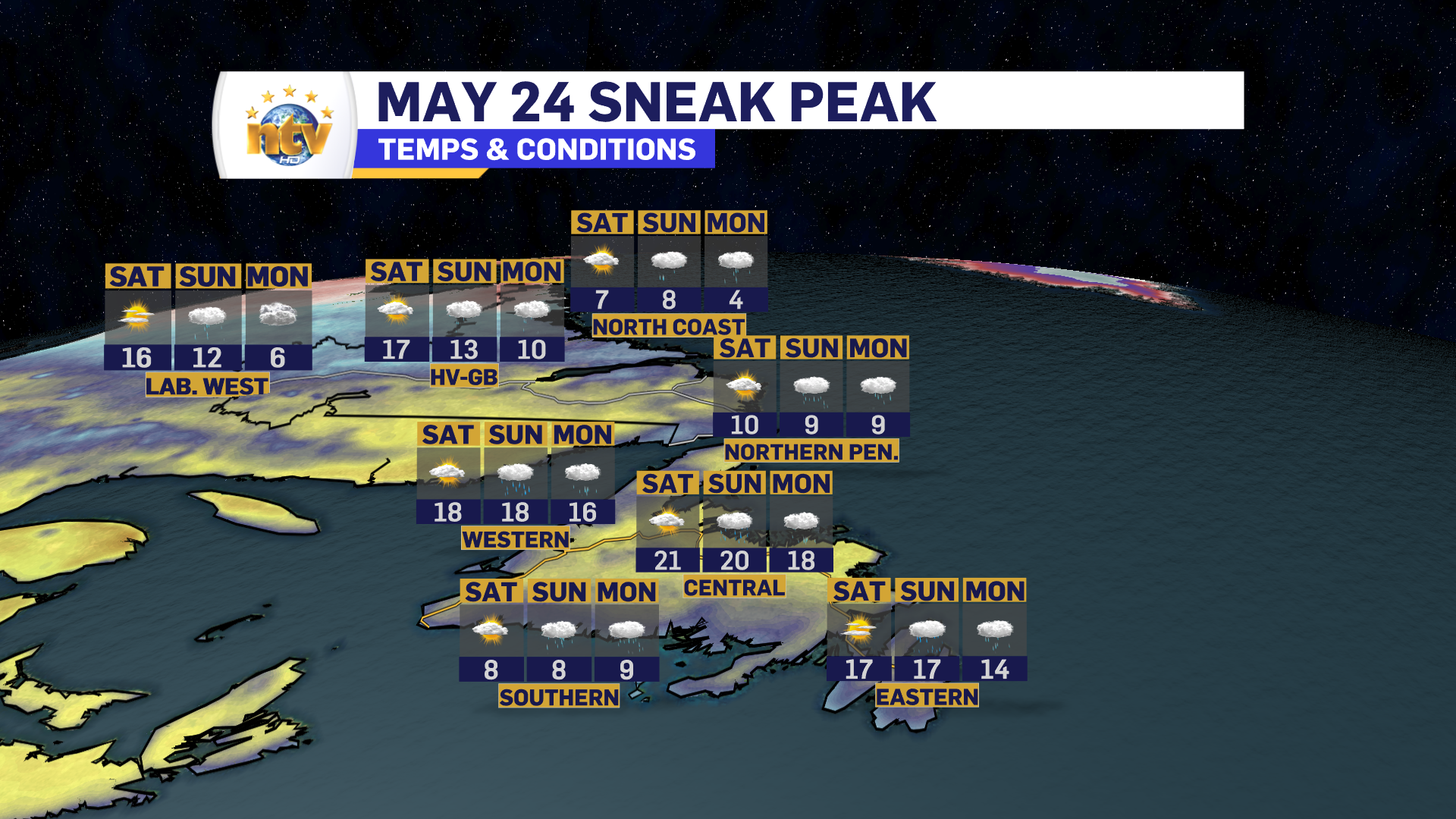
While there is rain in the forecast for Monday, it looks to be more showers at this point… with the heavier rain coming in on Sunday, for some areas. I’ll have a more detailed look at the forecast for May 2-4 over the next couple of days.
Have a great night!
Eddie


