


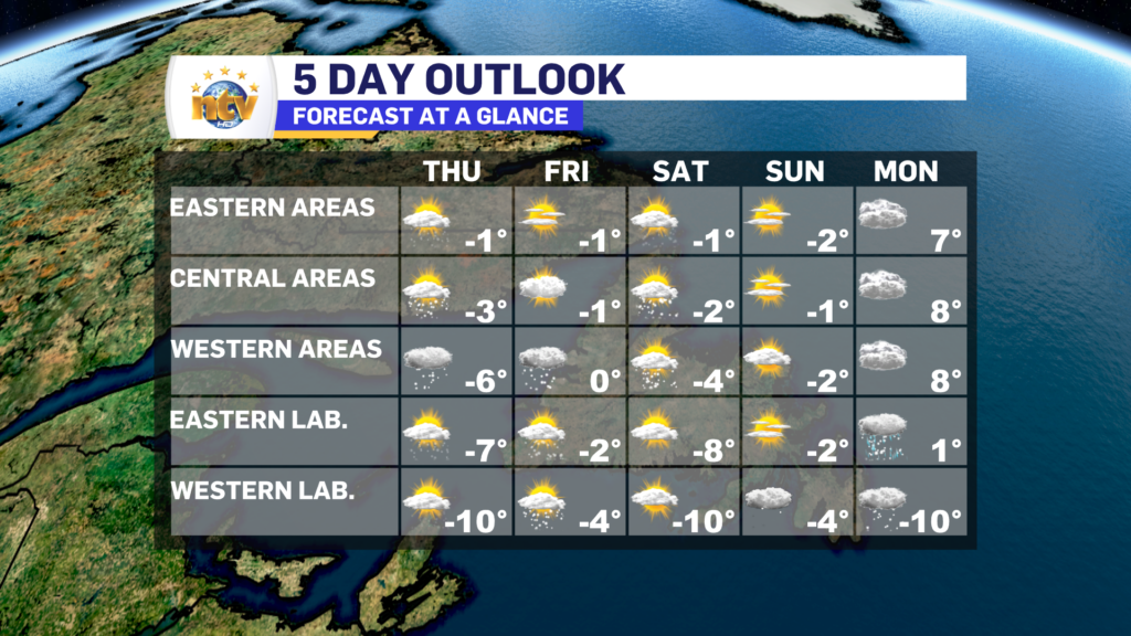
The weather pattern will generally be quieter over the next few days as no major low-pressure centers are set to move through between now and Sunday. That said, we will see a shot of arctic air settling into the region between Thursday and Saturday. The animation below shows this very well!
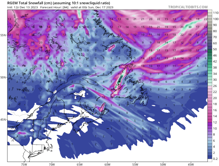
With the arctic air will come a few disturbances rolling across the Province. While these will not bring widespread significant snowfall for most areas, they will for parts of the West Coast. Onshore flurries will be persistent and consistent beginning this evening and continuing through Saturday. While the lower elevations will see some snow, the higher terrain will see >30 cm over the next few days.
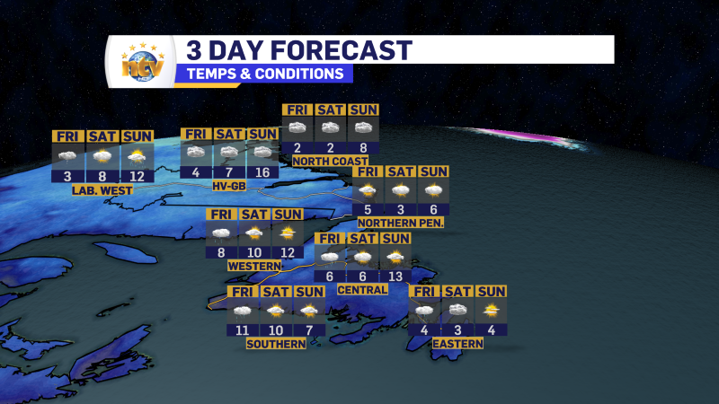
Temperature wise we are looking at highs across the Province in the minus single digits through Saturday or Sunday on the Island, and minus single digits to minus teens in Labrador.
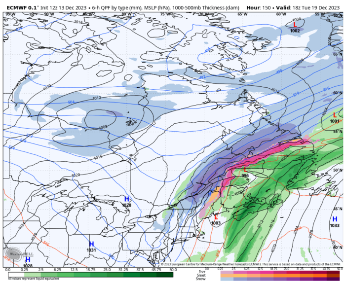
The next weather maker arrives early next week, and this will be a warm one for the Island and a rain and snow maker for Labrador. In fact, we are going to see a widespread thaw for most of next week as North Atlantic Blocking gets established and sends a pool of warm air over most of the Island and southern Labrador.
The details will get clearer for next week over the coming days, so be sure to check back in the meantime.
-
Your Latest Forecast!
Click here to visit the NTV Weather Centre to get your latest forecast!
-
Eddie’s Forecast; Some slight improvements for Friday, more noticeable this weekend
The area of low pressure that has driven all the wet weather across much of…
-

Eddie’s forecast; May starts like April ended
May starts like April ended… cold and damp for much of the Province. Eddie has…
