


Tuesday Night’s Outlook
Scattered flurries across the Island may be briefly locally heavy. Significant snow accumulation isn’t expected, but some areas with heavier flurries will pick up a few centimeters. The West Coast will see snow becoming more widespread early Wednesday morning. A narrow snow area will sink southward in Labrador, dropping up to 15 cm on the North Coast by Wednesday morning, with amounts generally 10 cm or less elsewhere.

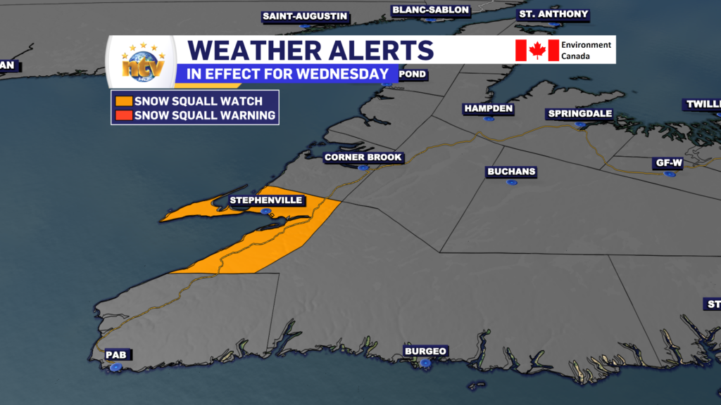
Wednesday’s Outlook
Scattered flurries across the Island will be a bit more numerous on the West Coast. Snow Squalls are possible on the West Coast, particularly around Bay St. George, where the Snow Squall Watch is in effect for Wednesday.
Meanwhile, more snow will fall in coastal Labrador, mainly south of the TLH. Expect roughly 5-10 cm in the area. Some of that snow will push onto the Great Northern Peninsula from Labrador later in the day.

Thursday’s Forecast
Cold and quiet on the Island with scattered flurries. Highs will be a few degrees below the freezing mark. Snow will push onto the coast of Labrador during the afternoon and become heavy by evening. Highs in Labrador range from freezing on the coast to the minus teens inland.
The Extended Forecast
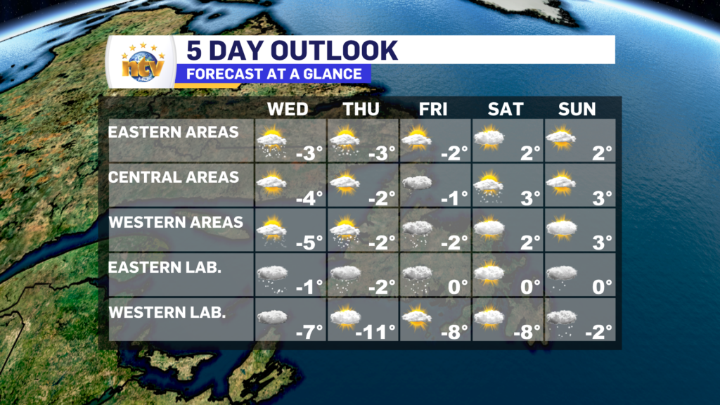
Friday will see the periods of snow continue on the coast of Labrador. Onshore flurries will be found on the west coast of the Island and scattered flurries elsewhere.
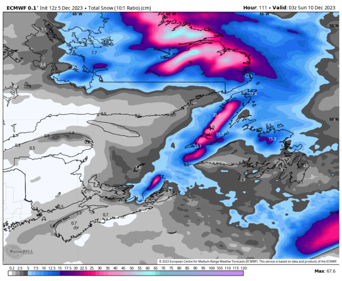
The snow ends on the coast of Labrador by late Saturday or Sunday. Some areas will have hefty amounts of snow, potentially over 50 cm in some areas. Onshore flurries will continue on the Islnad (west coast) into Saturday and taper off Sunday as the weather pattern changes.
-

Threat of wildfires on west coast higher this year, say forestry officials
As residents of the province prepare to head out into the woods for the Victoria…
-

Labrador West MHA wants water bomber back
With wildfires threatening Fort McMurray, Alta., again, Labrador West MHA Jordan Brown wants a water…
-

Province warns residents to be ready for forest fire season as wildfires threaten Fort McMurray
Evacuation orders and alerts remain in effect for Fort McMurray, Alta., as wildfires continue to…
