


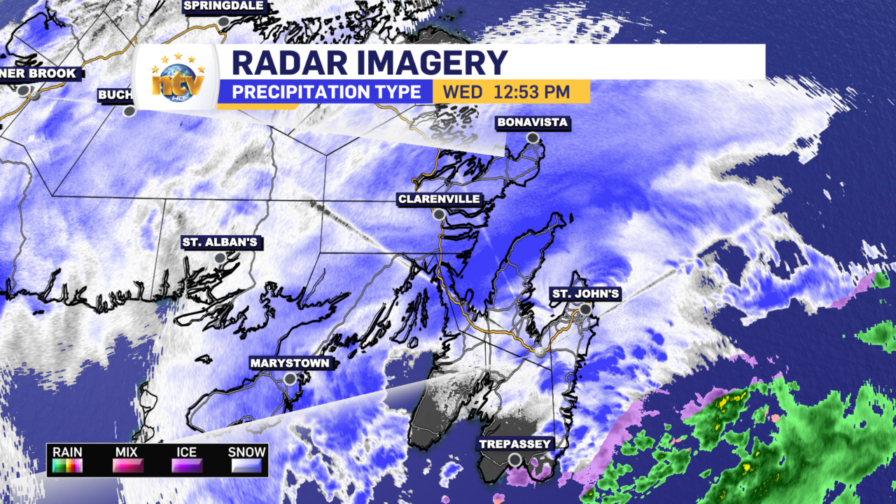
The snow moved onto the Island early this morning and has fallen heavy at times for many areas of eastern and southern Newfoundland. Here are some snowfall totals as of 12:30 PM:
- Victoria: 25 cm
- St. John’s East: 24.1 cm
- St. John’s International Airport: 15.0 cm
- Gander Airport: 5 cm
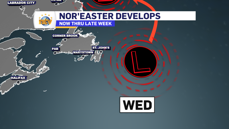
As of the early afternoon, radar indicates the heaviest snow is oriented from near the Avalon North back toward the Burin Peninsula. This heavy band should expand a bit to the east and west this afternoon as our area of low pressure intensifies as it passes east of the Avalon Peninsula.
As the day progresses, the snow will continue to fly over much of the Island, with the heaviest snow in the east. Wind speeds will also gust to 80+ km/h, making for areas of reduced visibility and blizzard-like conditions at times. Winter Storm Warnings and Blowing Snow Advisories are up for the Island and parts of coastal Labrador.

We are also looking at the Storm Surge Warning for the northeast-facing shoreline from near Cape Freels to Cape Race.

This is mainly for tonight’s high tide however we are already seeing some minor coastal flooding in some areas. This picture was taken in Brigus earlier today, wherein minor coastal flooding was observed with the mid-day high tide. Tonight will see higher water levels.

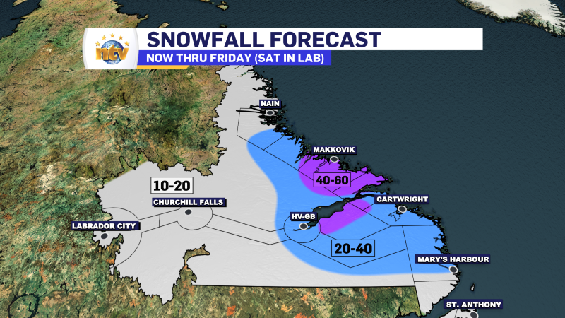
This storm is going nowhere fast, and snowfall will linger into Friday for some areas of the Island and later in parts of Labrador. The bulk of the snow on the ISland will fall today into tonight and Thursday, while in Labrador, it will just pile up over the next few days. Snowfall amounts will be highest over eastern and northeastern Newofudlnad and the mid-coast of Labrador. High-end totals are expected to be between 40 and 60 cm, with some areas possibly exceeding 60 cm.

More updates will come later today.
-

Threat of wildfires on west coast higher this year, say forestry officials
As residents of the province prepare to head out into the woods for the Victoria…
-

Labrador West MHA wants water bomber back
With wildfires threatening Fort McMurray, Alta., again, Labrador West MHA Jordan Brown wants a water…
-

Province warns residents to be ready for forest fire season as wildfires threaten Fort McMurray
Evacuation orders and alerts remain in effect for Fort McMurray, Alta., as wildfires continue to…
