


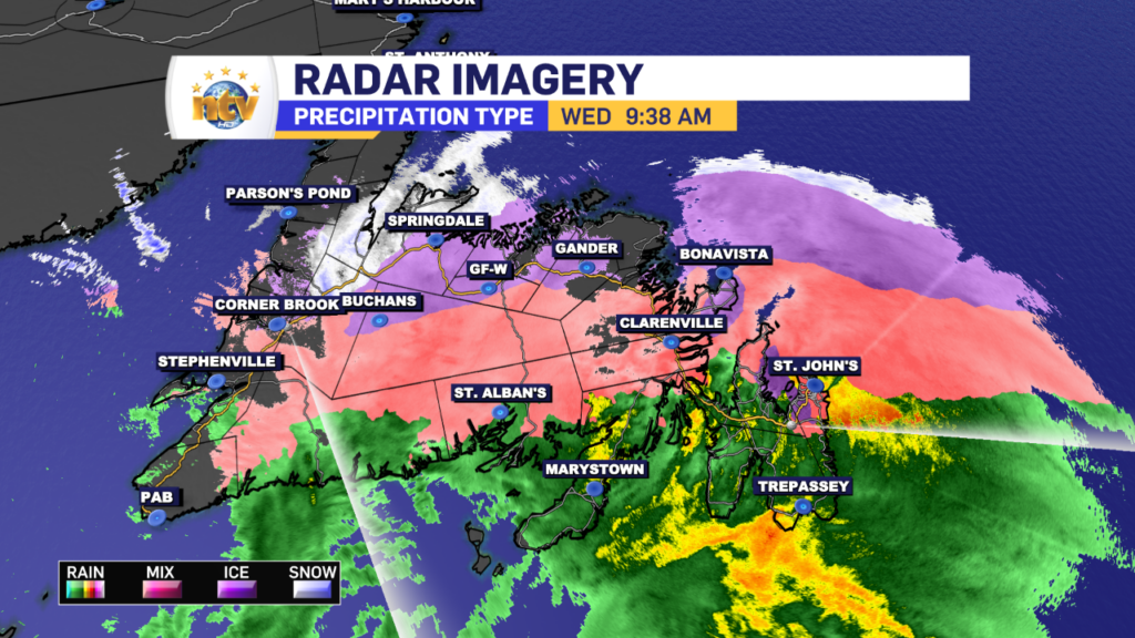
Temperatures will shoot up throughout the morning and early afternoon for most of the Island. Highs will reach as high as 8° for most. The exception will be the GNP where highs will only be as warm as 2°.
The drizzle and rain will end by late afternoon or evening for most. And the warmth will quickly be erased by a cold front. That front will move east quickly and the cold air will flood across the Island Wednesday evening. All areas will be back below freezing before midnight Wednesday night.
Meanwhile, the snow becomes heavy at times along the coast as the area of low pressure makes its way into the North Atlantic. Wind speeds ramp up along the mid and north coast, and by evening, blizzard conditions will be found north of Cartwright. Highs of -1 along the coast to -14 in the west. Wind speeds as high as 60 km/h from the east on the coast and 30 km/h from the north, in the west.
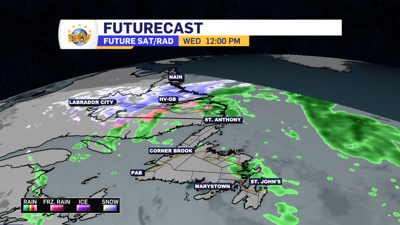
The snow in Labrador will continue into Friday along the coast and through Thursday elsewhere. On the Island, our messy weather today will give way to intense snow squalls Thursday and Friday. Snow Squall Watches are already in effect for areas of eastern, southern, and western Newfoundland.
A more thorough weather update will be posted this afternoon.
Stay safe!
/ Eddie
-

Eddie’s forecast; May starts like April ended
May starts like April ended… cold and damp for much of the Province. Eddie has…
-
Not much change in the weather for Wednesday
An area of low pressure continues to spin southeast of Newfoundland and Labrador and remains…
-
The RDF continues into Wednesday… but there are some literal bright spots in the forecast
Get all the details in Eddie’s forecast from tonight’s NTV Evening News Hour!
