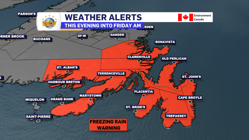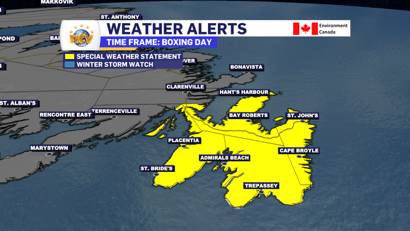
An area of low pressure is going to pass over, or just east of, the Avalon Peninsula tonight. This low is going to bring a mix of snow, ice pellets, freezing rain, and rain to portions of eastern, southern, and central Newfoundland in that time. The Environment and Climate Change Canada Weather Office in Gander has issued weather alerts and warnings for various parts of eastern Newfoundland. They are as follows.
A Freezing Rain Warning is in effect from this evening until Friday morning for the following areas:
- The Avalon Peninsula Southeast
- The Avalon Peninsula Southwest
- The Avalon Peninsula North
- St. John’s & vicinity
- The Burin Peninsula
- Cannaigre
- Bonavista Peninsula
- Clarenville and vicinity
- Terra Nova
Current details: Ice build-up due to freezing rain is expected or occurring.
Locations: The Avalon, Burin, Connaigre, and Bonavista Peninsulas, as well as Clarenville and Terra Nova.
Freezing rain duration: 4 to 8 hours, except up to 12 hours over higher elevations on the northern Avalon, as well as areas west of the Avalon Peninsula.
Total freezing rain and rainfall amounts: 15 to 25 mm (except 25 to 35 mm over the southern Avalon).
Time span: this evening until early Friday morning.
Remarks: Parts of the Avalon and Burin Peninsulas will experience a changeover to rain, at times heavy, later tonight; however, freezing rain is expected to persist over higher terrain.
Although the freezing rain is expected to end early Friday morning, motorists are advised that roads will likely still be icy and hazardous during the morning commute.
Surfaces such as highways, roads, walkways and parking lots will become icy, slippery and hazardous. Utility outages may occur.
Take extra care when walking or driving in affected areas.
Freezing rain warnings are issued when rain falling in sub-zero temperatures creates ice build-up and icy surfaces.

A Rainfall Warning is also in effect for the following areas from this evening until Friday morning:
- Avalon Peninsula Southeast
- St. John’s and vicinity
- Avalon Peninsula Southwest
Current details: Rain, heavy at times is expected. The frozen ground has a reduced ability to absorb this rainfall.
Locations: St. John’s and vicinity, and the southern Avalon Peninsula.
Total rainfall: 25 to 35 mm (highest over the southeastern Avalon).
Time span: this evening until Friday morning.
Remarks: Snow or ice pellets will quickly change through freezing rain to rain along parts of the coast this evening and over most other locations later tonight. However, freezing rain may persist over higher elevations well after the changeover occurs in most other locations.
Pooling of water and minor flooding may occur in areas prone to runoff from melting snow, especially in areas where storm drains are not clear.
Be prepared for winter conditions at higher elevations.
If visibility is reduced while driving, turn on your lights and maintain a safe following distance.
Rainfall warnings are issued when significant rainfall is expected.
Remember that the lack of a weather alert doesn’t mean there is not going to be impactful weather in your area. It just means the weather isn’t expected to be severe enough to warrant an alert. Please have a look at the NTV Weather Centre for your latest forecast.


