


The Big Picture & Small Details
The windy conditions we’ve seen for much of the day on the Great Northern Peninsula and the Straits will relax this evening and as we go through the overnight. Some areas saw some very high wind gusts earlier today. Here are some of the peak gusts from Tuesday:
- Englee: 128 km/h
- St. Anthony: 111 km/h
- L’anse-au-loup: 87 km/h
- Twillingate: 79 km/h
- Fogo: 77 km/h
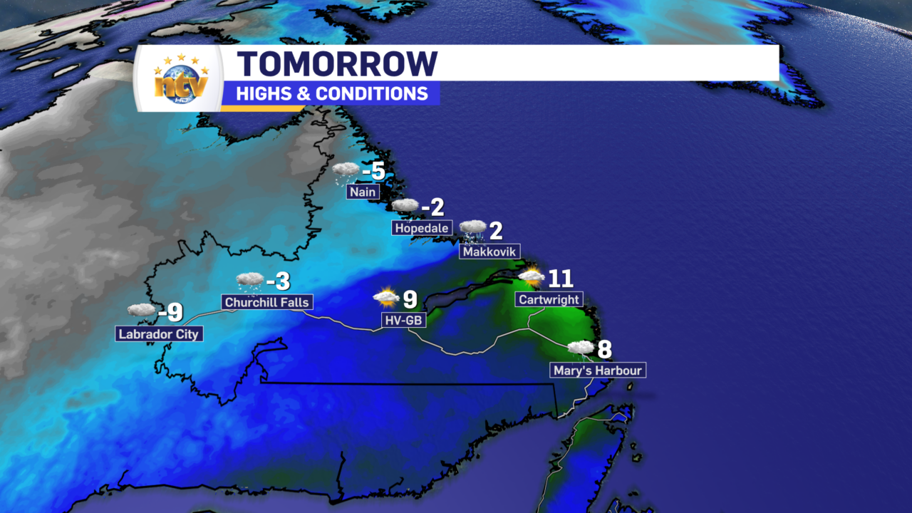
Tonight, we will see a boundary and an area of low-pressure move from southwest to northeast across Labrador. Northern and western regions will be on the cold side of the front, and the southeast quadrant will be on the warm side. Areas in the cold sector will see some snow overnight, and areas in the southeast, including Goose Bay, will not see much of anything. There will be a large temperature discrepancy, however, with readings north and west remaining much colder than areas south and southeast.
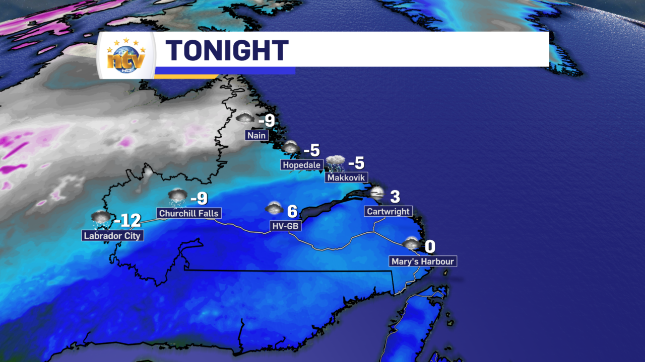
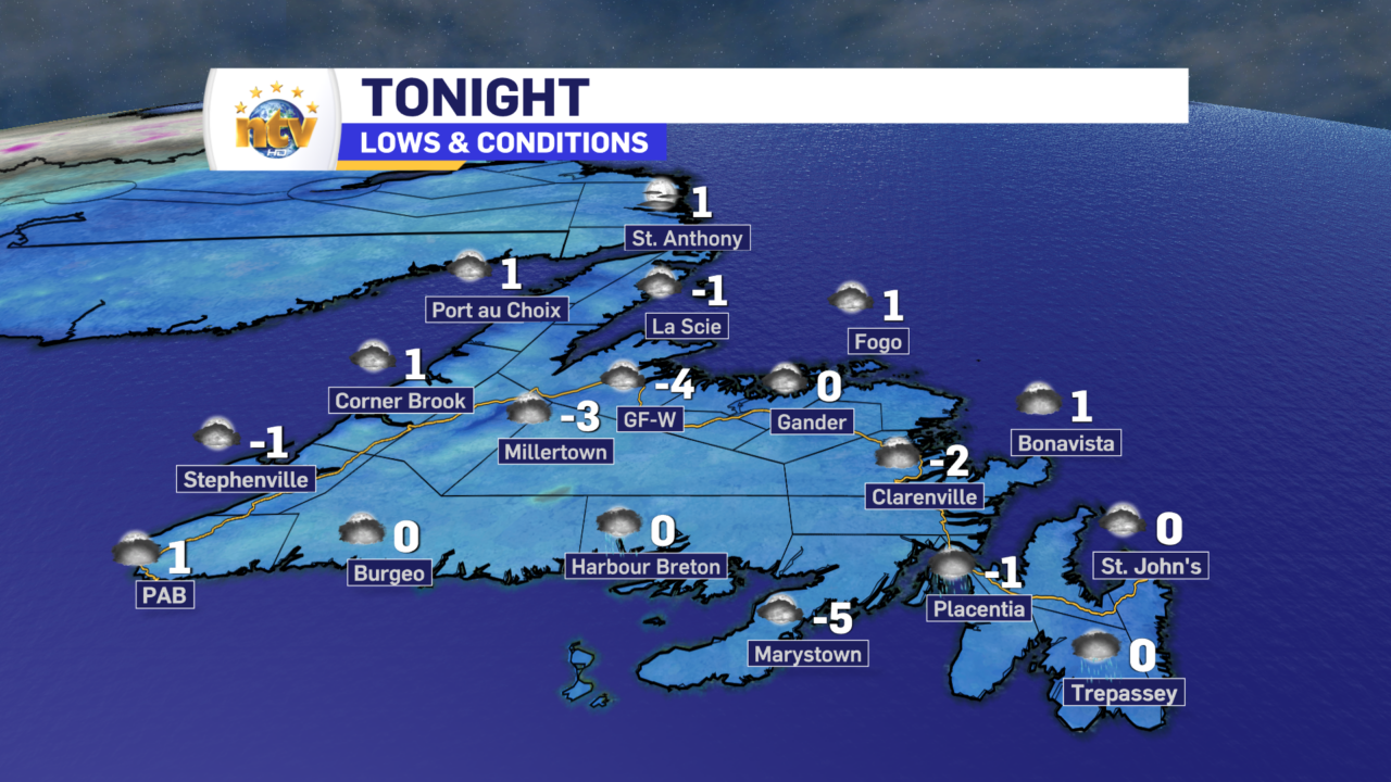
The Island will see tranquil weather overnight, with lows of 0° to -5°. The coldest readings will be in Central, while the rest of the Island will be on the warmer side of the scale. The wind speeds will also come down significantly overnight.
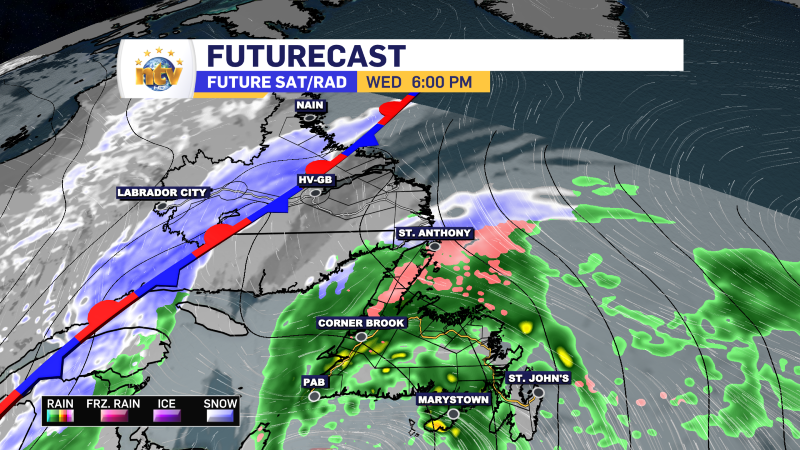
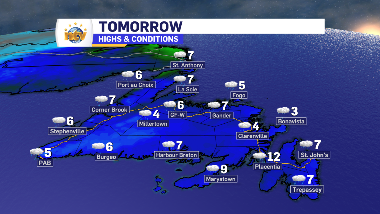
On Wednesday, an area of low pressure will approach the Island from the South, spreading rain from south to north during the day. Most areas will see the rain move in during the second half of the day. Some locations on the Northern Peninsula, especially on the eastern side, will see a period of freezing rain. The ice buildup in some areas may be significant, but it looks like those areas may be remote at this time.
The same low is going to start to push snow into southeastern Labrador on Wednesday evening; however, before that, the weather across southeastern Labrador will be quite mild. The same cannot be said for the north and west on Wednesday, where snow will fly for much of the day.
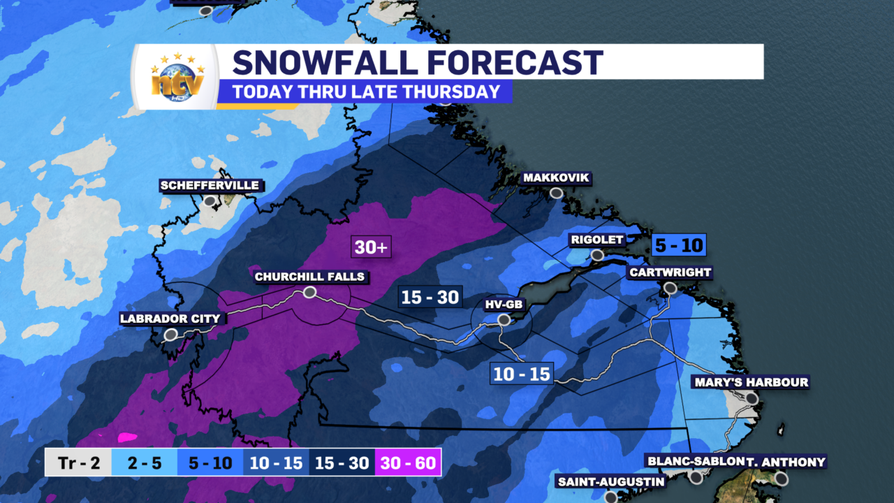
Snowfall by Wednesday evening in parts of Labrador West and on the North Coast will be in the 10-20 cm range. There will be lesser amounts east and south by the time Wednesday comes to a close, but that will change Wednesday night.
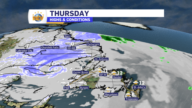
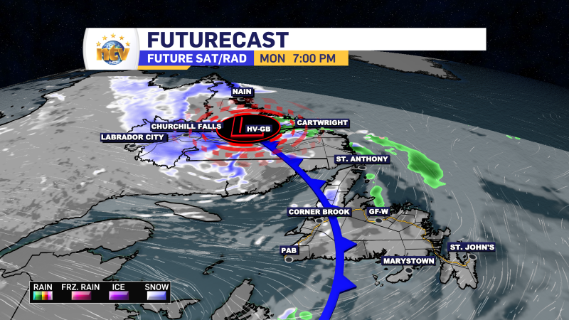
The area of low pressure moving over the Island with the rain on Wednesday will interact with the cold front over Labrador. This will pull the cold air farther east and southeast, bringing a late-season snowfall to the coast and southeast Wednesday night into Thursday. The snow will linger on the coast later Thursday and early Friday. Amounts by Friday morning will be as high as 20 to 30 cm in some areas north of Cartwright.
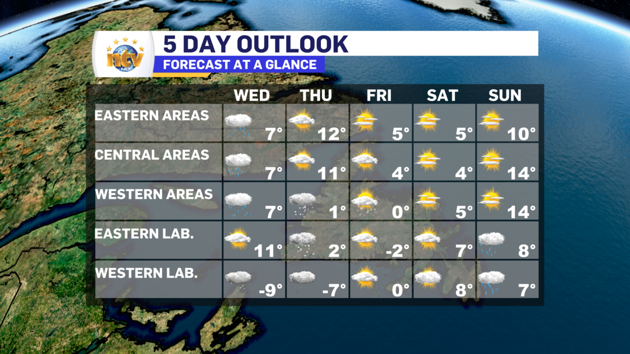
Thursday and Friday, we will see some flurries on the west coast of the island. They may be locally intense in some areas at times. Beyond that the weather looks quiet on most of the Island for Friday and the weekend, while parts of Labrador will see some rain and/or snow by Sunday.
Thanks for reading!
-
Nicer weather arrives to end the work week!
The weather will generally improve across the Province overnight as an area of low pressure…
-
Rain, snow, and ice linger into Thursday across N.L.
Here is Eddie’s forecast from tonight’s NTV Evening News Hour
-
Eddie’s Forecast for Tuesday and beyond
Here is Eddie’s forecast of what we can expect over the next 5 days across…
