


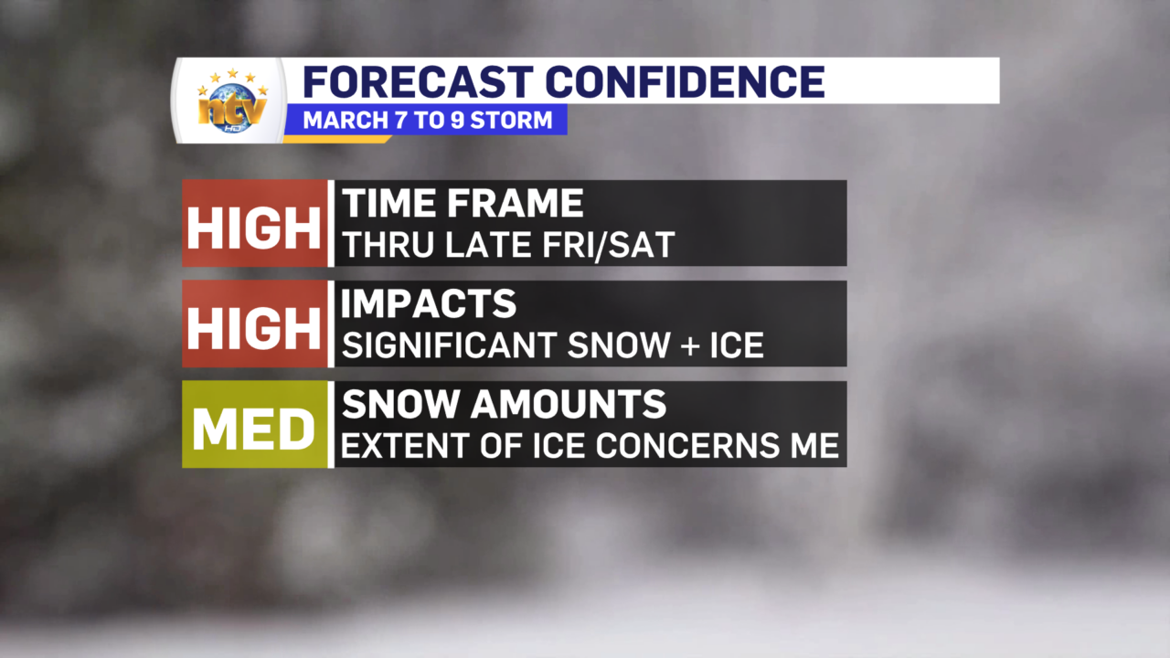
Forecast Confidence
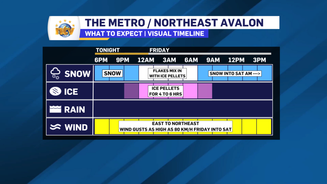
Generally I have a pretty good idea of what to expect with this storm. The thing I’m uncertain of is how long the ice pellets will last on northeast Avalon and what impact that will have on the total snowfall expected by Saturday morning. Keep in mind that the bulk of the snow we are going to see with this system will fall Friday into early Saturday in this area.
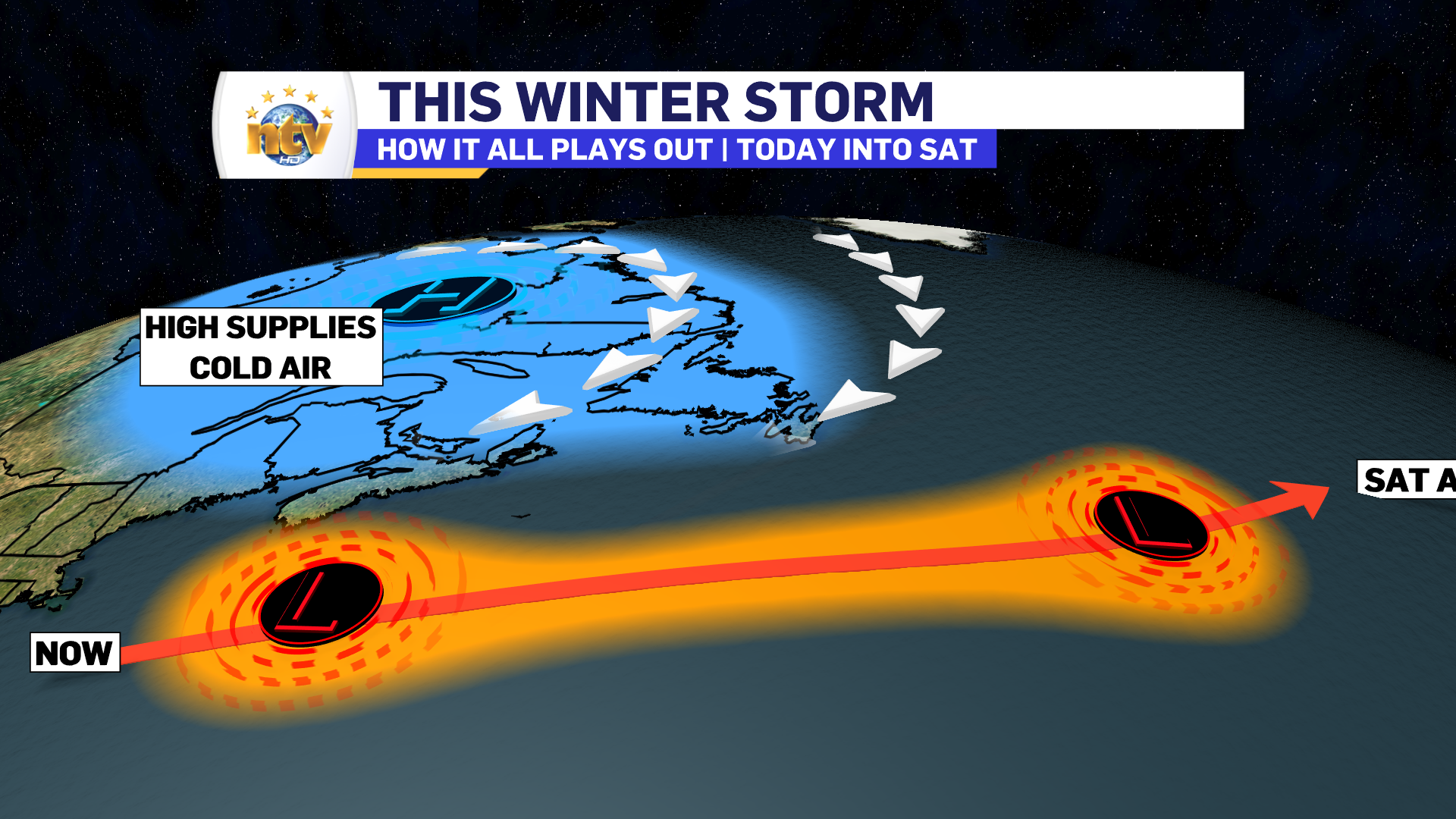
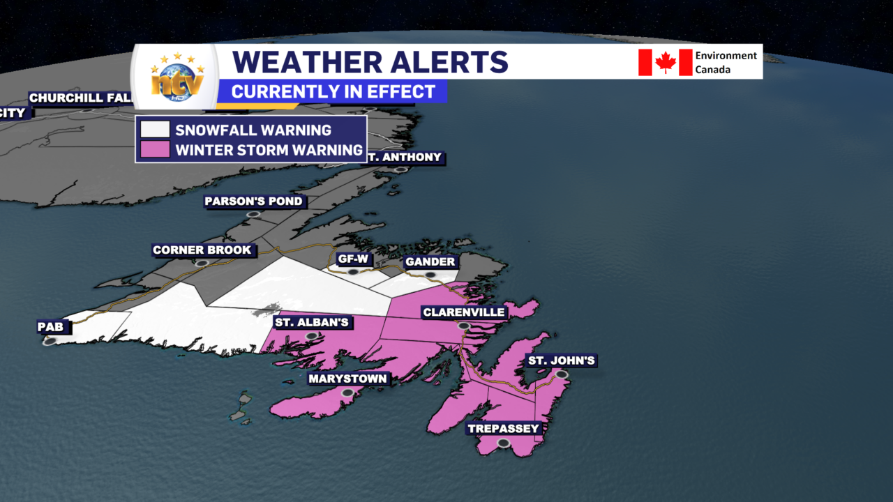
An area of low-pressure will slowly track south of Newfoundland between today and Saturday morning. The low will bring significant amounts of snow and ice to the Island in that time frame. The snow will last longest in the east and will not end until Saturday morning. Areas farther west will see the snow ending earlier; in fact, along the West Coast and through Central, the snow will be done by Friday morning. Winter Storm and Snowfall Warnings are in effect for many areas of the Island due to the impending weather.
Snowfall Amounts
Snowfall will be highest on the Avalon Peninsula and some adjacent areas. I’m expecting between 50 and 80 cm to fall in these by Saturday morning. I think the higher end of that range will fall over the Avalon Peninsula. The northeast Avalon will likely see the mid to lower range due to some ice pellets mixing in overnight. What I’m unsure of is how long the ice pellets will last and just how far north they will make it. Keep in mind the bulk of the snow on the Avaln will fall Friday into Friday night and not Thursday night.
Areas to the west will see lower snowfall totals because snowfall amounts will be less. Areas to the south will see lesser amounts of snow due to a prolonged period of ice pellets and freezing rain tonight into Friday morning.
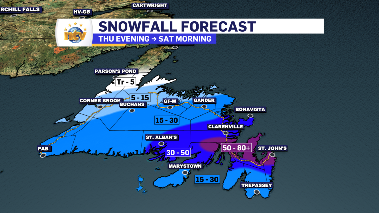

The southern Avalon and Burin Peninsula areas will see a prolonged period of ice pellets and freezing rain tonight into Friday. There may be a significant amount of freezing rain for the southern part of the Burin Peninsula and the extreme southern Avalon. If that happens, there is going to be the risk of power outages due to ice loading on the power lines and tree limbs.
The Storm Breakdown: Region by Region
The Avalon Peninsula
Friday: Any mixed precipitation, or ice pellets, or freezing rain will go over to snow during the morning or by early afternoon as colder air takes hold. This will occur first in the north and last in the southeast. The Avalon Penisula North will likely remain snow throughout the day. The snow will be heavy at times. High near -1.
Friday Night: Periods of snow. Lows near -1.
Saturday: Snow ends in the morning. High near 0.
The Burin Peninsula
Friday: The freezing rain and ice pellets will transition to mostly ice pellets in the morning before changing to snow in the afternoon. The snow will be heavy at times once is starts. Highs near -1.
Friday Night: Periods of snow, ending after midnight. Lows near -1.
Saturday: Mostly cloudy with a hear near 0.
Central and Northeastern Newfoundland
Friday: Snow ends in the morning. Highs near -2.
Saturday: Mostly cloudy. Highs near 0.
The South Coast / Connaigre
Friday: Snow ending the morning. Highs near -1.
The West Coast / Southwest Coast
Tonight: Periods of snow. Lows near -4.
Friday: Mostly cloudy. Highs near -2.
The Northern Peninsula
Tomorrow: Sun and cloudy with a high near -4.
Labrador
Friday: Sunny. Highs of -8 to -13. Coldest in the north and west
-

Hot and humid start to the weekend
The Island will see sunny skies to start today. There are a few fog patches…


