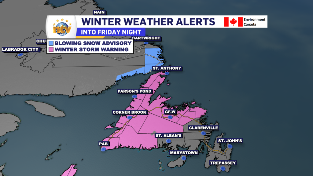
Winter Storm Warnings are now in effect for large areas of the Island from the West Coast, to the South Coast and into parts of Central and the northeast. Snow and ice became more widespread in these areas overnight, which will continue to be the case as we move through Friday.
Radar imagery shows where the snow, ice, and rain are this morning. As you can see in the radar loop, the snow and ice line is slowly drifting toward the east. This trend will continue throughout the day as colder air moves in that direction behind an eastbound cold front.
Get the latest radar imagery in the NTV Weather Centre!
Due to the snow falling over the island’s western half this morning, road conditions aren’t exactly great. The road conditions map from 511nl.ca shows that most roads are snow-covered west of Gander this morning, with many being reported as ‘travel not recommended’. In fact, the highways at the top of the Great Northern Peninsula are closed this morning.
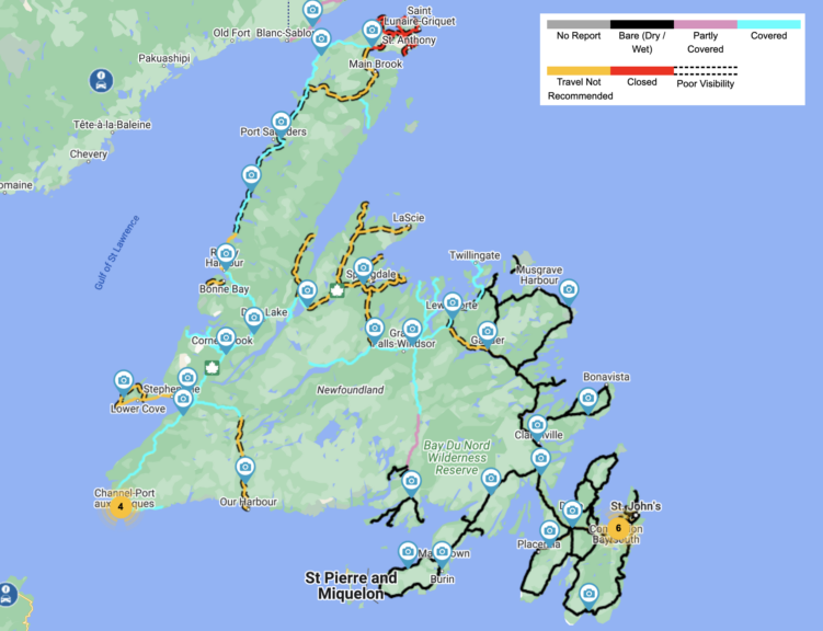

Many of the roads are in such poor conditions due to the snow falling, combined with areas of blowing and drifting snow. The combo of snow will make travel very difficult today over much of the Island, particularly later in the day and tonight as the snow expands and the high winds become more widespread. The video below shows the future radar, along with the predicted wind gusts.
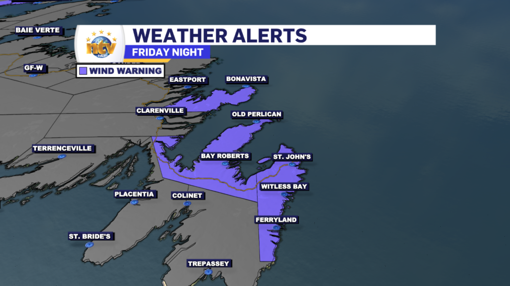
Wind speeds will ramp over eastern areas late today and tonight, and gusts will be near 100 km/h at times. Due to this, the Weather Office in Gander has also issued a Wind Warning for the Avalon Peninsula
The weather will slowly improve overnight and Saturday as this area of low pressure departs. The weather looks to then remain quiet through the Christmas Holiday across the Province.
Stay tuned for further updates!
-

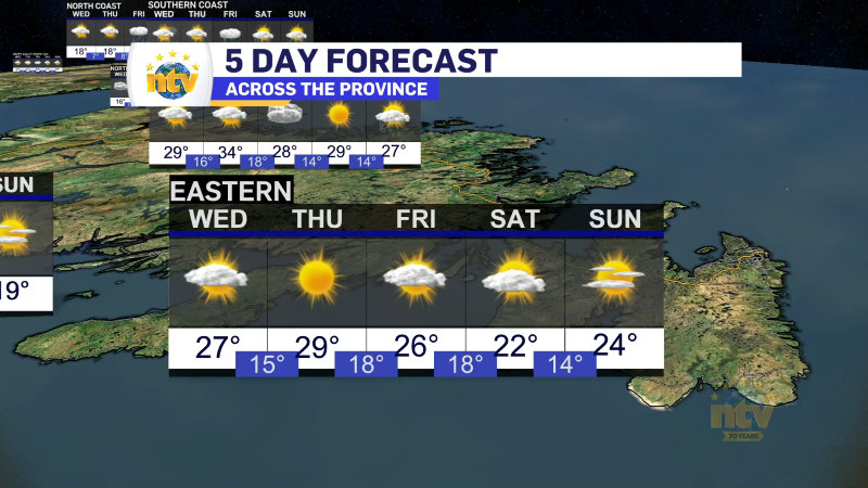
Unsettled for most of the province today
There will be a risk of some morning showers along the west coast of the…