


Good Monday morning, everyone!
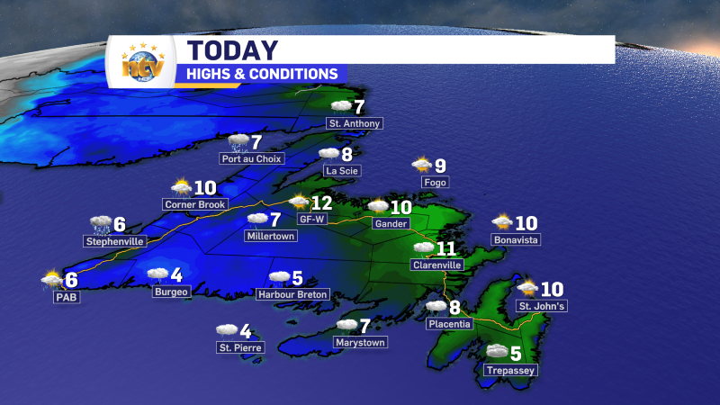
The weather on the Island today will not be half bad! We can expect some sunshine for most and mild temperatures. There will be some showers over the West Coast and the South Coast at times later this morning and in the afternoon.
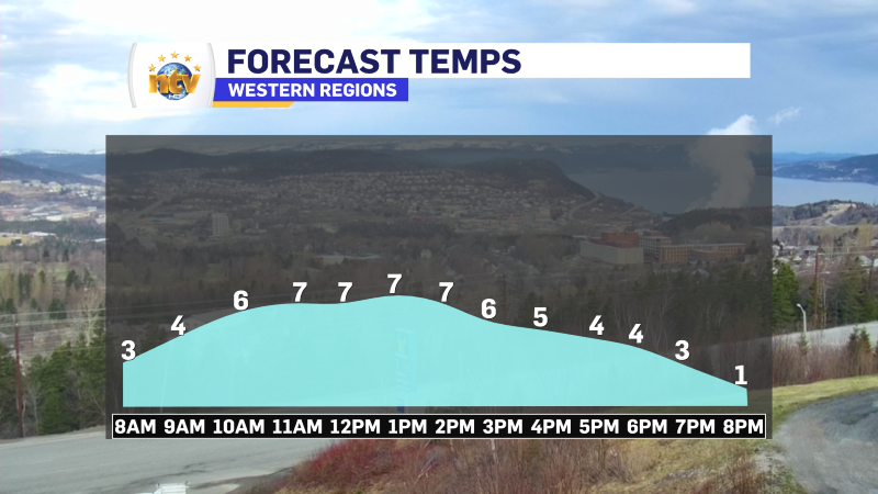
On the West Coast, a cold front will sweep through, driving a large temperature drop this afternoon. Rain showers will change to snow flurries. In fact, some of the snow flurries or squalls that develop later today and tonight may be intense in some areas. They will relax overnight and end Tuesday morning as warmer air returns.
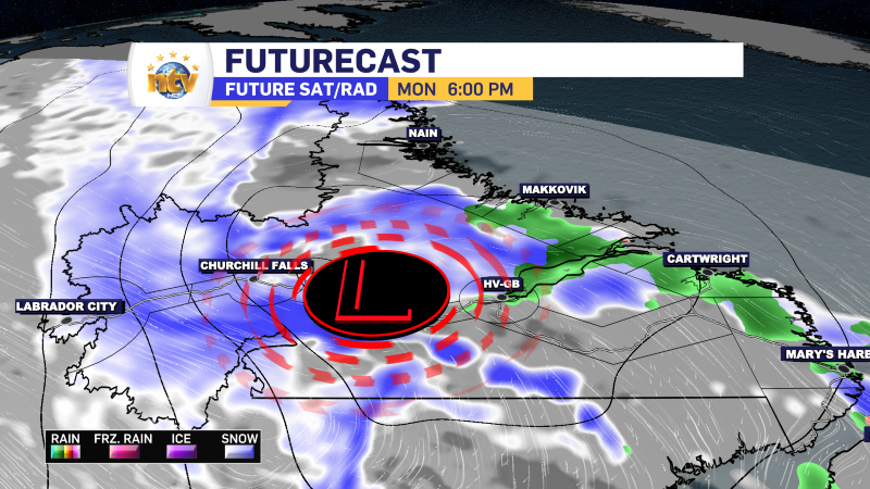
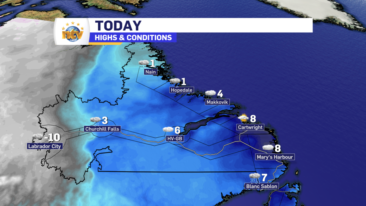
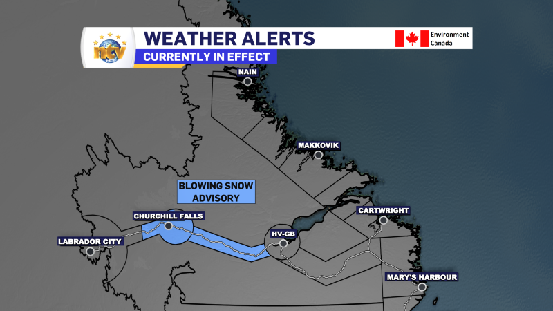
This is all being driven by a quick-moving area of low pressure that will track across the region today and will move from the Lower North Shore of Quebec, into the Churchill Valley and off the north coast near Hopedale. This quick mover is on the border of some very cold air and will be a small but very energetic system. The bottom line is that much of northern and western Labrador will see a period of snow, gusty winds, and eventually very cold temperatures for the time of year as this moves through. In fact, as of 6:04 AM AST, Labrador City and Wabush are reporting a temperature of -10º.
A Blowing Snow Advisory is in effect for the Churchill Valley and Churchill Falls today into tonight, and that comes from the ECCC NL Weather Office in Gander. Snowfall amounts up to 10 cm are expected later today and this evening, along with wind speeds gusting as high as 80 km/h.
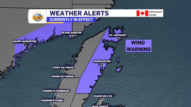
This low will also generate high wind speeds for parts of the Labrador Coast, the Straits, and the Northern Peninsula later today, tonight, and tomorrow. A Wind Warning is in effect for the Northern Peninsula East tonight into Tuesday for southwesterly wind gusts as high as 110 km/h along parts of the coast.
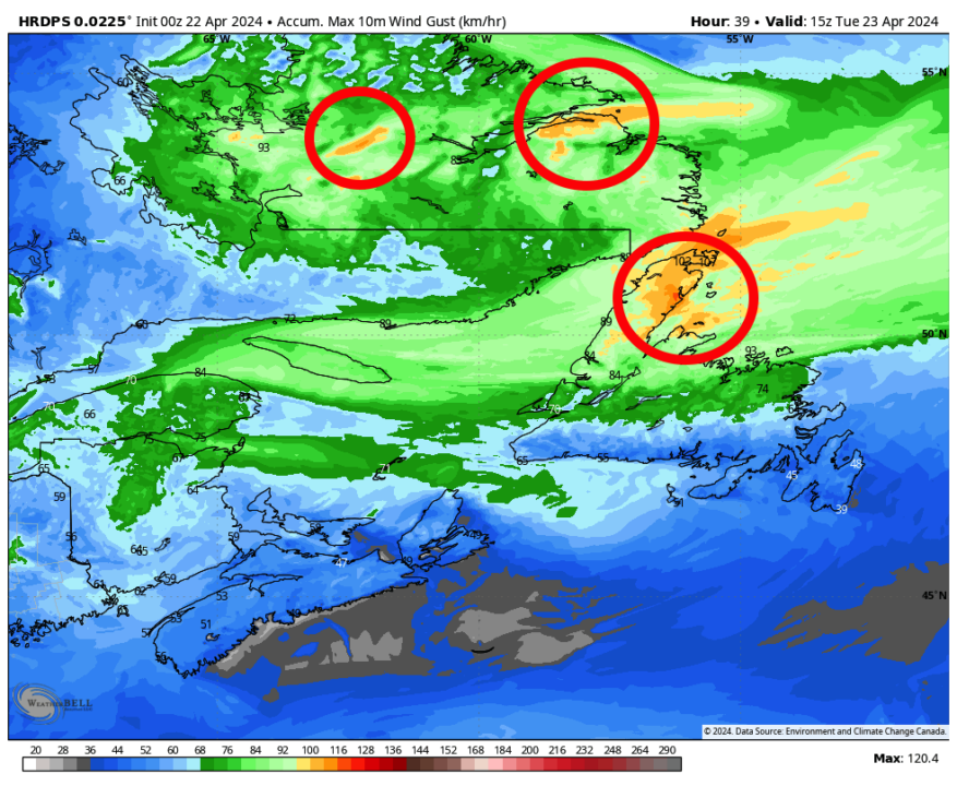
There will be a few other areas with high gusts as well. The image below shows the peak wind gusts between today and late Tuesday. Notice there area between Cartwright and Rigolet? And the top of the Baie Verte Peninsula? These areas will also see winds gusting near 100 km/h at times in the next 24 to 36 hours. Areas farther south and west will see breezy conditions, but not the wind like that.
The snow will end in Labrador from this low early Tuesday morning as it rolls offshore. However, another system will move into the West on Tuesday, which is going to drive more snowfall in the west by the afternoon. The Island will see a more tranquil day on Tuesday. However, rain is on the way for Wednesday on the Island, while more rain and snow will fall across the Big Land. I’ll have more details on the extended forecast later today.
Have a good one!
-

Hot and humid start to the weekend
The Island will see sunny skies to start today. There are a few fog patches…


