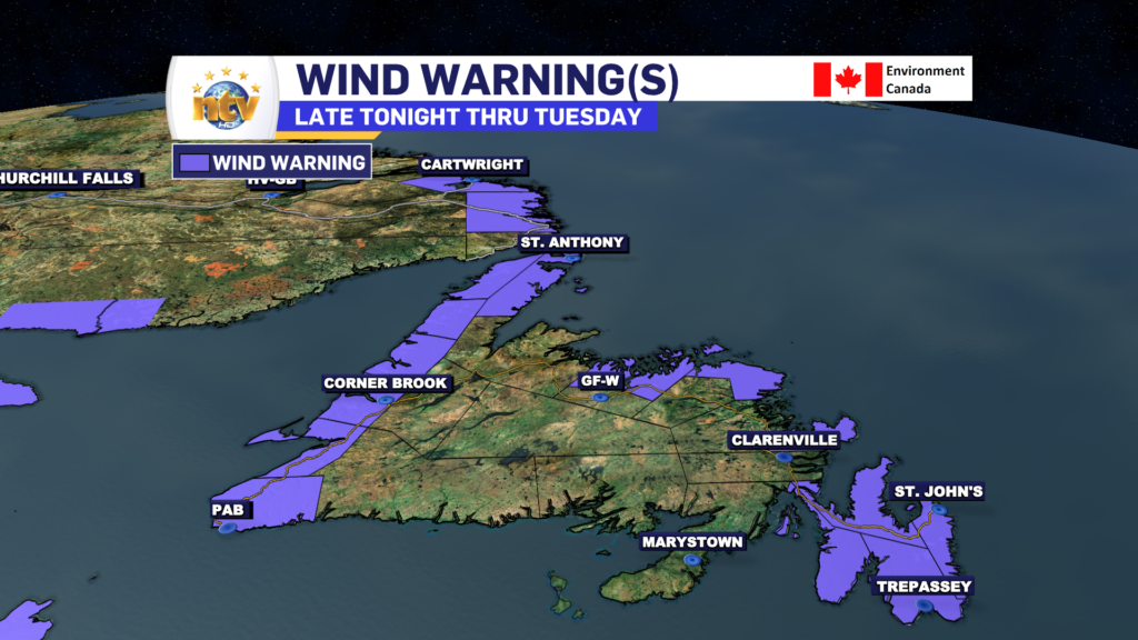
A strong area of low pressure will move across the region Tuesday and will bring a period of high winds and waves through the course of the day.
For eastern and northeastern Newfoundland the highest wind speeds will occur Tuesday afternoon and peak in the 80 to 100 km/h range from the southeast. Wind speeds will be highest along the coast.
For the eastern side of the Northern Peninsula, the gusts will be in the 80 to 100 km/h, from the southeast, with the highest gusts along the coast, during the day Tuesday and into the afternoon.
From Parson’s Pond to the Strait of Belle Isle, winds will gust from the southeast as high as 80 km/h, except along the coast, where gusts will be as high as 130 km/h during the day Tuesday and into the afternoon.
Farther south, from Gros Morne down through Bay St. George, southeasterly winds will gust to 80 km/h for most areas, except as high as 130 km/h in areas prone to enhanced southeasterlies. The outer edge of the Bay of Islands and areas like Woody and Norris Point are prime examples of where the winds will be enhanced. The highest winds will occur late tonight and Tuesday morning.
A Wind and Wreckhouse Wind Warning are in effect for the Channel-Port aux Basques areas for tonight and Tuesday morning. Winds will gust from the southeast as high as 100 km/h. And the Wreckhosue area will see gusts to 130 km/h.
A Wind Warning is also in effect for southeast Labrador, as far north as Lodge Bay, for winds gusting to 100 km/h along parts of the coast Tuesday afternoon and evening, from the southeast.
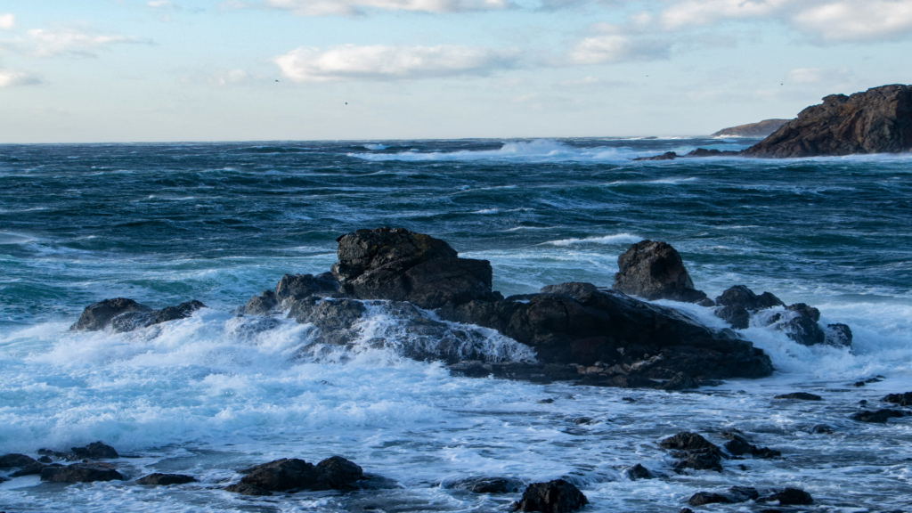
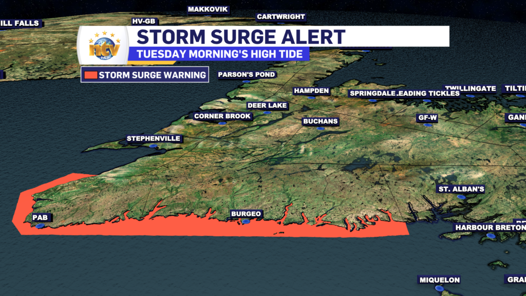
A Storm Surge Warning is in effect from Burgeo to Channel-Port aux Basques for Tuesday morning, centered around high tide (7 AM to 10 AM). Expect waves of 4 to 6 metres breaking upon approach to shore. Expect water levels to exceed high astronomical tide, with water inundating vulnerable sections of the coastline.
-
Hot weather continues across the province
It will be another nice day across the Island portion of the province with a…