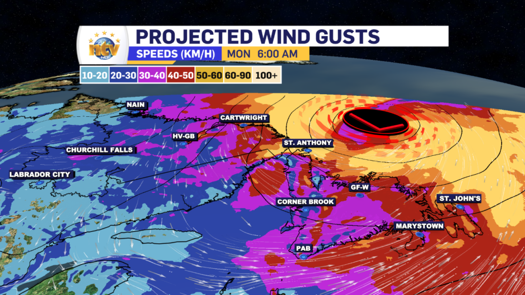
What’s left of Post Tropical Storm Lee is swirling in the North Atlantic this morning north of Newfoundland and east of Labrador. The broad circulation around the low is driving some gusty winds across parts of coastal Labrador, along with some areas of the Island from the Great Northern Peninsula to the Avalon.
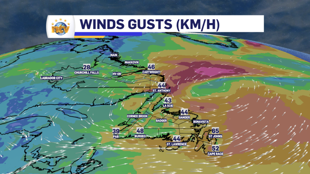
As the remnant low of Lee departs throughout the day, the wind speeds will drastically come down across the Province, leaving a much calmer late morning and afternoon for you to enjoy!
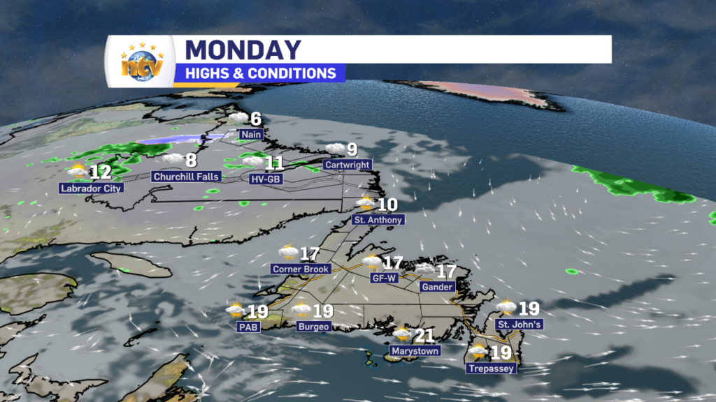
Our Monday will see a mix of sun and cloud over much of the Island, with highs ranging from near 10º in the north to nearly 20º, or a bit better, in the south and southeast. The difference today will be the air mass will not be as humid, so even though temperatures will be similar to the last few days, it will not be nearly as muggy. There may be a few scattered showers this afternoon.
Labrador will see highs near 10º today, with areas of scattered showers… and dare I say, high-elevation flurries. It may seem early for many… but that’s probably not unusual for the Big Land this time of year, especially on the back side of a Post Tropical Storm, which often pulls down some cooler air.
The Next One
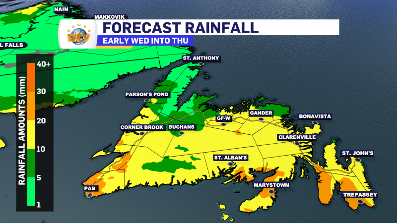
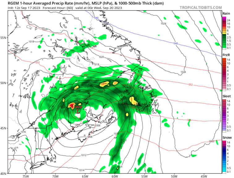
The next area of low pressure in the pipeline arrives tomorrow. This will spread rain across the Island during the second half of the day. This low will bring rain into Wednesday for parts of central, east and northwestern Newfoundland and eventually southeast Labrador as well. Long story short… Tuesday and Wednesday don’t look great at this point.
Your next update will be this afternoon!
/Eddie


