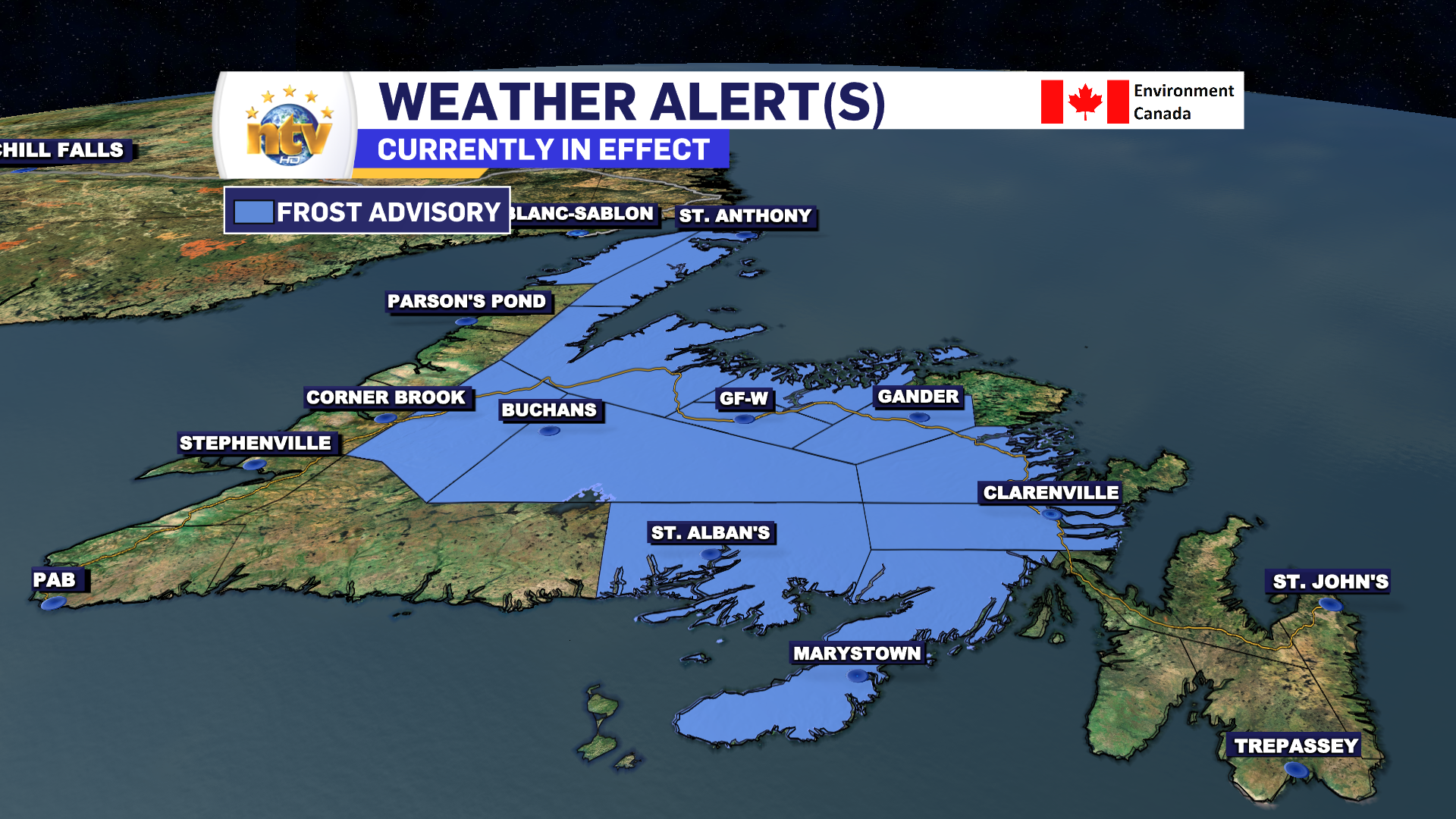
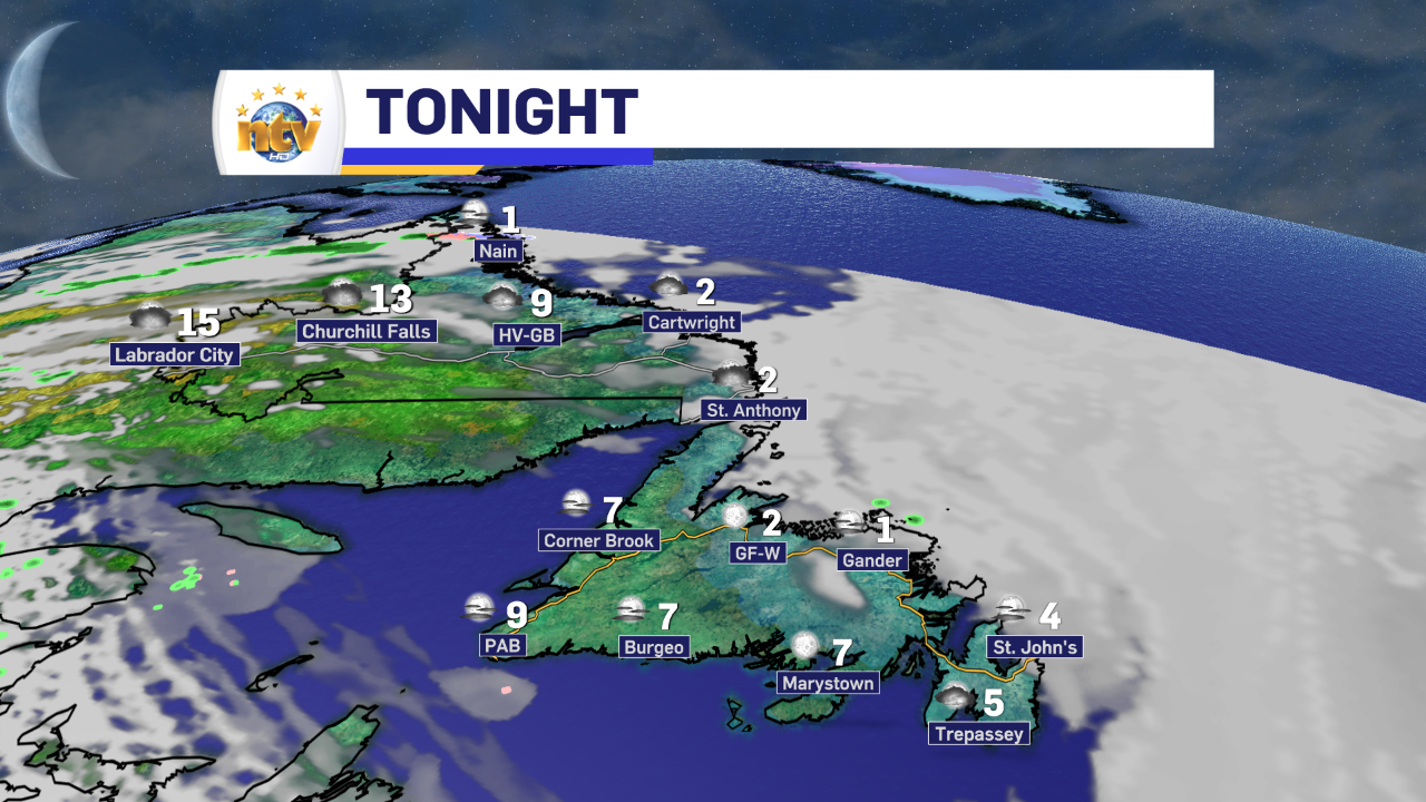
Before we talk about the sunshine on the way for tomorrow, we need to get to the blue elephant in the room, which is the Frost Advisory in effect for much of the Island west of the east coast and east of the west coast for tonight. Lows in many locations, particularly those inland and low-lying will be in the -1 to +2 range overnight.

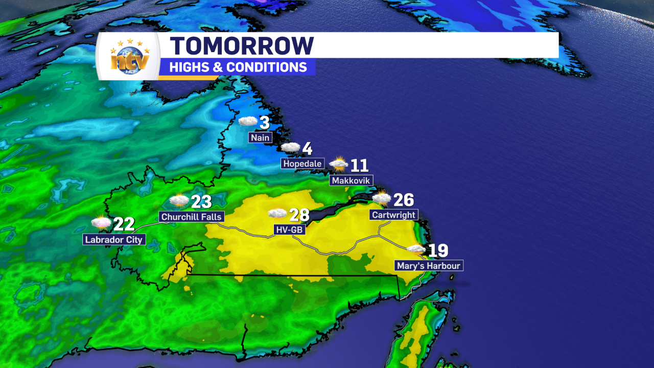
Low temperatures across the rest of the Province will vary somewhat, but expect single digits to be widespread, with the mildest readings being found in Labrador West.
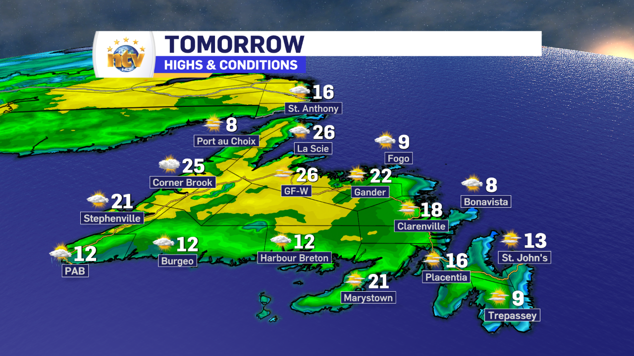
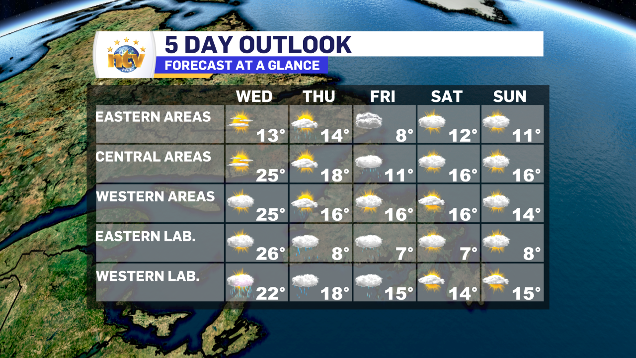
Wednesday will, by far, be the nicest day of the week across the Island portion of the Province. Skies wil be sunny and temperatures will reach the mid-teens to mid-20s for afternoon highs. The warmest readings will be found over Central and western sections.
Wednesday will also be a day where the sea breeze plays a big role in afternoon temperatures. Meaning coastal areas will likely be considerably colder than their inland counterparts. And a little distance will have a big impact. Take the Avalon, for instance, tomorrow afternoon. Areas along the coast, and east will struggle to get out the lower to mid-teens, while areas just inland will see middle to upper teens. And further inland low 20s are attainable!

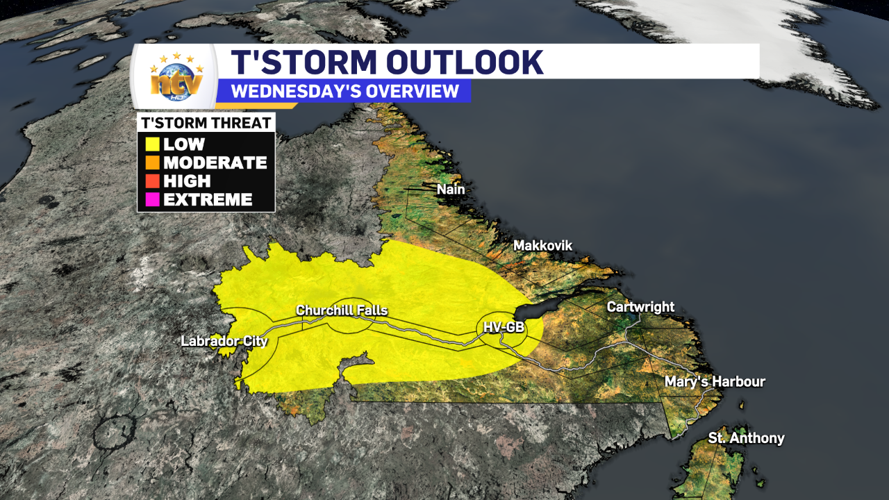
Labrador will see highs in the single digits, teens, and 20s on Wednesday. The warmest readings will be found between Cartwright and Goose Bay, where the mid to upper 20s will be found in the afternoon. There’s also the chance of some afternoon thunderstorms from Goose Bay to the Quebec border in the afternoon.
Thursday will see somewhat cooler readings across much of NL and more in the way of widespread showers. Sadly, the weather looks to remain unsettled as we go into the rest of the work week and the weekend.
-

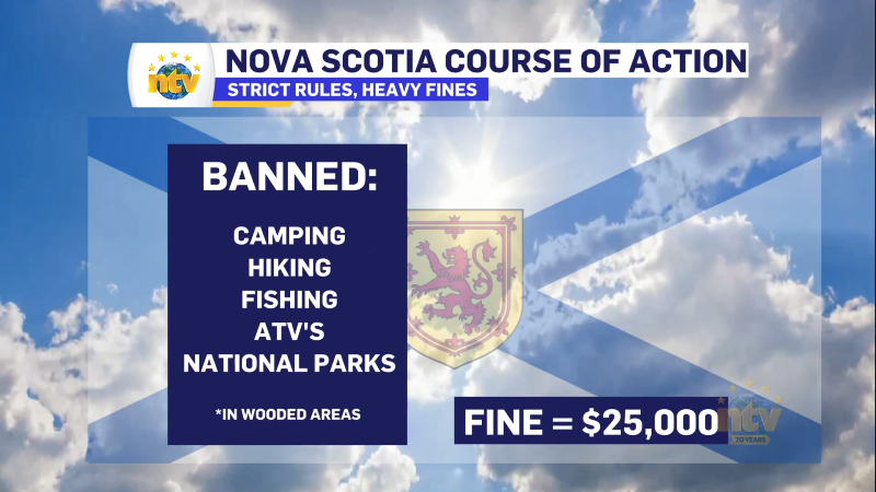
Hot and dry weather continues
Sunny skies are expected right across the province today. There will be some areas of…
-
Canada Games officials monitoring air quality for athletes amid wildfires
In just a few days, thousands of athletes will descend on the metro St. John’s…