Winter Storm breaks Spring hopes across Newfoundland Tuesday with up to 40 plus cm possible for Avalon

Ryan Harding, NTV Weather Centre
Here we go again with the latest low-pressure system moving over Newfoundland Monday night through Tuesday, toggling the winter storm alerts once more and dropping 20-50 cm of snow over parts of the island.
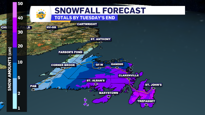
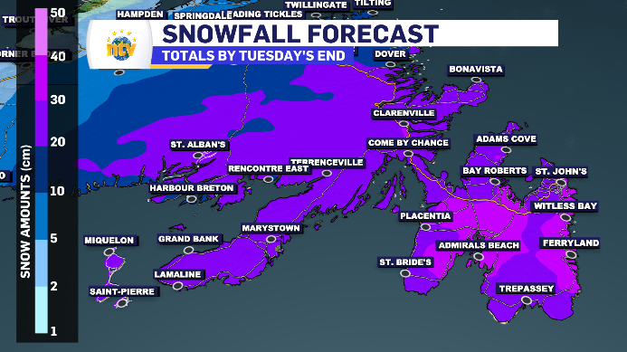
20-50 cm of snow for Burin, Avalon, Bonavista Peninsula and Clarenville Tuesday
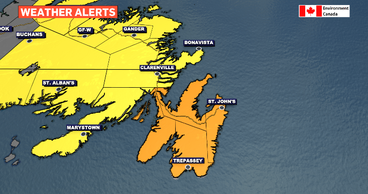
The snow is making it’s entrance on the south side of the Burin and Avalon Peninsula Monday evening. As the centre of the system moves closer to these regions, the snowfall rates will increase peaking at 4.5 cm/h early Tuesday morning for the Metro region. As a result, the Avalon is under an orange-level winter storm alert compared to the rest of the regions classified under the lesser yellow.
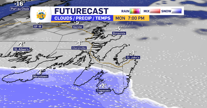
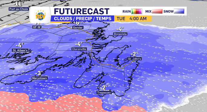
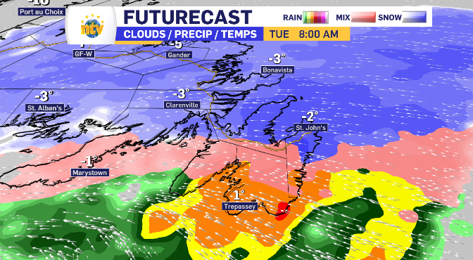
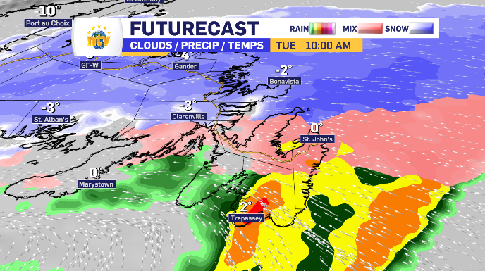
The snow looks to finish with a transition into freezing rain before making the full switch to rain at various times. Following the trend of the snow arriving, the south regions will see the transition first, leaving the Metro region to see the change to ice and freezing rain late Tuesday morning and the rain by the early afternoon. The rain amounts range from 5-30 mm with the higher end of that being reserved for the Southern Shore as the temperature looks to increase earlier.
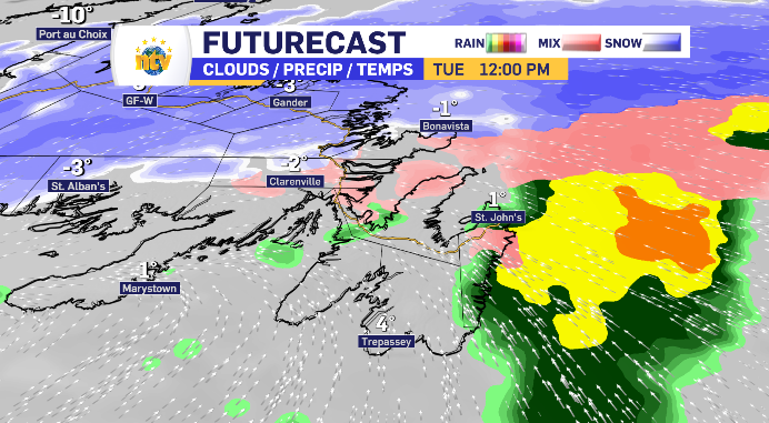
When it’s all said and done the snow range break down is as follows:
Burin Peninsula: 20-30 cm
South Avalon: 20-25 cm
North Avalon: 25-50 cm
Clarenville: 25-35 cm
Bonavista Peninsula: 25-35 cm
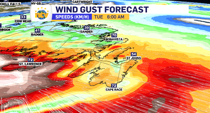
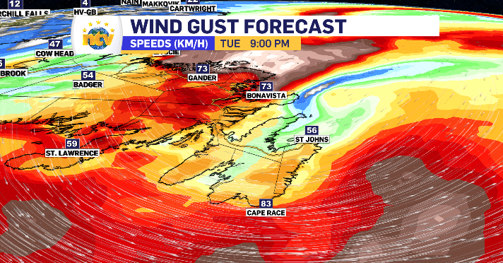
The wind looks to pick up from the east early Tuesday morning and again in the evening on the back end of the system from the west, both with gusts ranging from 50-85 km/h.
15-30 cm of snow expected for Central Newfoundland Tuesday
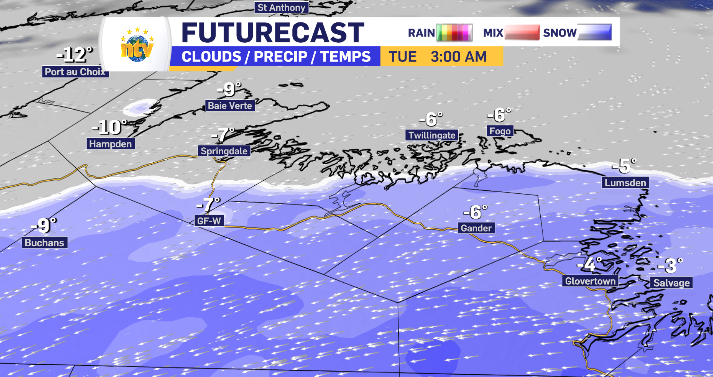
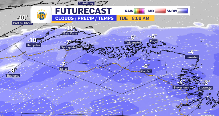
The outer bands of the system reach Central Newfoundland later into the evening, starting with flurries through the overnight. More snow is expected in Gander compared to say Grand Falls-Windsor as the centre of the system is directed further east. Between 7-8 am Central, Fogo and Twillingate, the Kittiwake coast and the Baie Verte Peninsula are expected to have started the snowy day. Temperatures hold cold enough throughout to see snow exclusively while the wind shifts from northeast to west as the system passes gusting 30-60 km/h.
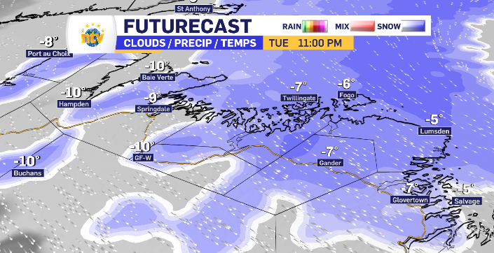
The snow looks to hold consistent throughout the day and evening, reducing to flurries right at the end of Tuesday. Again, the wind looks to peak morning and night.
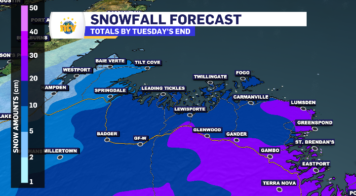
The above region’s totals for Tuesday look as follows:
Gander: 20-30 cm
Kittiwake Coast: 15-30 cm
Fogo/Twillingate:
Grand Falls-Windsor: 15-25 cm
Baie Verte Peninsula: 5-15 cm
South Coast Newfoundland under blowing snow alert while West Coast and north sees limited snow totals
The wind will be relatively evenly distributed across the south and west coast of the island, however its the system’s outer bands that will be delivering the snow, so, the totals are expected to be significantly lower compared to the central and eastern regions.
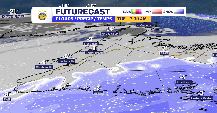
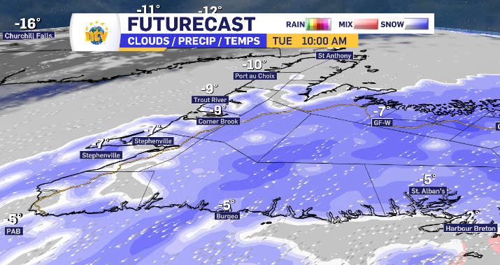
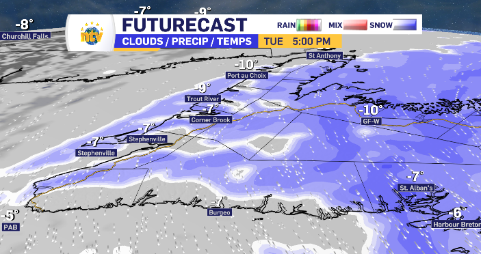
The snow starts along the south coast through the overnight, with lower snowfall rates the further west you travel. By late morning, flurries will kick off along the west coast, lasting through to the supper hour before tapering off.
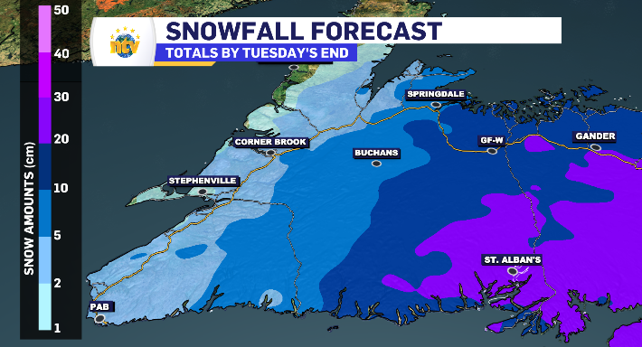
West and South Coast of Newfoundland expected snowfall totals Tuesday:
St. Alban’s: 15-25 cm
Harbour Breton: 10-20 cm
Burgeo: 10-15 cm
PAB: 5 cm
Stephenville: 3-5 cm
Corner Brook: 5-10 cm
Limited to Flurries for Newfoundland’s Northern Peninsula Tuesday
As the system rotates away from the island, it’s outer bands does brush the Northern Peninsula with flurries starting late in the afternoon and lasting into the early evening dropping a manageable 2-4 cm along the way.
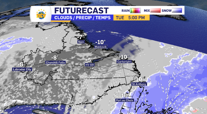
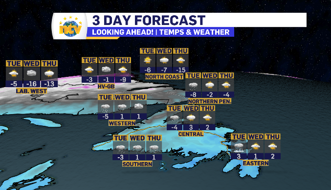
Labrador has it pretty easy this week, some extra cloud on Wednesday, but a sun and cloud mix for the next 72-hours or so. The temperatures to swing, warming through Tuesday only to drop right back down into Wednesday.