


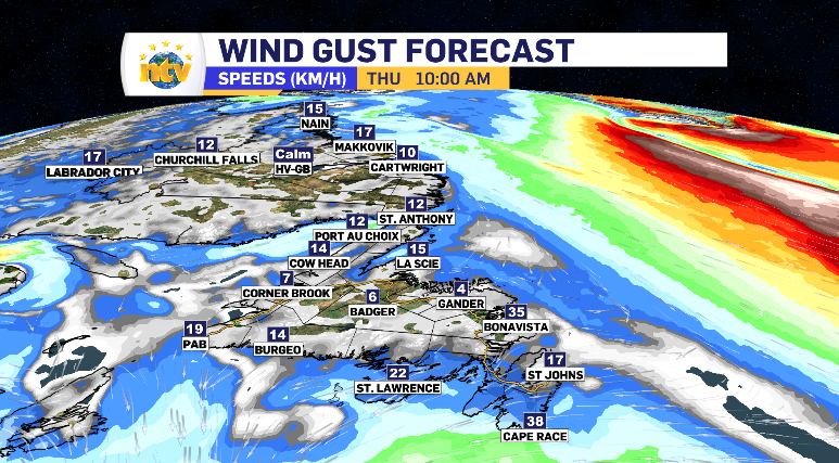
Winds remain low for another calm Thursday
Ryan Harding, NTV Weather Centre
What a difference 48 hours can make. After a large portion of the province was left buried in snow and with waves crashing it’s shorelines, Wednesday brought just a breath of wind – and Thursday brings a similar stillness.

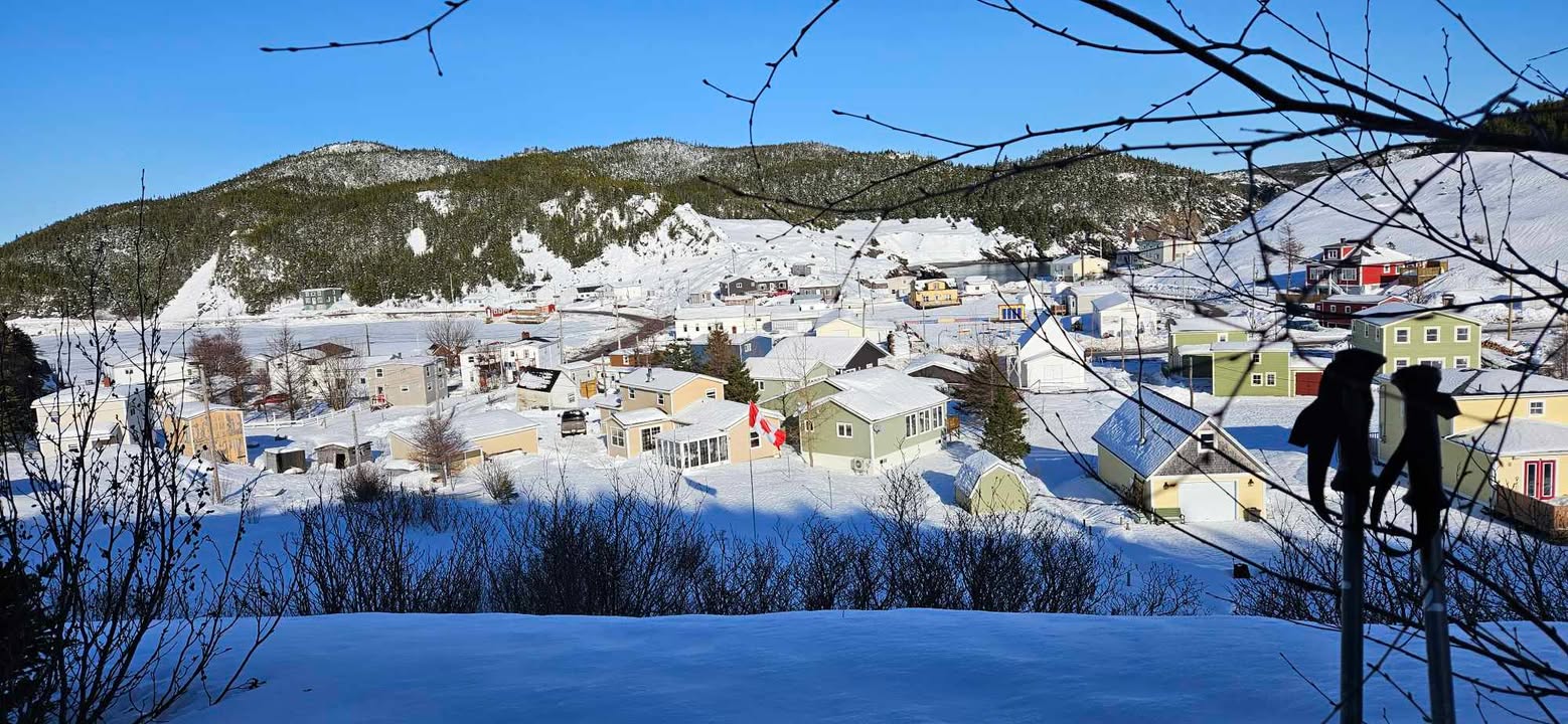
Harbour Breton, Beulah Drake
The lone regions to experience wind above the 30 km/h province-wide on Thursday is Bonavista and the Southern Shore – and it’s not much more than that. This is due to a low-pressure system passing by the south our province. Originally, this system looked to spread it’s outer bands across the very bottom of Newfoundland. However, now it looks to track beyond range of land.
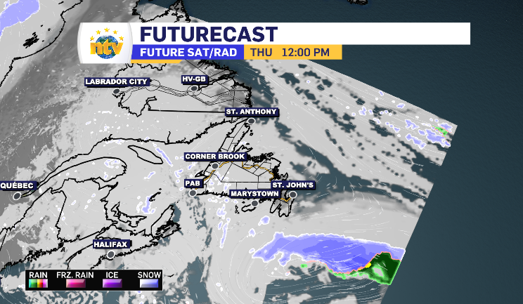
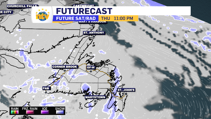
The day doesn’t pass with an absolute net-zero snowfall. There are some flurries spending time along the south and west coast. Those were forecasted to begin Wednesday evening, spending limited time crossing central Newfoundland and the Baie Verte Peninsula as well. From overnight to end of day Thursday, parts of Corner Brook could see up to 5 cm in total, while the other regions fall in the 1-3 cm range.
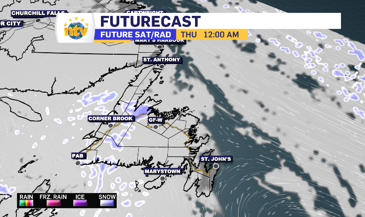
Late Thursday evening those flurries pick up some distance and travel across the Connaigre Peninsula, into the Burin Peninsula and finish over the Avalon through the overnight, all areas should expect to see 1-2 cm at the very most. Essentially, Thursday night leaves a dusting behind.
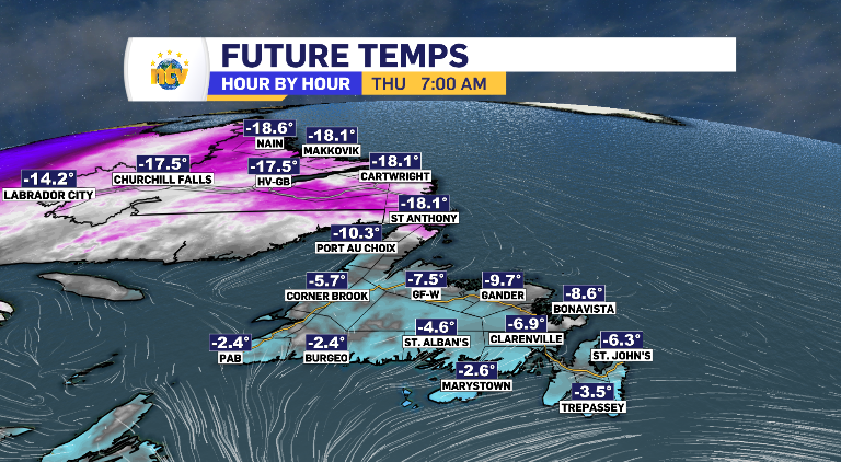
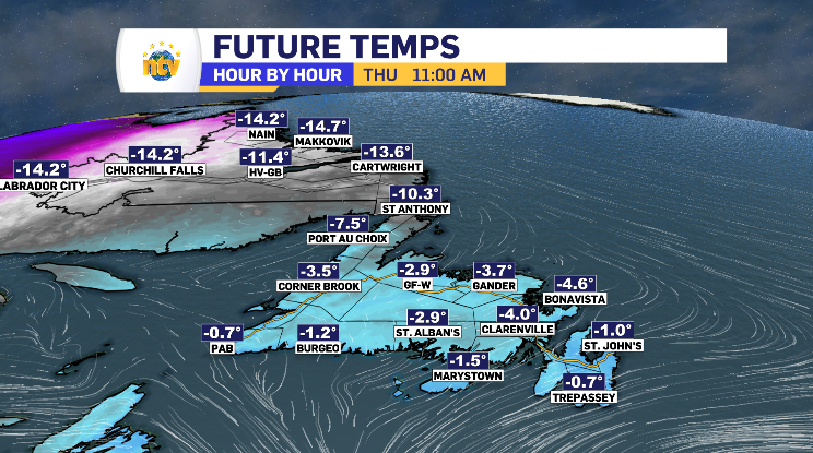
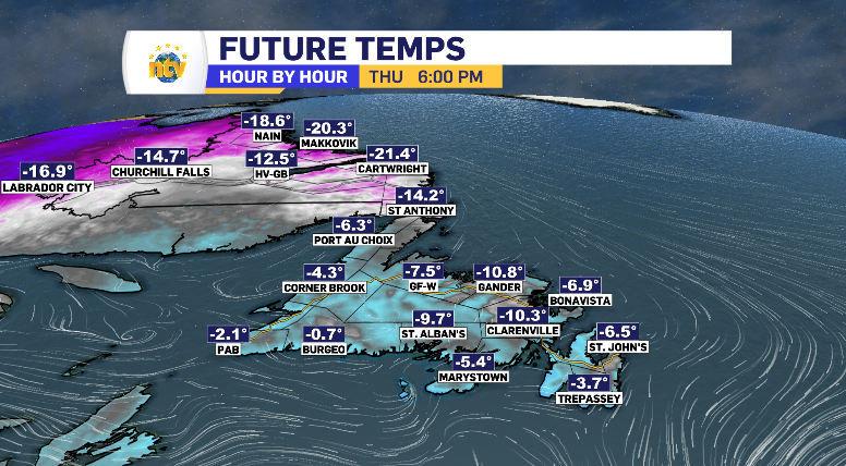
Temperatures stay seasonal into Thursday, following a trend you’d expect for an average day. Cooler in the morning and evening, enjoying day-time highs by the afternoon. With the limited wind, wind chills will be limited as well.
Enjoy the calm and we’ll see you on the news!