Sunny and breezy continues across Newfoundland Friday with a little bit of everything in Labrador

Ryan Harding, NTV Weather Centre
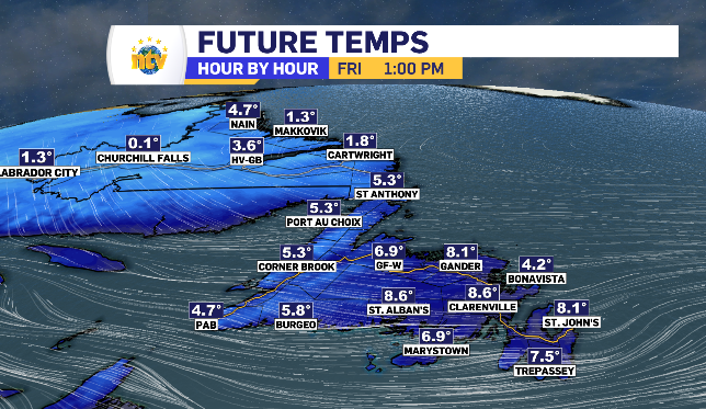
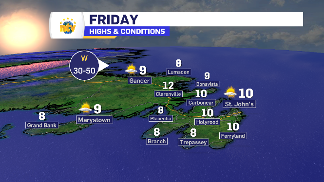
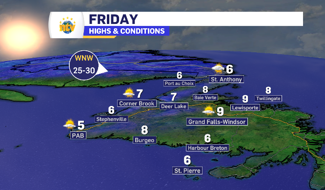
Sunny skies with limited highs for Newfoundland Friday
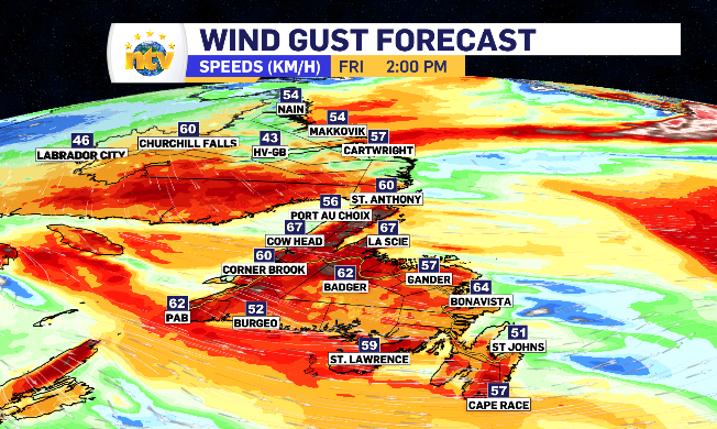
Much the same for Newfoundland Friday, when compared to Thursday. The sun continues to shine, while the west and northwest winds keep the daytime highs to the mid teens, single digits for some. Like Thursday, Friday’s wind is expected to increase as the day unfolds.
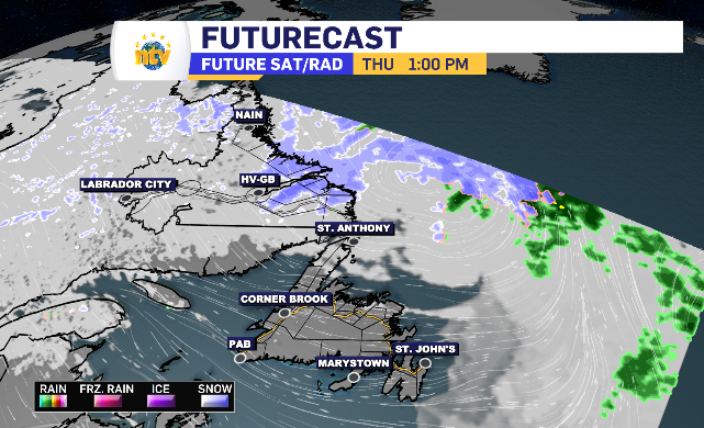
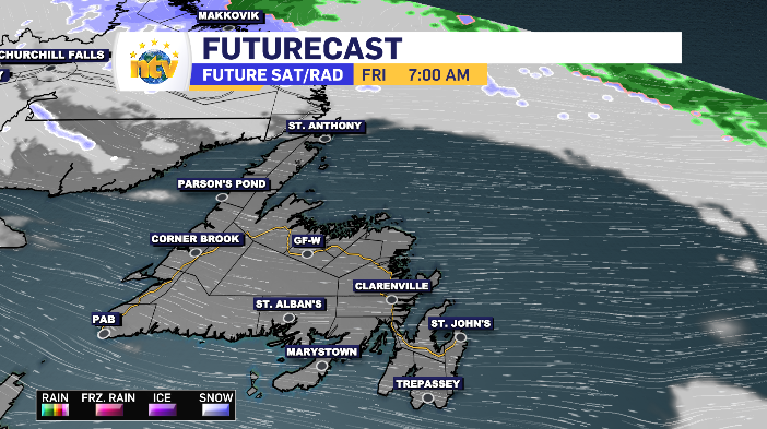
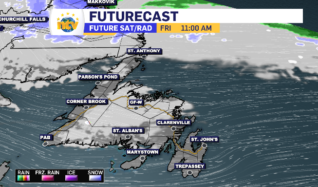
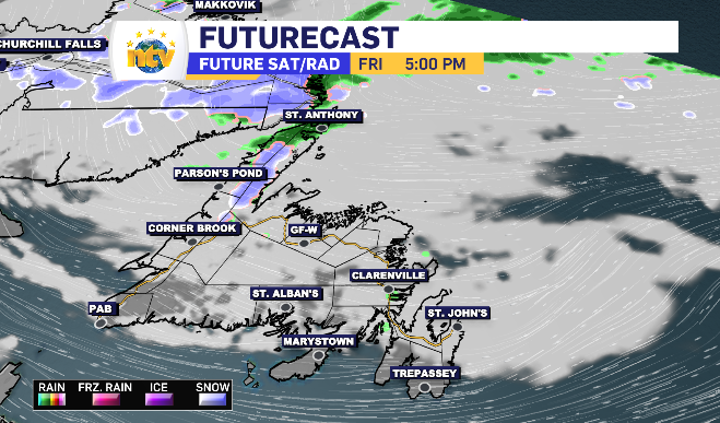
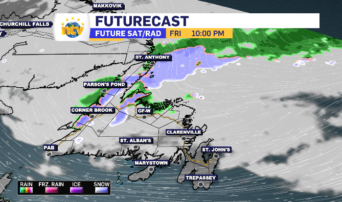
There is some increasing cloud moving in late in the afternoon, settling in over the Central region and expanding east. To that, some precipitation will pass through the Northern Peninsula and make it’s way across the northern side of the island into the evening and overnight.
It looks as though the first moments of the precipitation could be snow, likely a wet snow, before transition into rain. The long range mountains do have the opportunity to see limited accumulation in the highest elevated areas.
The rain totals look to top out simply as 1-4 mm.
Newfoundland and Labrador’s daytime highs for Friday
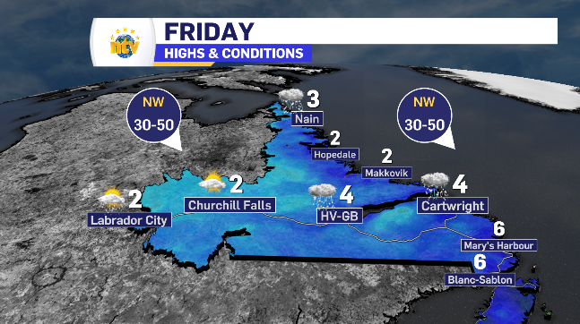
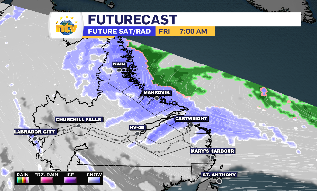
Snow into rain for portions of Labrador Friday before clear weekend
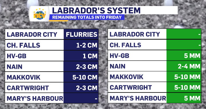
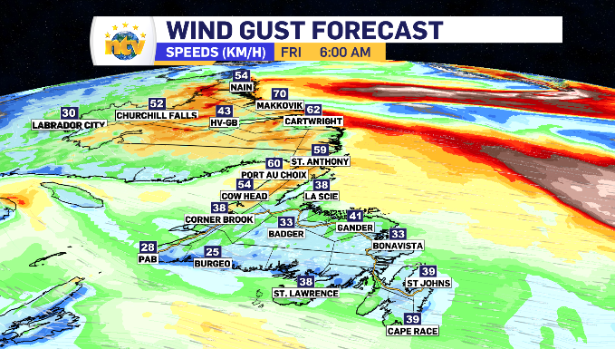
Nain through to Makkovik remains under a special weather statement from Environment Canada. Increased wind gusting 60-90 km/h mixed with the final hours of snowfall transitioning into rain is the broad outlook of that statement.
Friday looks to start cool and warm to above zero through the late morning, allowing for coastal Labrador into Happy Valley-Goose Bay to see the snow finish off as rain.
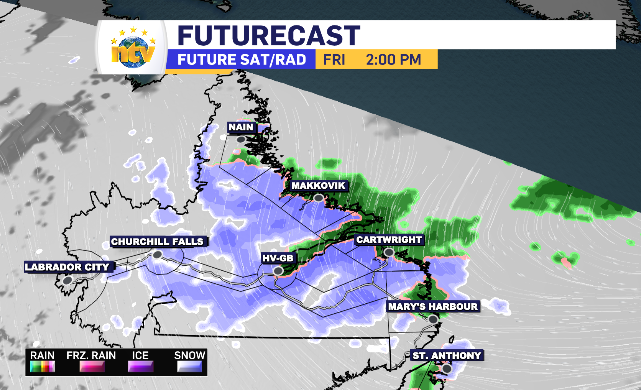
The remaining totals of both the snow and rain can be found below.