Snowfall alerts shift to Northern Peninsula and Coastal Labrador Friday
Ryan Harding, NTV Weather Centre
On to the next one! The weather alerts board is going to be warn out by winters-end as they continue to flash for Friday into Saturday. This time around they’re reserved for the northern portion of the island and coastal Labrador.

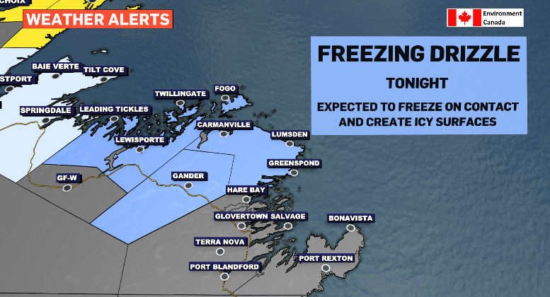
We’ll start with the lesser of the alerts in terms of severity which is granted to Gander and vicinity, Bonavista North and Bay of Exploits. The icy blue zone represent a freezing drizzle alert for Thursday evening. We’re anticipating this to be toggled off by Friday morning.
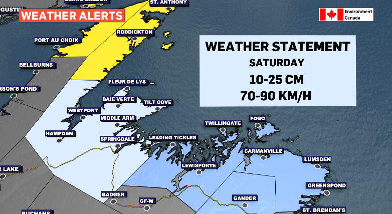
Right next door from Green Bay to white Bay we find a special weather statement. This is all apart of the storm that will be effecting our next regions with a wide range of effect. 10-25 cm is the broad range handed down currently. We saw wide ranges come to fruition on the Avalon from Tuesday’s system where parts of St. John’s topped at 53 cm while Paradise was slammed with 75 cm. The further north you travel on the Baie Verte Peninsula, odds are you’ll have the better chance of reaching the high end of the given totals.
The snow for this region looks to kick off Friday night, more so Saturday’s overnight, and last until Saturday evening with the heaviest snowfall reserved for early Saturday morning.
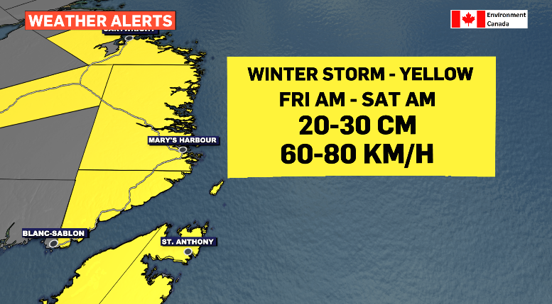
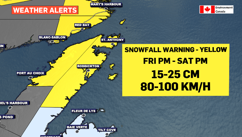
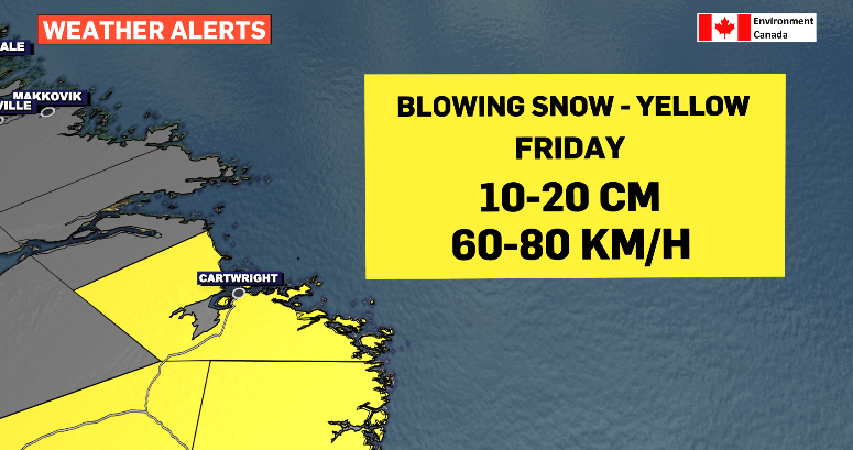
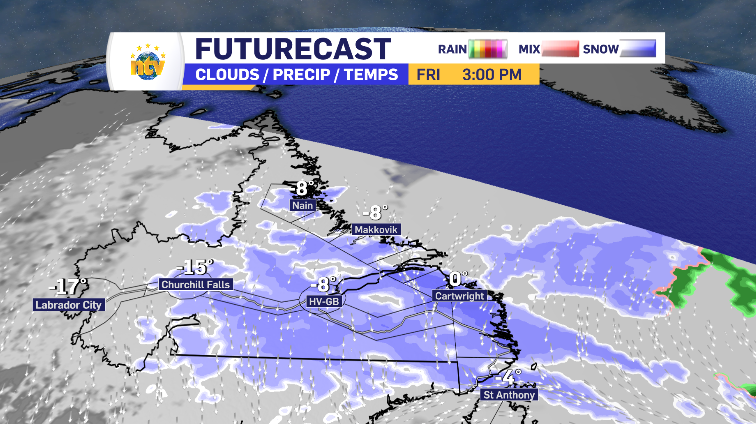
The system is fueled by a strong north wind. The Northern Peninsula and the south coast of Labrador will see first snowfall while also seeing the strongest winds and highest totals. The Northern Peninsula has a snowfall warning in place. In Labrador, Norman Bay to Lodge Bay is under a winter storm alert while Cartwright to Black Tickle-Domino is facing a blowing snow alert.
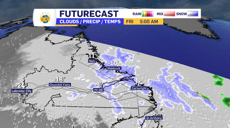
It all kicks off in Labrador Friday morning. By the afternoon, the heavier snow is starting to fall in Cartwright, while the more modest snowfall is creeping across the mainland. There’s a second wave of an increased snowfall rate along the coast Friday afternoon and lasts into Saturday morning for the southern coast.
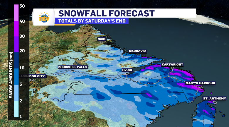
The Labrador totals look as follows.
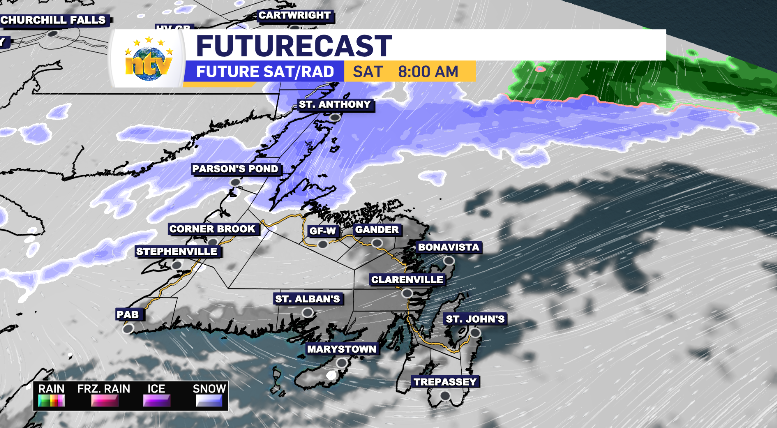
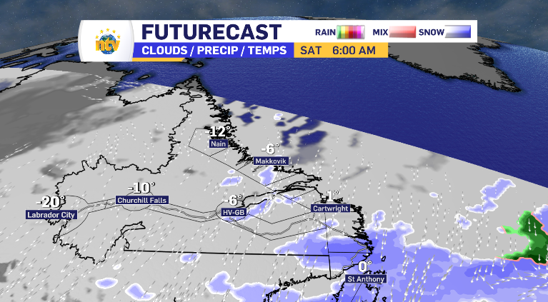
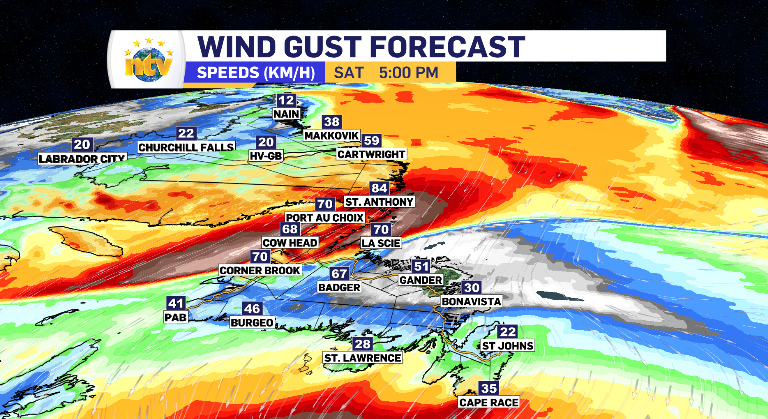
For Newfoundland, the snow looks to hover over the top of the Northern Peninsula Friday afternoon before the west wind below gives way allowing for the snow to push south. This wind pushes with a clip too, ranging from 60-100 km/h by Saturday end.
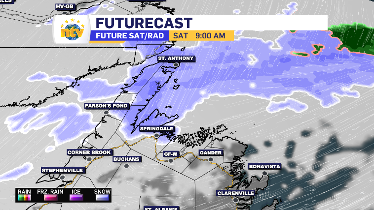
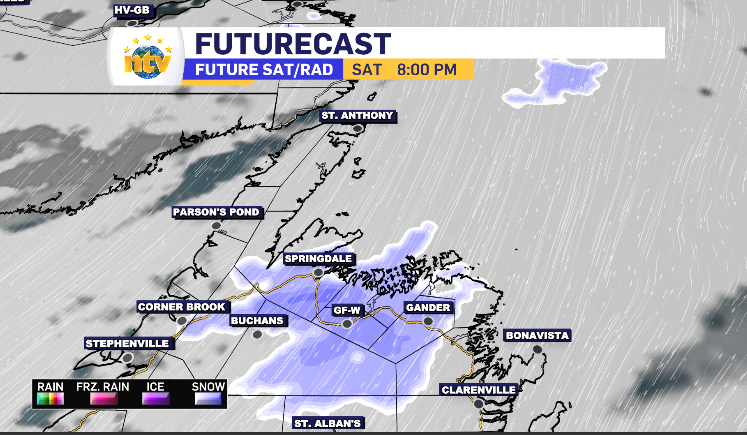
Also by Saturday end the snow has reached central – pushing along into Gander and likely lasting through the overnight into Sunday morning.
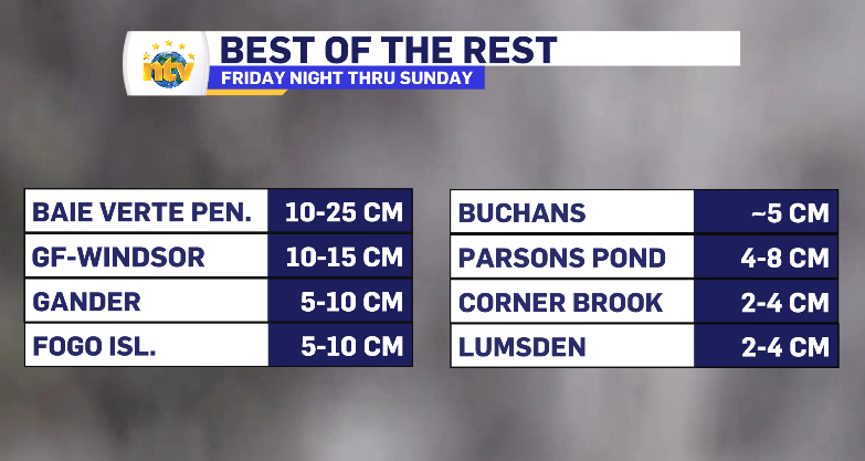
The island totals look as follows.