Snow-related alerts issued for parts of Newfoundland and Labrador Wednesday

Ryan Harding, NTV Weather Centre
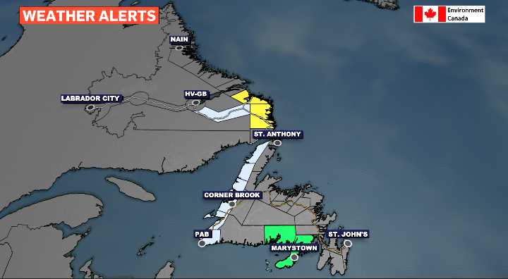
A special weather statement has been issued for the western side of Newfoundland into Wednesday, with coastal Labrador seeing a wind alert added as well. This comes on the back of a low-pressure system bringing strong northwest winds, dropping temperatures and bringing a snow and rain mix throughout the day.
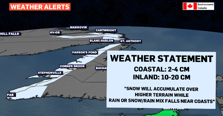
Wednesday’s snow is bookended by rain, transitioning back into rain first along the coastlines. This is going to result in limited accumulation with the higher totals being found further inland and over the higher terrain areas, like in Gros Morne and along the Long Range Mountains.
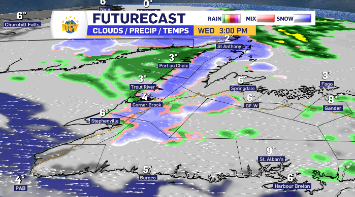

Snow into coastal Labrador Wednesday afternoon and evening
There is a better chance of seeing wider-spread accumulation into coastal Labrador as the best chance for snow comes paired with increased wind from the north, dropping temperatures and toggling on the wind alert from Environment Canada.


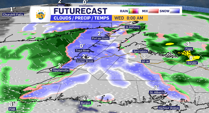
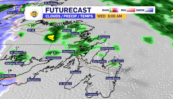
Light rain, cloud and increased wind for rest of Newfoundland Wednesday
The rest of the island looks to finish off with some light rain before entering into a cloudy afternoon. The Baie Verte Peninsula may see a flake of wet snow or two before returning to the light rain and finishing the day, like the rest of Newfoundland, seeing the skies clear into the evening.
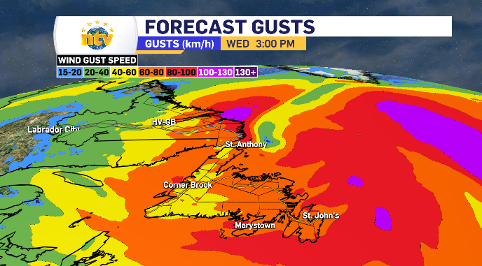
A strong southwest wind shifts west throughout the day with the top gusts along the Avalon coming in the morning and peaking at 60-80 km/h. This wind also drive the fog out for a break from the RDF.


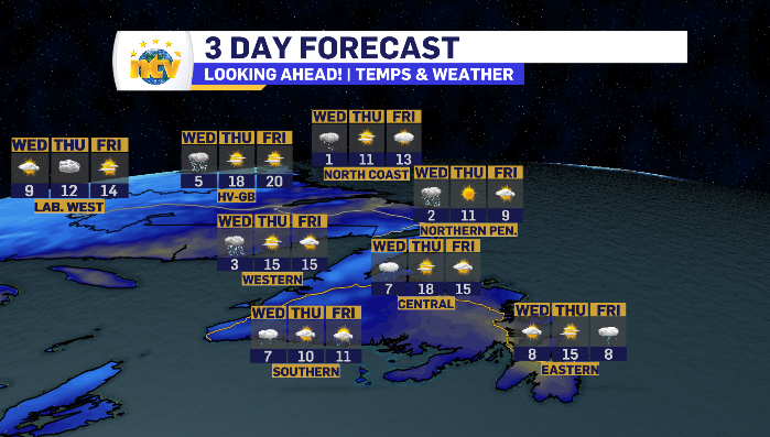
3-Day outlook for Newfoundland and Labrador