


Rainfall Warning in effect for eastern Newfoundland ahead of expected deluge
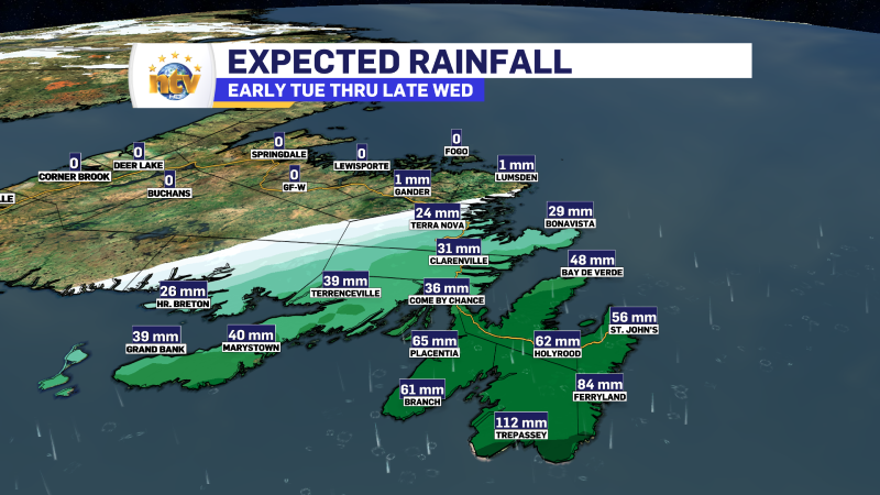
A chain of moisture will move over eastern Newfoundland over the next 24 hours and is expected to bring a hefty bout of rain as it does so. The areas that see rain will primarily be the Avalon, Burin, and Bonavista Peninsulas. Areas just west of there will likely see very little rainfall.
The rain will come in pulses, and the most intense on Tuesday afternoon and night. Rainfall rates will exceed 10 mm per hour at times, and there is also the slight risk of some embedded thunderstorms.

A Rainfall Warning remains in effect for the following areas until Wednesday morning:
- The Avalon Peninsula
- The Burin Peninsula
The Rainfall Warning was issued by the Enviornment and Climate Change Canada Weather Office in Gander and states that between 65 and 125 mm of rain are expected to fall over the warned areas by midday Wednesday.
Similar events in the past have led to localized flooding, especially in locations with poor drainage, elevated water levels in creeks and streams, at times flowing over the banks, water pooling on roads and erosion of road shoulders.
Heavy downpours can cause flash floods and water pooling on roads. Localized flooding in low-lying areas is possible. Don’t approach washouts near rivers, creeks and culverts. Rainfall warnings are issued when significant rainfall is expected.
Stay tuned for further updates from NTV and me throughout the day.