Province-wide break from wild weather stretch
Ryan Harding, NTV Weather Centre
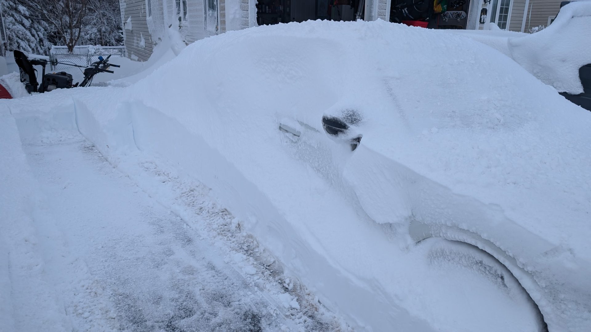
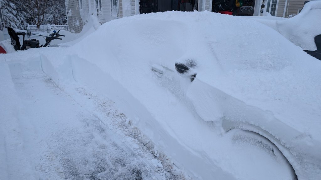
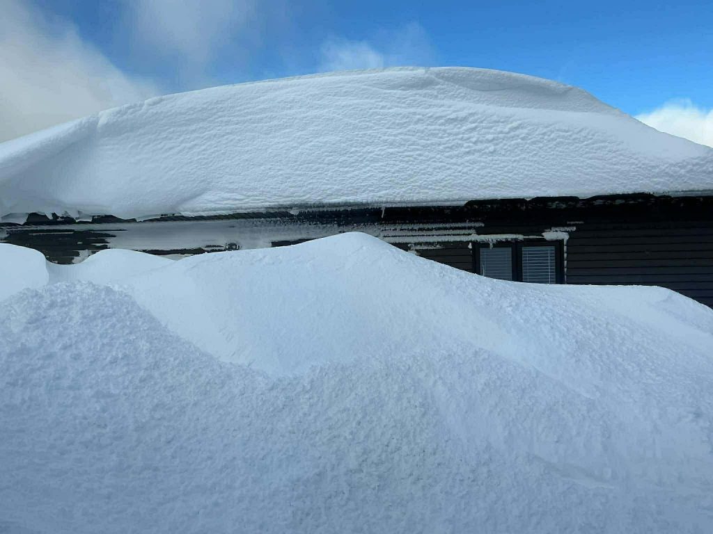
Goodness, that was an eventful seven days of weather. From coastal Labrador being on the docket for 50-60 cm, the northern side of the island piling up 50+ cm over a 60 hour period – it was all capped off with the Avalon’s largest snowfall of the year Monday.
Mount Pearl, Caleb Thorne
Clarenville, Shirley Osmond
The top totals, in terms of snow, fell on the Avalon into Clarenville. Kicking off in the early hours of the morning and lasting, in some degree, for a full 24 hours.
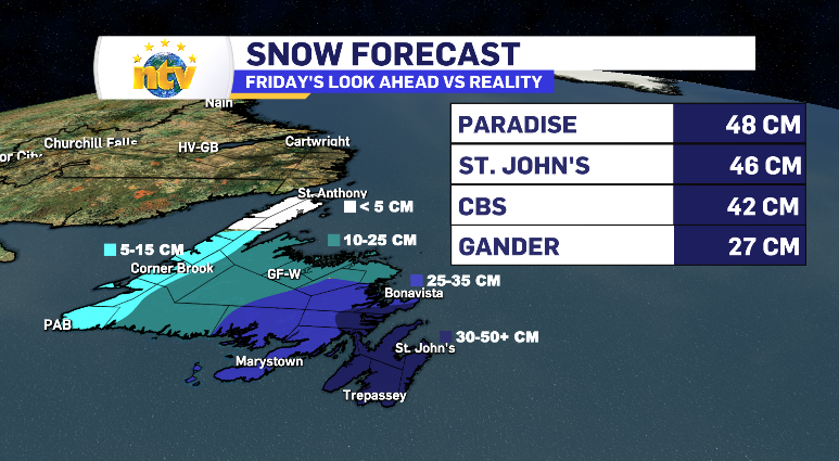
The outlook from Friday and Sunday’s broadcast held true. The West Coast stayed closer to the 5 cm mark, while the Burin Peninsula, admittedly, would have been better represent by the neighbouring 10-25 cm range. Winterland finished the event with 19 cm, a number that represents the peninsula well.
The other two elements of this storm were the wind and waves. Eastern communities saw another night of 100 km/h plus winds while it was snow, reducing visibility to next to zero for a large portion of Monday’s early evening hours.
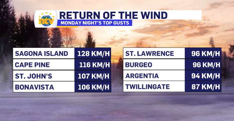
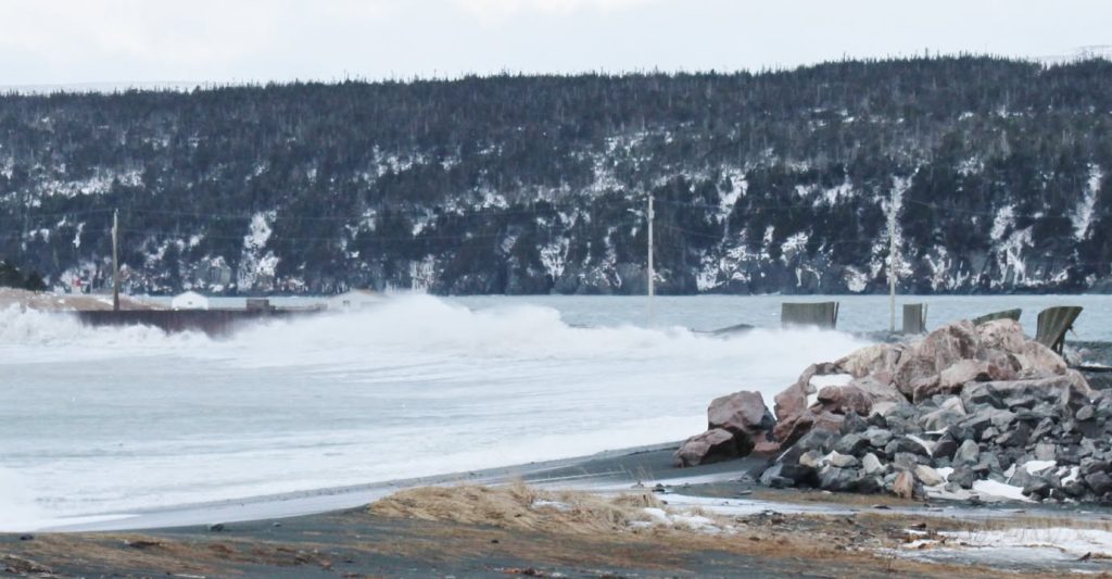
With the highest wind recorded on the back end of the low-pressure system a coastal flood alert was in place. Waves in the six to nine metre range were forecasted, specifically for the south-facing side of the island. Those waves delivered. Trepassey’s breakwater took another blow, placing that community back in to a state of emergency, while Harbour Breton has some of it’s wharves completely submerged.
Trepassey, Clifford Doran

Harbour Breton, Garry Molloy
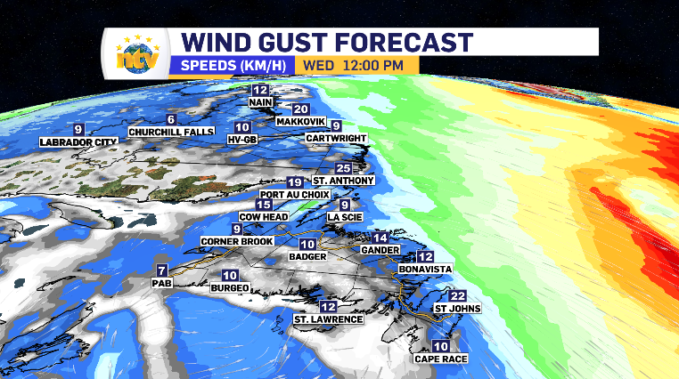
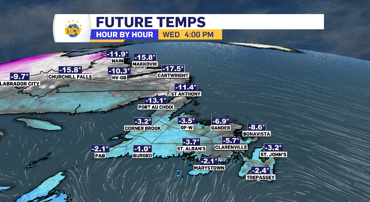
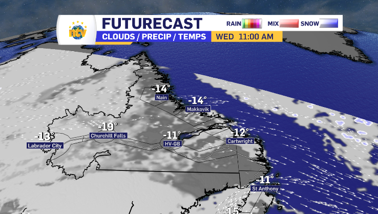
The wind is anything but the weather story going forward. From Nain to St. Shott’s, Wednesday will see the wind calm down to just a breath, leaving the seasonal temperatures to feel almost exactly as they appear at base temp. A welcomed break!
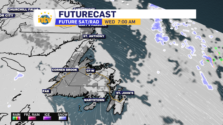
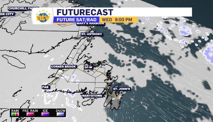
When it comes to conditions, the entire province is going to start with sun. In Labrador, that clouds over in Labrador West relatively quickly. For the island, the cloud makes it’s push in the afternoon starting in Port aux Basques, reaching Clarenville by sundown. Those clouds look to hold some flurries in them for the coastline on the south and west side of the island.
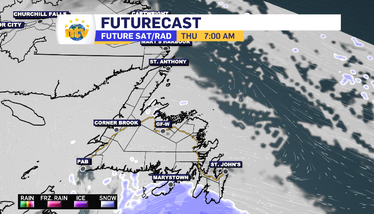
The next low-pressure system comes Thursday. However, as it tracks currently, it appears just the outer bands cross over the province. Brushing the Burin Peninsula and southern portion of the Avalon, before moving along. On the high end, there may be up to 3-5 cm in that snowfall.