


Latest winter storm bringing messy mix

There is a little (or big) bit of something for everyone Sunday night into Monday.
The overall range for this system is wide, from less than 5 cm to 40 cm plus. Snow transitioning in and out of freezing rain and rain will touch Newfoundland as a whole and into parts of Southern Labrador with first snow making landfall in Port aux Basques late into Sunday afternoon.
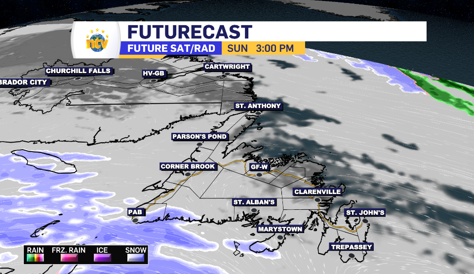
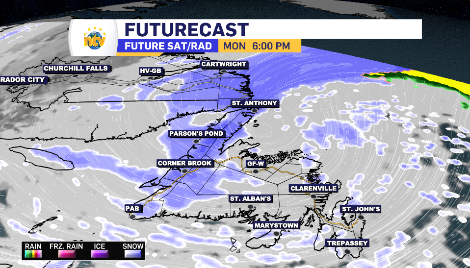
By 10 p.m. we’re expecting to see snowfall spread over the Avalon and into Corner Brook, while the freezing rain starts to creep into the picture for the southern portion of the island.
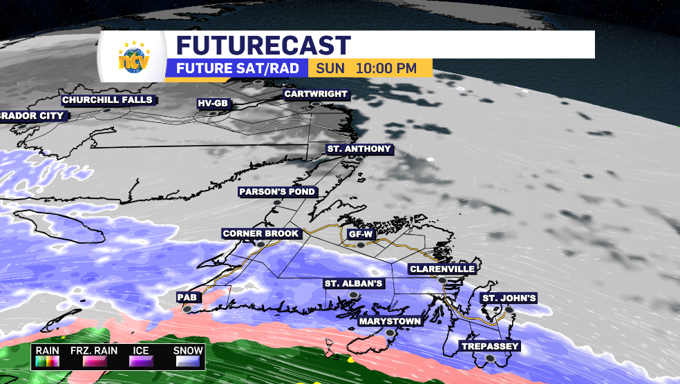
By midnight, we’re expecting to see the snow begin across Central, for a total of 15-25 cm. The further west you go, the higher the total is expected to rise as the West Coast is looking at a 20-40 cm range, matching the Baie Verte and Northern Peninsula. As the snow begins to move upwards, so too does the freezing rain and rain through the Avalon and South Coast. Clarenville, Bonavista and the North Avalon leave the initial snow first, limiting totals to 5-15 cm.
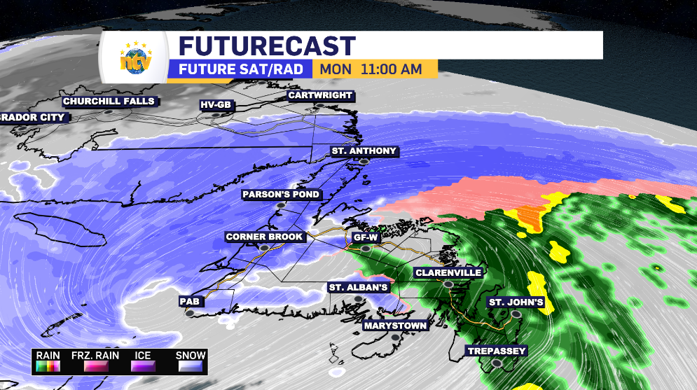
While the freezing rain begins its transition Monday morning, eventually turning to good old-fashioned rain, snow looks to remain further northwest and push into Southern Labrador, toggling the Winter Storm Alert from Red Bay to Cartwright.
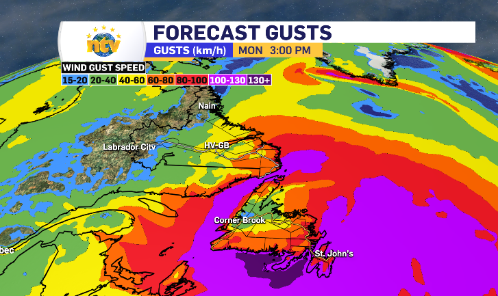
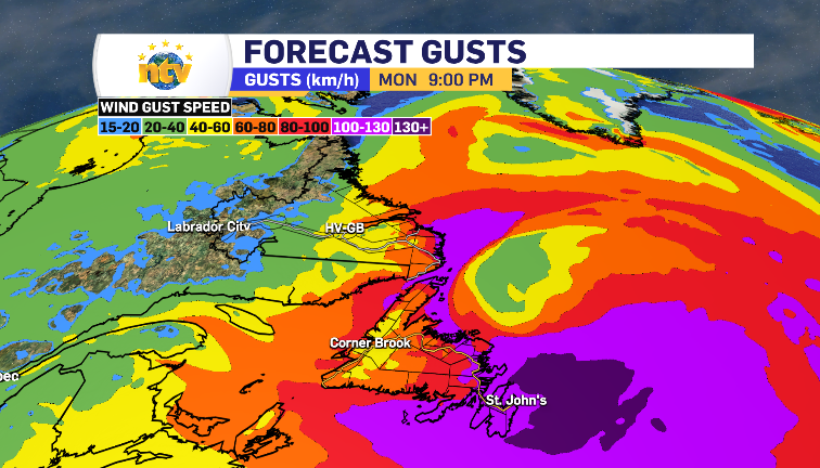
Winds Sunday night into Monday morning are a familiar 60-80 km/h with the strongest in the usual coastal communities. However, the back end of this system hits with a harder 100-130 km/h, comparable to some of the storms we saw through November and December. These winds look to last into Monday evening and finish the storm is some squalls and limited visibility on some common roadways.
In terms of totals for the Metro region, snow is limited to the initial 5 cm or so before 5-10 mm of freezing rain and rain leaves the radar around noon on Monday.
Even into the midnight hour of Tuesday, this system is leaving it’s final touches of snow in parts of the West Coast, Northern Peninsula and Southern Labrador.
Fun!