


Early-day warmth gets erased as cool air returns to the Island

For most of the province, Wednesday is starting off chilly. However, chilly isn’t created equally. Labrador is experiencing temperatures in the single digits above and below the freezing mark. The coolest reading in the Province, as of 6:30 AM, is Makkovik, at -0.1º.
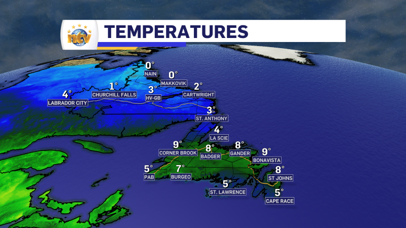
The delineation of the cooler and warmer air is a stationary boundary set up across the Island. While this isn’t making a huge difference in temperatures this morning, it will as the day goes along and the air heats up.

South of the boundary, temperatures will climb into the teens, and north of it, readings will be stuck in the single digits to lower teens on the island and single digits through most of Labrador. This is reflected nicely in today’s high temperatures forecast (below). And we can also see on that map that showers will be possible over central and eastern parts of the Island this afternoon, while the Big Land deals with rain showers and wet snow along and near the coast.
But that only tells part of the story. The stationary boundary will start to move south. Meaning the colder air starts to push that direction. That will turn that boundary into a cold front. That cold front will move across the rest of the Island later today, bringing a drop in temperatures. You can see that play out nicely in the video below. If you’re looking to get outside today, I suggest doing so before it gets cooler.
Have a great day, and stay tuned for more updates on NTV.ca and NTV News!