


Cold air storming into Labrador and is not long from arriving on the Island

A potent cold front is moving across the Big Land this afternoon and temperatures are falling like a rock behind it. As of 1:30 PM AST (2 PM NST) there is a tremendous temperature differential across the Big Land. Readings in the east are well above freezing, and in the west, they are well below.
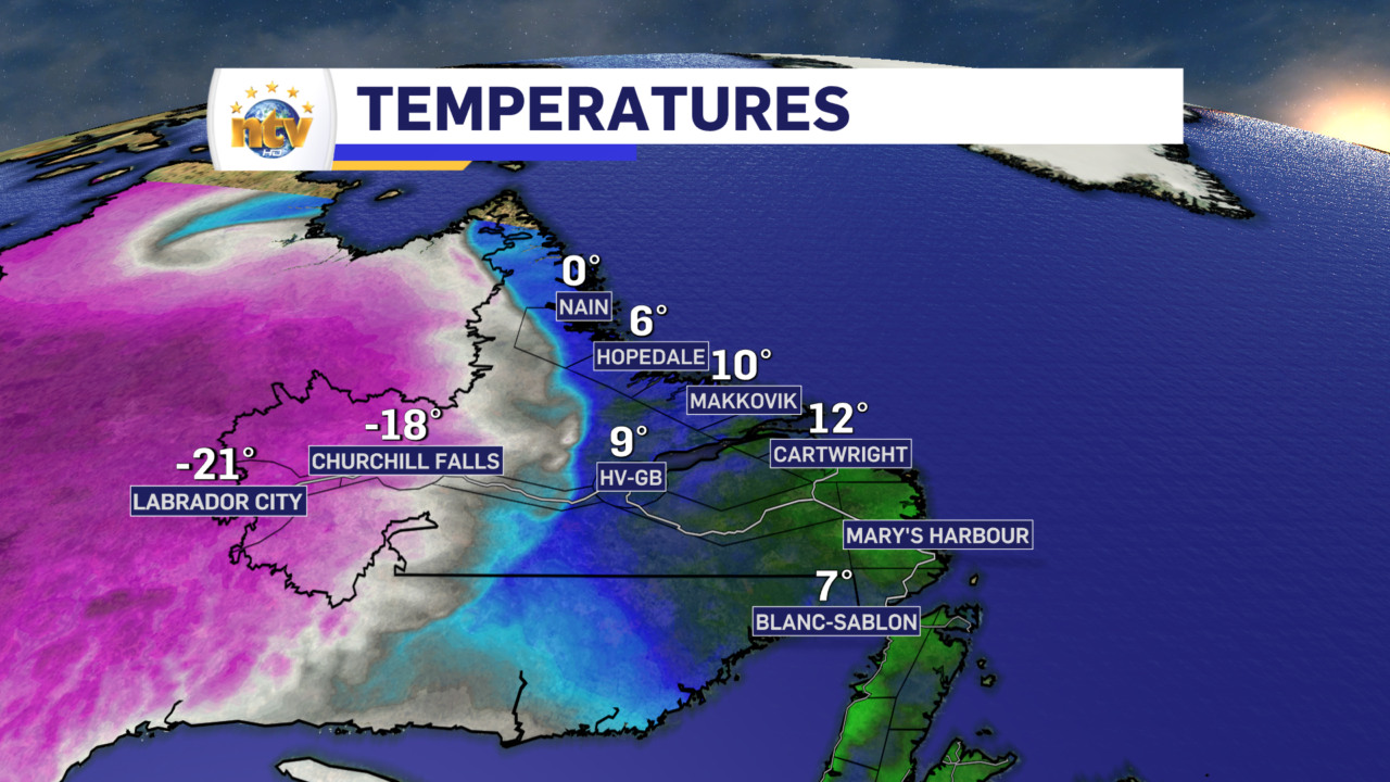
And this only tells you part of the story. The bigger item is just how quickly temperatures are dropping behind the front. Readings in Wabush this morning dropped more than 11° in a half hour and and 23° in just 3 hours!

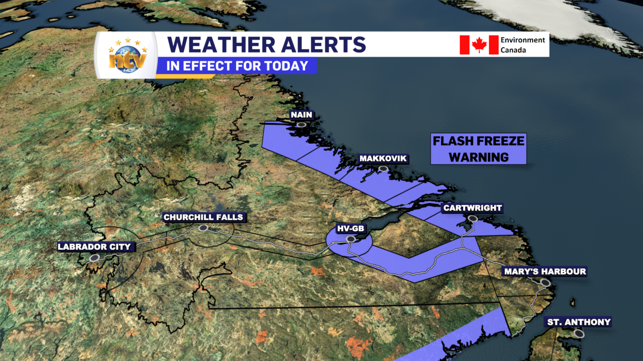
An Extreme Cold Warning remains in effect for portions of Labrador as of this writing but is being scaled back from west to east with the passage of the cold front and the temperature drop. As the cold front moves through, any liquid water will freeze quickly, and surfaces will become very slippery.
Meanwhile, on the Island, we are in the midst of another mild day, with temperatures as of 2 PM NST in the high single digits to lower teens. Temperatures will remain warm on the Island until later this afternoon when the cold front arrives on the West Coast. The sharp drop that we’ve seen in Labrador will happen there as well, but it will not be quite as dramatic.

There is also a Wind Warning in effect for the West Coast (as for north as Corner Brook) and southwest Coast into this evening. Wind speeds will gust as high as 140 km/h in the Wreckhosue area and as high as 100 km/h for exposed areas of the West Coast. Wind speeds will subside this evening with the passage of the cold front.

Tonight, the warm air will be completely erased as the cold front sweeps across the island. The front will be accompanied by an area of rain just ahead and snow just behind. That will be done by the early morning of Friday as the front moves offshore. Then, snow squalls will take hold over western, southern, and eastern Newfoundland on Friday. Accumulations in areas under persistent squalls will be significant. But at this time I”m not expecting widespread heavy snowfall. Travel conditions on the West Coast will be treacherous at times tomorrow. The same goes for the Burin Peninsula and even the Avlaon at times.


Your next forecast update will be posted this evening.