


Big mid-week cool down on the way
Ryan Harding, NTV Weather Centre
Gone is the 16 degrees in St. John’s that saw the capital city break a one hundred plus year old record for January.
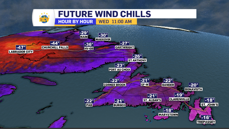
While Monday did bring a morning warm up, allowing for snow to transition into the common messy mix, its a west wind that is going to grip the entire province in it’s bitter-cold grasp by Wednesday.
We’ll first see the winds shift southwest throughout Tuesday, ensuring the South and West coast, along with the Northern Peninsula, is cold enough for Tuesday’s precipitation to fall as snow.
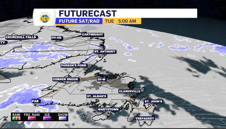
The snow Tuesday starts early in Port aux Basques and moves up the West Coast into the Northern Peninsula providing on-and-off snow start to finish.
Port aux Basques to Corner Brook is looking at 5-10 cm, with the highest totals booked for higher terrain areas, while the rest of the South Coast, Northern Peninsula, Baie Verte Peninsula and Grand Falls-Windsor is looking at a simple 1-3 cm.
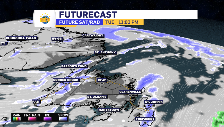
To be fair, there are plenty of sunny breaks province-wide Tuesday, with the snow picking its moments.
Those moments finish off brushing across the Burin, Bonavista and Avalon Peninsula for a centimeter or so between 10 pm and midnight.
Meanwhile, in Labrador, the snow is arriving from the south. It is forecasting to leave behind 5 cm of snow in Happy Valley-Goose Bay and the South Coast. Cartwright and Makkovik can anticipate 1-3 cm by early evening.

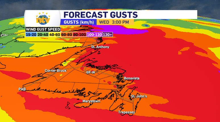
The entire province is going to see that south southwest wind be replaced by a direct, cooler, west wind by late Tuesday evening, lasting through Wednesday and dropping the temperature and putting some serious wind chill numbers on the board. It appears as though that wind will come in with potential to clip the 100 km/h mark for a large portion of the island again as well.
The next low-pressure system is slated to arrive for Newfoundland Thursday. Join us each night for Frist Edition at 5:30 and the NTV Evening Newshour at 6 for further details.