Below average temperatures continue for Eastern Newfoundland Wednesday

Ryan Harding, NTV Weather Centre
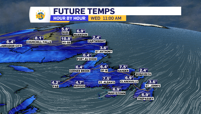
To be fair, Wednesday is going to likely be below average for most of the island while the West Coast and inland Labrador have the best chance at pushing over the double digit mark.
East winds cooling much of province this week
It’s the east and northeast winds bringing the temperatures to sub-10 degree marks in Newfoundland this week, plaguing the island with below seasonal daytime highs.
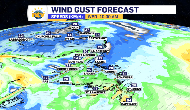
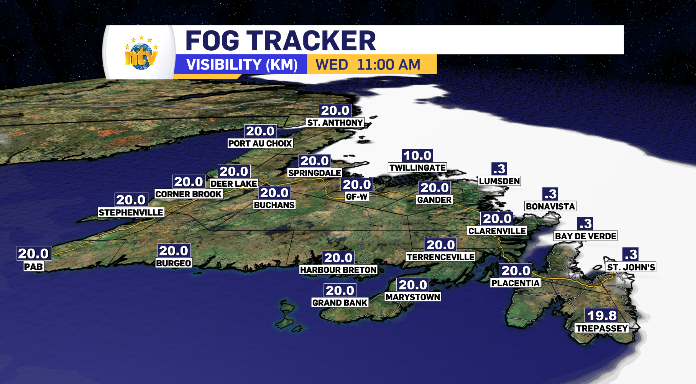
Wednesday’s wind averages a 20-40 km/h gust and allows the fog to stick to the northeastern coastline for much of the day. However, St. John’s specifically is likely to see that fog roll back out the narrows into the afternoon. Bonavista Peninsula is looking at an extra 10 km/h on the wind, gusting to 50.
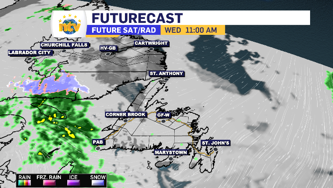
The very southwest coast looks to be in line for some extra drizzle and light rain Wednesday, with the east wind keeping it from moving up the coast or inland.
Outside of that, we’re looking at a day of cloud on the island with rotating sunny breaks along the southern portion of the island and prolonged periods of sun breaking through for the West Coast and parts of the Northern Peninsula.
Newfoundland and Labrador’s daytime highs for Wednesday


Diverse temperatures across inland and coastal Labrador Wednesday
Cartwright looks to buck the trend Wednesday as a coastal community pushing into the double digits late in the day.
The wind for coastal Labrador will be from the east for the majority of the day, with Cartwright seeing it shift south, joining inland Labrador for the warm up before sunset.
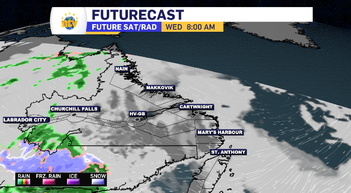
The sun will set for most of Labrador, with clearing skies throughout the day. Labrador City spends extra time in the clouds, picking up moments of light rain in the morning and evening along the way.