


Alerts divide the province between wind, rain and snow to close the week

Ryan Harding, NTV Weather Centre
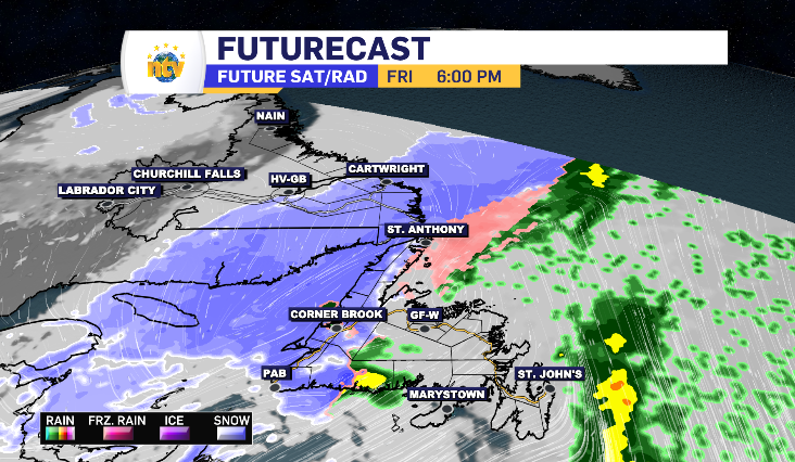
Friday can be divided with one glance at the alert board. Above average wind, rain and snow. It’s confirmed by a second glance at the future radar models.

It all kicks off with rain making landfall on the South Coast late in the overnight, bringing the Burin Peninsula’s heaviest rain of the day near 5:00 am. By that time, most of Central and the West Coast has welcomed the rainy morning with the Avalon entering into it’s day of lighter rain and stronger winds.
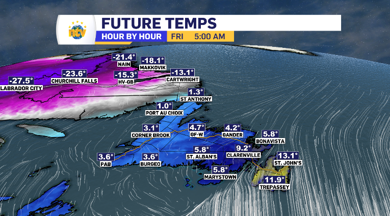
It’s the strong south winds that have fueled the 48-hour warmup to the island, and will push the Metro region to the mid-teens Friday morning and that has allowed for the rainy window. However, By Friday morning, a cold north wind off the Labrador Sea brings the Northern Peninsula and South Coast of Labrador back below zero – and quick.
Just take a look at the difference in St. Anthony’s temperature at 5:00 am and 10:00 am.

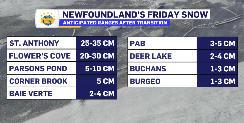
Parsons Pond acts as a line-in-the-sand of sorts for the Northern Peninsula in terms of the heaviest snow fall and drastic early drop in temperature. North of there, a yellow-level winter storm alert has been placed by Environment Canada with the potential to see 25-35, maybe even 40 cm across into southern Labrador, with the heaviest snow fall reserved for between 12-2 pm where it falls at a rate of 3-4 cm per hour.
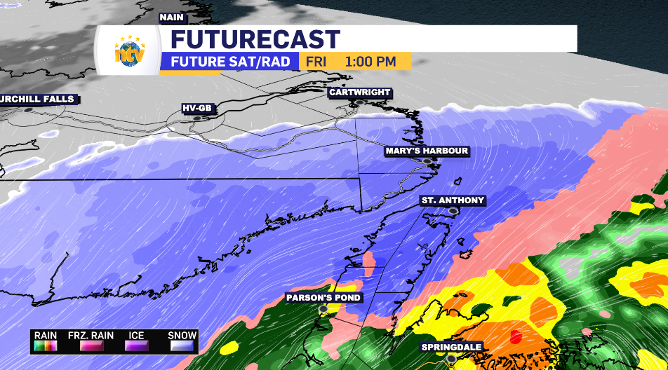
That snow looks to push the middle bands of the system into Cartwright for a 15-25 cm total, ahead of HappyValley-Goose Bay’s 10-15 cm outlook, while Makkovik will take on the outer band, anticipating sub 5 cm.
Meanwhile, the rain lightens on the West Coast slightly by noon, where it picks up into it’s heaviest for parts of Central and into the Central North Coast. These regions are under the yellow-level rainfall alert, with totals ranging from 20-40 mm. Grand Falls-Windsor looks to sit on the high end of that, while Gander is on the low.
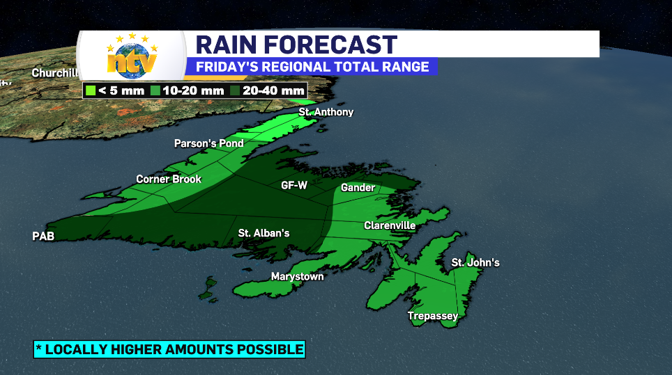
The Burin, Avalon and Bonavista Peninsula sits on the low end of this scale as well, likely seeing the top numbers trickle in at 10-15 mm. Here, the alert is wind. That looks to hit top gusts at three points in the day. Once at 2 pm, again at 4 pm – then finally on the back end of the system at 11 pm. These top gusts range from 80 km/h, which could be reached in Gander, to 110 + km/h, which will like wrap the coastline of the three aforementioned peninsulas.

The north wind that dropped temperatures on the Northern Peninsula in the morning looks to meet up with an equally cold southwest wind on the West Coast around supper time Friday. This is going to turn that rain into snow for varying amounts, as seen below.
The mix finishes with a brief wet snow potential in parts of Central and hits the high winds out east into the evening causing blowing snow to finish the night – not accumulating to anything throughout the Burin and Avalon Peninsula.

Then Saturday, province-wide, we get to catch our breath with some sun a cloud before another mix of rain and snow returns Sunday.
