A little bit of everything mid-week ahead of next snow accumulation
Ryan Harding, NTV Weather Centre
With the temperatures across the island dancing the freezing line, we’re seeing conditions jump in and out of drizzle, freezing drizzle and flurries almost by the minute.
Many regions reflected the above image of the Baie Verte Peninsula. Neighbouring communities finding themselves on different sides of the zero mark, resulting in conditions coming and going. Snow into drizzle, only to freeze. This is in part due to the dew point mimicking the same dance between plus one and minus one degree. The result, some wet snow – but also some freezing on our trees and vegetation.

Flatwater Pond Park, Baie Verte Peninsula, Cindy Hurley
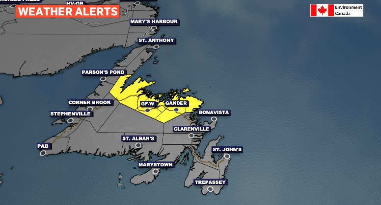
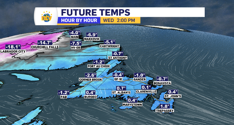
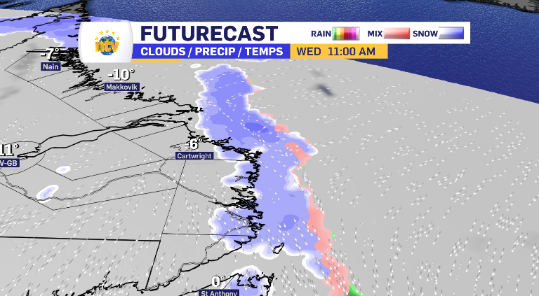
This trend continues into Wednesday. A cooler morning warms into an afternoon returning to that critical freezing point. At times pushing over, others falling short. In that time frame, there are two opportunities for precipitation. Once in the morning and again in the evening. The north coast and parts of central Newfoundland will see limited totals, but that transition point is likely to cause freezing drizzle and icy conditions. To the point that Environment Canada has issued a freezing drizzle alert.
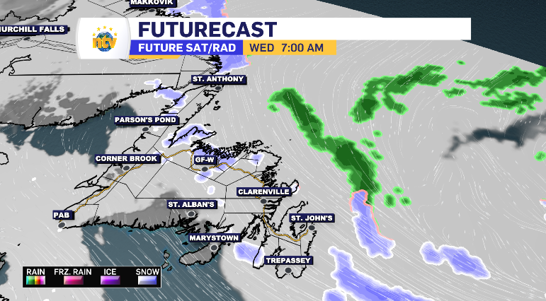
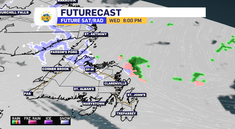
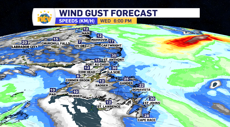
Throughout the day on the island, the wind is going to tapper off as well, getting ready to change direction and pick up in speed Thursday on the back of the next snow-bearing low-pressure system.
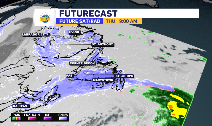
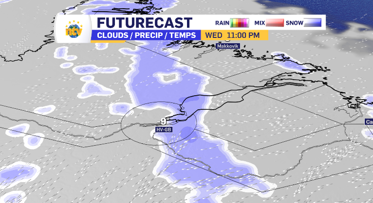
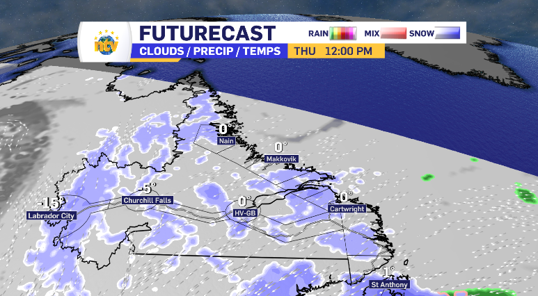
Before the island’s next snowfall on Thursday, there is some snow to tackle in Labrador. It starts on the coast, with the first wave staying coastal. The second push of snow breaks land and makes it’s way to Happy Valley-Goose Bay by end of day, leading to some snow in Labrador West Thursday. Totals are fairly limited, 5 cm being the average, with Nain and Cartwright finding the opportunity to push closer to the 10 cm mark. Coastal Labrador looks to add to it’s totals on Thursday as the snow is pretty consistently arriving from the north east over the next 48 hours plus.
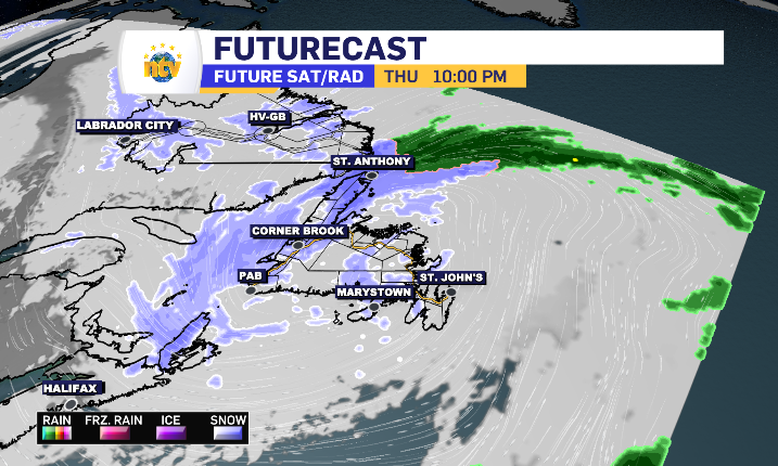
Now then, as for Newfoundland’s Thursday.
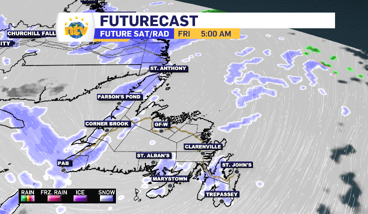
By morning, the southern portion of the island is looking like it will be in the middle of it’s snow. South Coast, Burin, Bonavista and Avalon Peninsula is currently looking at a limited 5-10 cm range. Into Central, the snow arrives later but offers the chance of 10-15 cm. The snow spends the most time in the Baie Verte Peninsula and Northern Peninsula, as it uses St. Anthony as an anchor point while the inner band makes it’s turn. Those areas are forecasted for the highest totals, sitting at 15-20 cm at this time. The West Coast is looking at 5-10 cm in Thursday’s system, however, the back end comes through early Friday and clings to the coastline, bringing this region an additional 5-10 cm to top the totals up.