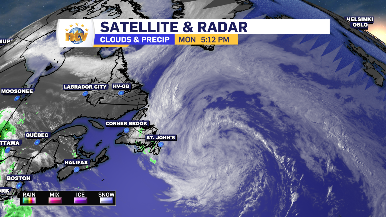
An area of low pressure continues to swirl east of the Island this evening. This low is keeping showers on the go across a large swath the Central and Eastern Newfoundland this evening. The showers will continue throughout the night, before easing off late tonight or early Tuesday morning.
Farther west, skies will be clear overnight and that will set the stage for some cool lows, in the single digits, and the potential for frost. A Frost Advisory remains in effect for Deer Lake-Humber Valley and Buchans and the Interior for late tonight into early Tuesday. Lows in some spots will be near the freezing mark.


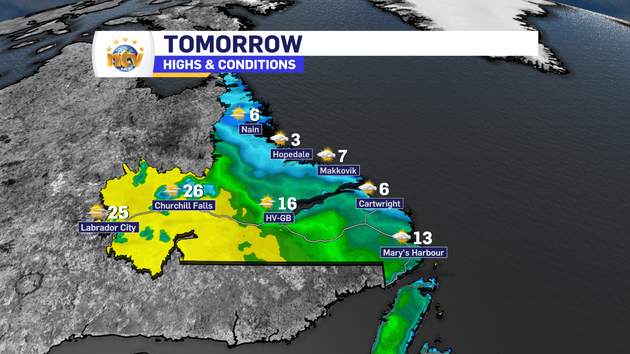
Labrador will see lows tonight near 0 on the coast to 6 or 7 inland and in the west. The weather throughout the Big Land looks fairly tranquil tonight and Tuesday. Although highs will range widely, from the single digits on the coast to sweltering 20s inland.

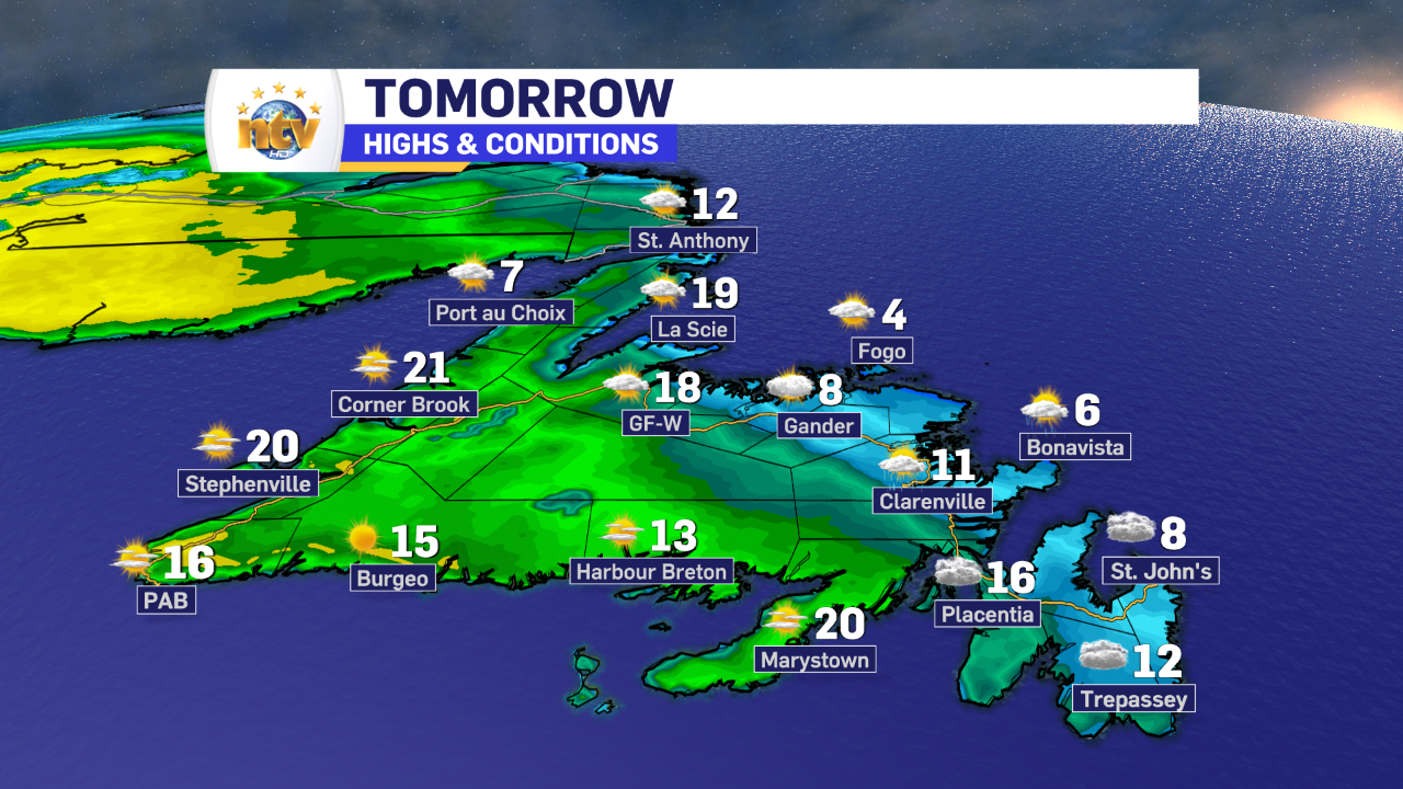
Tuesday will see better weather across much of the Island… but better won’t take much in the east and northeast. Expect cloud cover in this area, with perhaps the odd break of sun late in the day. Highs will be in the 7 to 10 range. Farther west, highs will reach the teens to near 20 during the afternoon. The West Coast and Southwest Coast will be the places to be!
Wednesday will see readings a bit better across much of the Province, with the nicest day in about a week in store for the eastern regions of the Island. Expect lots of sunshine, and highs across the board into the teens and 20s. Labrador will also see a decent day Wednesday, but showers and thunderstorms will roll into the west during the afternoon.
Beyond that, more showers arrive for Thursday and Friday, but temps on the Island don’t look to cool down to the levels we’ve seen over the last few days. Temperatures in Labrdaor, however, will turn cooler as we approach the weekend.
-

Hot and dry weather continues
Sunny skies are expected right across the province today. There will be some areas of…
-
Canada Games officials monitoring air quality for athletes amid wildfires
In just a few days, thousands of athletes will descend on the metro St. John’s…