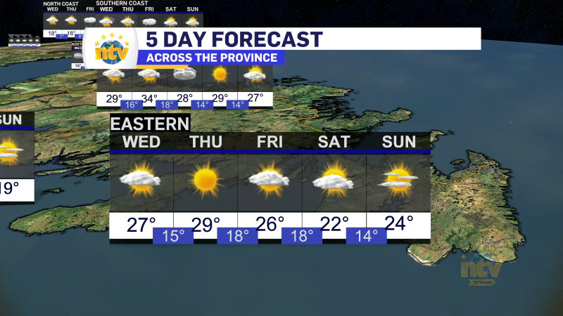
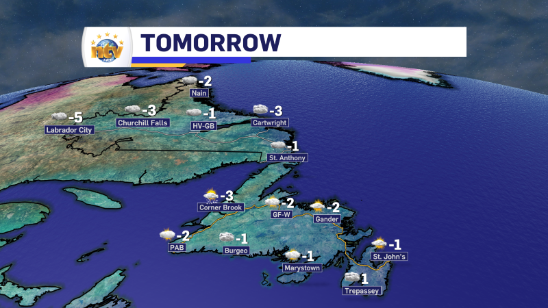
The following 24 hours across NL will be quiet across most of the province, with very little impactful weather. The exception will be parts of northern Labrador, where snow will fly through the 24-hour period. In fact, on Tuesday, it will move back toward Labrador West. The only thing of note will be some flurries over the western sections of the Island.

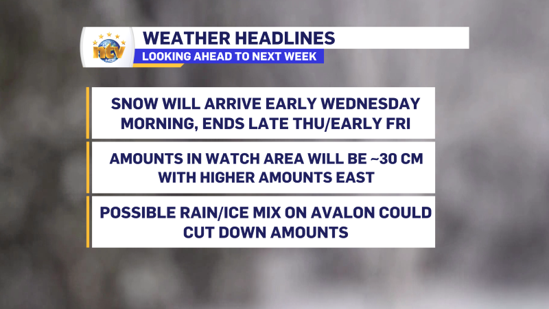
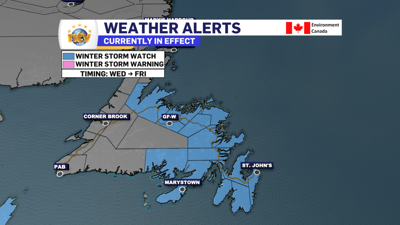
The next thing of note will be the long-duration winter storm that is set to arrive late Tuesday night or early Wednesday morning and continue into late Thursday or Friday for much of the Island and parts of Labrador. Ahead of this, the ECCC Weather Office in Gander has a Winter Storm Watch out for a good bit of the Island.
The weather alert states that total snowfall of 30 to 50 cm is likely over several days. With locally higher amounts possible. Wind gusts will also be as high as 80 km/h from the north.
There is some uncertainty in exactly where the low will track, with relation to the Avalon. If it passes near enough, the snow may mix with or change to rain for part of the day on Wednesday, which would significantly impact snowfall accumulations. Meaning areas of the Avlaon that see any mixing would see amounts closer to 30 cm, rather than 50 or more. The rain will change back to snow later Wednesday if this happens. Precipitation for all other areas will likely remain as snow.
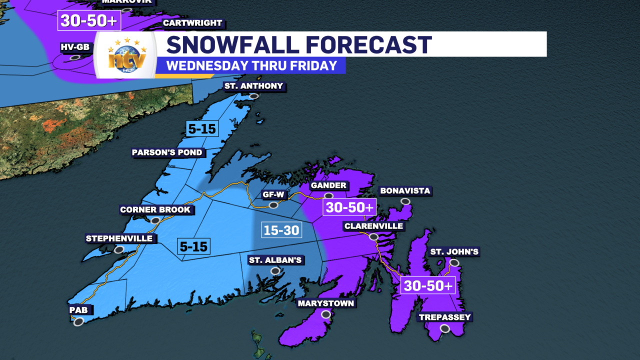
The snow will be accompanied by strong northerly winds, which could cause poor visibility and hazardous travel conditions in blowing snow. Rapidly accumulating snow could make travel difficult in some locations.
Remember, Winter storm watches are issued when multiple types of severe winter weather are expected to occur together.
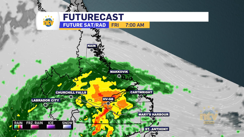
Parts of Labrador’s coast will also see significant snowfall in the Wednesday to Friday or Saturday time-frame. Amounts in this area will also be in the 30-50 cm range. With potentially higher amounts in the higher terrain.

There is still some uncertainty in the forecast and I’ll be able to clear that a bit more in the 24+ hours. Stay tuned for updates as there may be some changes in the meantime.
-

Hot and humid across the Island today
It will generally be a nice day across the Island portion of the province with…