


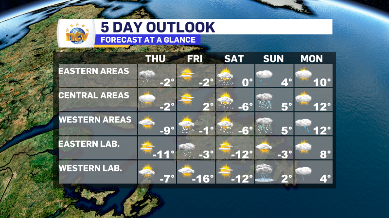
The Synopsis
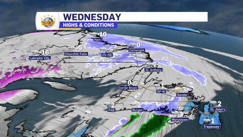
An area of low pressure will pass south of Cartwright and head northeastward into the Labrador Sea overnight. The low’s departure will end the snow across most of Newfoundland and Labrador overnight, minus a few lingering flurries along the coast of the Big Land and West Coast of Newfoundland. Notice how I used the word “most” and not “all” in the last sentence? The Avalon and Bonavista Peninsulas will see snow arrive overnight and continue through most of Thursday.
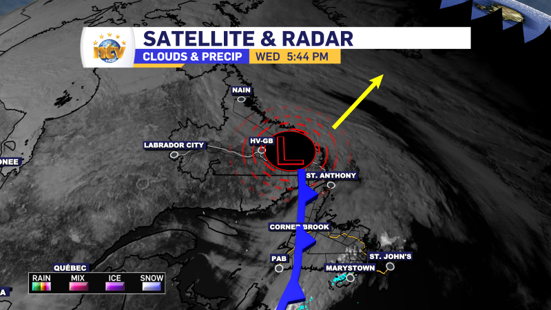
The area of low pressure has a cold front attached to it, and along the front is a narrow area of snow. Between later tonight and Thursday, the front will slow way down, or even stall, on the eastern two Peninsulas. The result will be a narrow area of light to moderate snowfall that persists over this area from later tonight through Thursday evening.
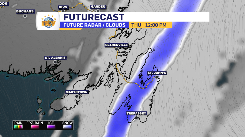
The result will be snow accumulation over these two areas, totaling 5 to 15 cm. The higher end of that forecast amount should be from near Grates Cove to Cape St. Mary’s, with amounts closer to 10 cm or less just east and west. Amounts drop off sharply to the west, with hardly anything expected on the Burin Peninsula.
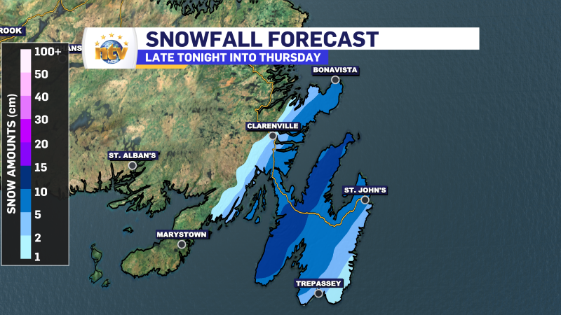
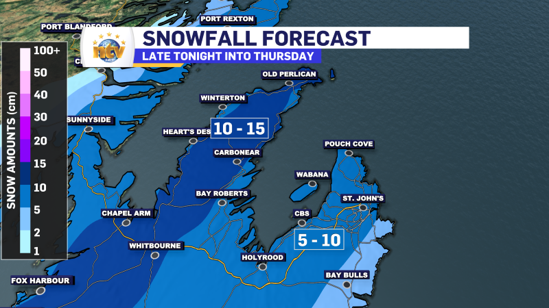
This is a small-scale feature, and often, weather models cannot get the exact position of these features correct. That means there is some forecast uncertainty, and a slight change in where this narrow band stalls could mean that areas just east or west of the current bullseye end up being the bullseye. Unfortunately, this is not something we will know until I see where that snowfall band sets up shop late tonight or Thursday morning.
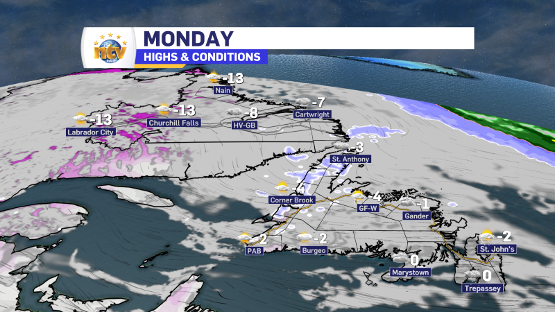
Once past Thursday, the weather on Friday and Saturday will be fairly tranquil across much of the Province. The next weather-maker arrives Sunday, promising to bring a mix of rain and freezing rain to the region as a surge of warmer air arrives. The warmth will be realized Monday when highs in the upper single digits to lower teens are a good possibility across much of the Province.
-
NTV Weather Update | March 12, 2025
Good morning! A weak area of low pressure will move through the Province today, bringing…
-
NTV Weather Update | March 10, 2025
Good Monday morning! Today, we can expect quiet weather across most of Newfoundland and Labrador.…
-

The weekend looks colder and snowy (for some areas) behind departing storm system
Today Scattered flurries across the Province, with the chance of light snow in southeastern Labrador…
