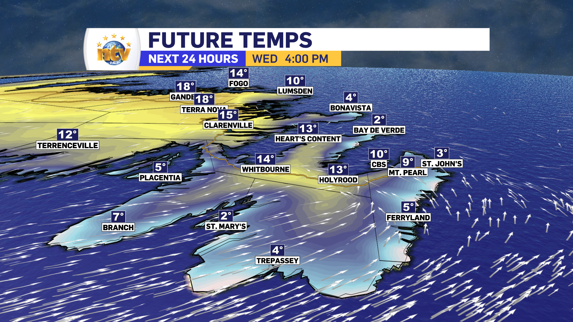

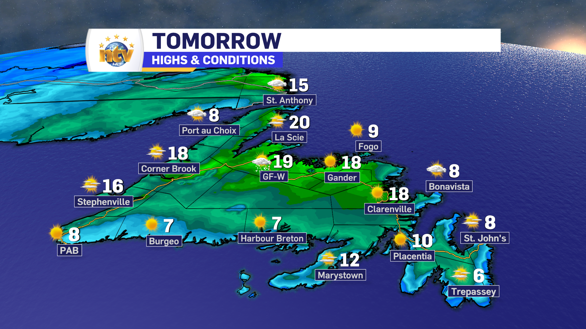
The sun will return on Wednesday for much of the Island, which will be a welcome sight for the Avalon. Wednesday will also be a day when parts of the easternmost Peninsula have vastly different temperatures. For instance, along the Southern Shore high temperatures will only reach the mid to upper single digits, while areas inland and farther west, like Holyrood and CBS, will peak into the mid-teens.

The rest of the Island will see warmer temperatures, by in large, with highs in the mid to upper teens. The exception will be on the South Coast and Northern Peninsula, where it’ll be a bit cooler. Locally cooler conditions will also be found in onshore winds.
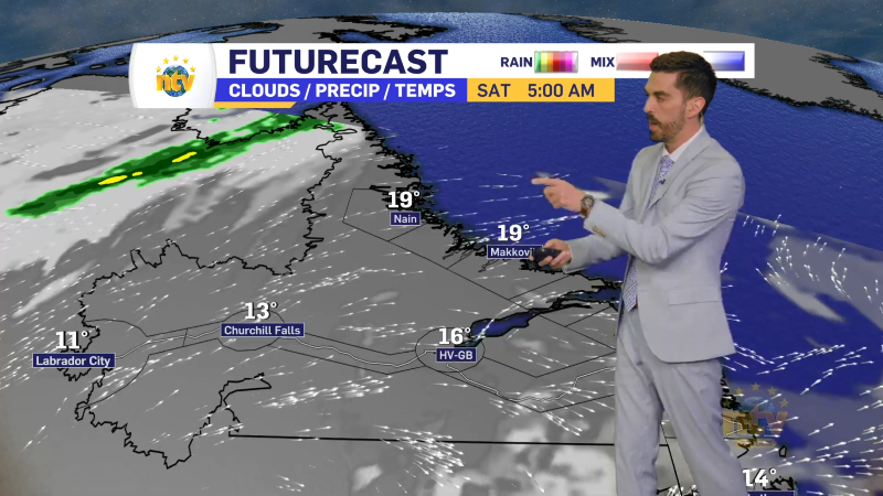
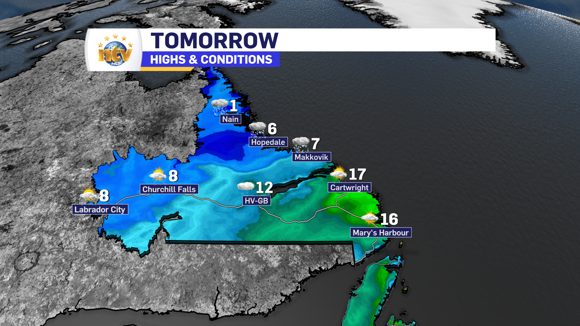
Labrador will see rain and showers tomorrow as a cold front works through from north to south. In the North, snow will be found north of Hopedale. This may impact flights going to parts of the coast through the day and into Voisey’s Bay. Conditions will be better on Thursday.
The peak at the Long Range
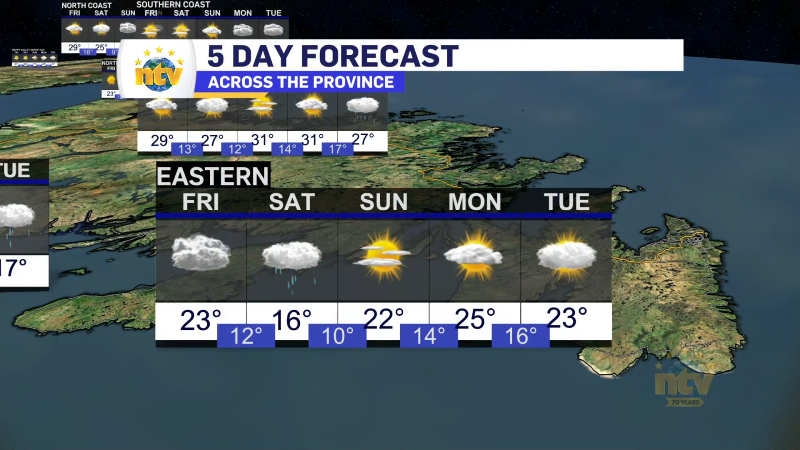
Thursday looks quiet across much of NL. Rain moves in for Friday and will linger on the Island into Sunday morning. In fact… some areas of Central and the northeast coast of the Island may see the rain end as wet snow Sunday morning.
Full details in tonight’s forecast below!


