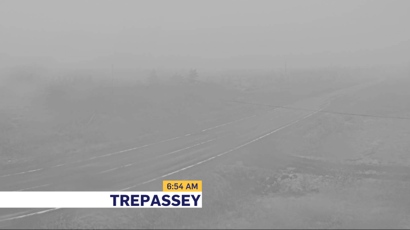
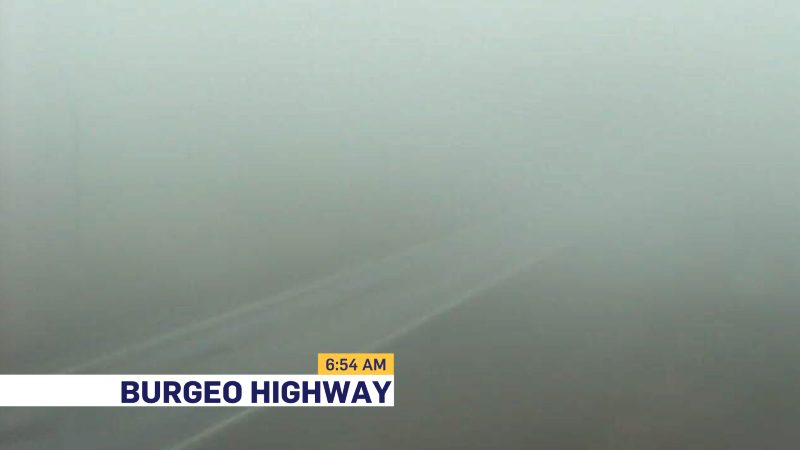
Good Monday morning, and welcome to the new work week! We have woken up to calmer weather across much of the Province. The strong wind gusts and heavy rain from yesterday have moved offshore. Behind that, we have seen somewhat cooler air move in behind a cold front. That being said, we are seeing some areas of dense fog this morning along many southern-facing shores and just inland. The views from the Burgeo Highway and Trepessay (below) show this very well.
Over the next few hours, as the air dries out along the south-facing shorelines we should see a dissipation in the fog. The weather across much of the province today will be pretty decent. There will be a mix of sun and cloud for most areas of Newfoundland and Labrador. Labrador will see a few scattered showers or flurries this morning. Temperatures will again reach the single digits to teens for high Province-wide.
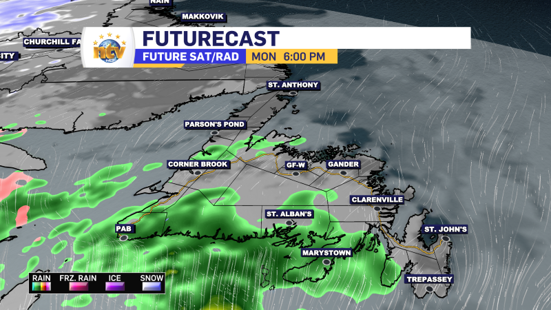
Rain returns tonight
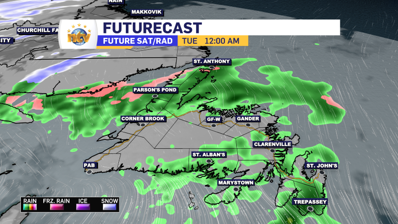
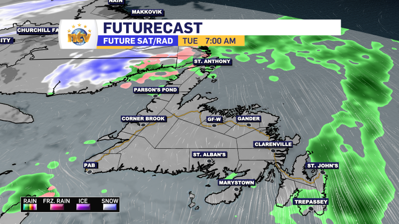
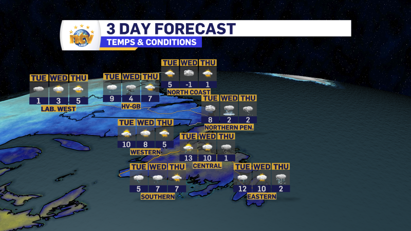
Another round of rain will move across the Island between later this evening and early Tuesday. The rain will arrive on the South Coast first and spread north and east overnight. The rain will end for most areas before sunrise Tuesday, except on the Avalon, where the rain will linger into the early morning hours of the day. We can expect a widespread 5 to 15 mm of rain with this round, except on the southern Avalon, where up to 30 mm may fall.
Tuesday and Wednesday
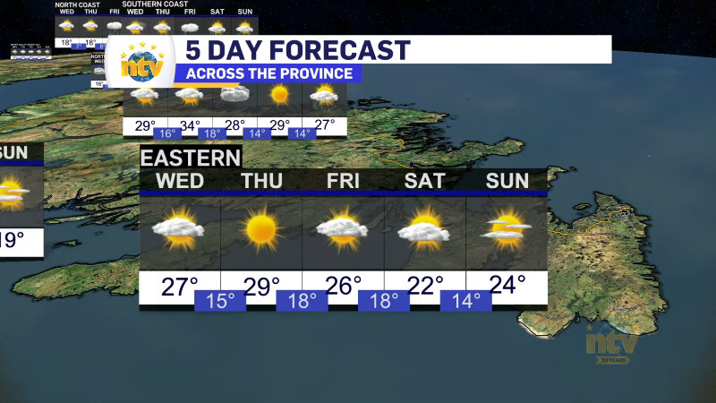
Another round of rain looks to affect eastern areas of the island from Tuesday night into Wednesday. This round may bring a period of heavier rain to the Avalon Peninsula and possibly some adjacent areas to the west. This rain will linger into Wednesday and will likely move into central and northeastern areas during the day as the area of low pressure driving it slows down as it moves north of the Bonavista Peninsula. This low will also have some cold air to work with and some locations west of the track will see the rain end as wet snow. At the moment, they look like areas of the Central and the Great Northern Peninsula.
Temperatures will be mild for the first few days of this week, but as that low taps into some colder air, we will return to chillier temperatures after Wednesday for eastern Newfoundland and before then farther west and north. I’ll have a more detailed forecast update for you later today.
-

Unsettled for most of the province today
There will be a risk of some morning showers along the west coast of the…