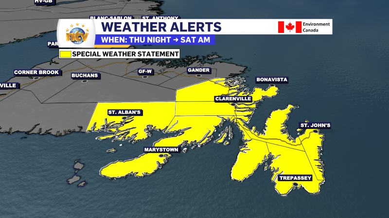
The remnants of Tropical Storm Oscar will move through the region between Thursday night and early Saturday morning. In that time frame, this storm system will threaten parts of eastern and northeastern Newfoundland with heavy rainfall and gusty winds. Rainfall amounts will likely exceed 100 mm over some areas of southern Newfoundland.
Ahead of the arrival of this weather-maker, the Environment and Climate Change Canada Weather Office in Gander has issued a Special Weather Statement for the following areas:
- The Avalon Peninsula North
- The Avalon Peninsula Southeast
- The Avalon Peninsula Southwest
- St. John’s & vicinity
- The Burin Peninsula
- Connaigre
- The Bonavista Peninsula
- Clarenville & vicinity
- Terra Nova
The rain and wind will arrive Thursday night and will continue into late Friday night or early Saturday morning.
Rainfall amounts are currently expected to be in the 70 to 100 mm range, with locally higher amounts possible, except for the Bonavista Peninsula, Clarenville and vicinity, and Terra Nova, where 40 to 70 mm of rain is currently expected. In addition, maximum wind gusts will be 70 to 80 km/h, with locally higher gusts possible.
Similar events in the past have led to hazardous driving from water pooling on roadways, road and shoulder erosion and washouts, elevated water levels in creeks and streams, and delays and cancellations of ferry services.
Rainfall Warnings will likely be issued.
-

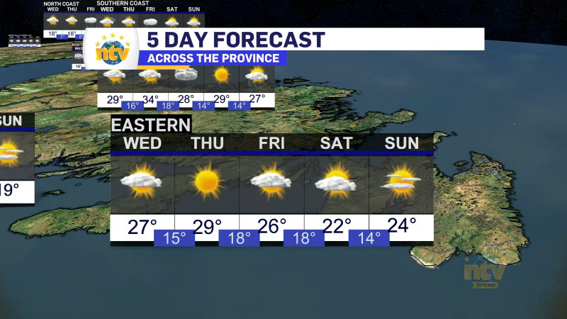
Unsettled for most of the province today
There will be a risk of some morning showers along the west coast of the…