


The slow-moving low-pressure center, or centers really, that has been driving snow and rain across much of Atlantic Canada for the last few days, is going to do more of the same today. With respect to the Island, snow will continue over most areas today to the west of the Avalon and Bonavista Peninsulas. On those two Peninsulas, mainly rain will fall. On the Bonavista Peninsula, the rain will likely be mixed with wet snow at times as this area is closer to the rain/snow line.
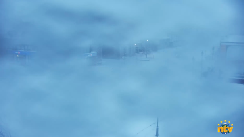
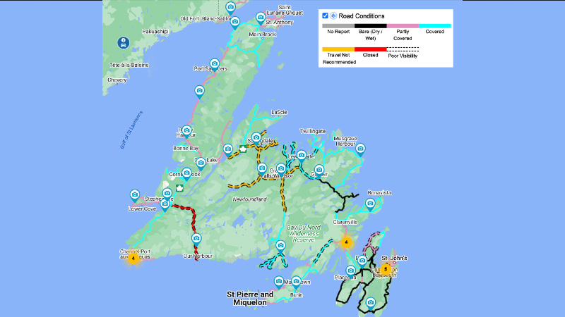
The snow that does fall today will generally be light to moderate. However, it will pile up in some areas and travel across much of the region, impacting it. You can see on this morning’s 511NL.ca that many roads across the Island are being reported as snow-covered, with a few marked as “travel not advised.”
The system driving this is going to remain parked south of the Island today and east of the Island tomorrow. As the centers drift east, the rain/snow line will start to move eastward as well. However, this will not occur until Tuesday morning at some point. So basically, between now and Tuesday morning, not much will change. Areas of rain will continue in eastern Newfoundland while most of the rest of the Island will see periods of light to moderate snowfall. Winter Weather Alerts are in effect from Environment Canada.
Future Radar should give you a better idea of how the rain will fall across the Island and parts of southern Labrador over the next 24 to 36 hours. It will all start to drift east tomorrow, at which point the weather will begin to improve. However, on the Avalon, it will get worse on Tuesday before it gets better, as we will have a round of snow to get through. How much is a big question, as it will be determined by how quickly the rain changes to snow and how much precipitation is left to fall at that point.
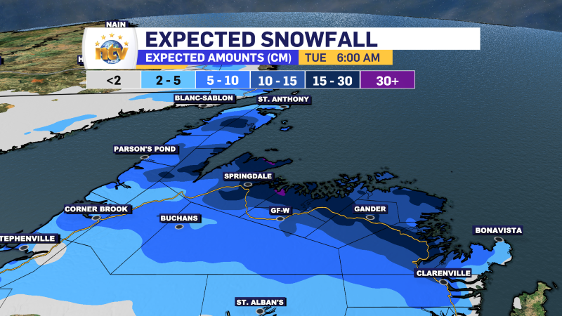
Snowfall amounts today will be highest over Central Newfoundland and the Green Bay – White Bay areas, specifically in the higher terrain that slopes north. Some of those locations will likely see over 30 cm of new snow. Lower elevations and nearer the TCH should see lesser amounts of snow.
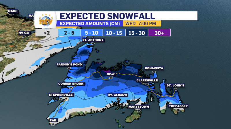
As the rain/snow line crashes east, there will be snow that falls over the Avalon and Bonavista Peninsulas on Tuesday before ending Tuesday evening or night. On the Avalon, the rain will change to snow during the mid-morning to early afternoon hours. This may make for a challenging commute home IF the snow comes down heavy enough and starts to stick. There is still a bit of a question mark at this point. As you can see, the snowfall amounts expand south and east for Tuesday. Keep in mind we will lose some of that amount to melting, so the actual amounts over eastern will likely be somewhat less than the model is showing below.
I’ll have a further update for you later today. Stay safe and have a good one!
/Eddie
-
NTV Weather Update | March 31, 2025
Good morning! The day will start off quiet, but a potent area of low pressure…
-
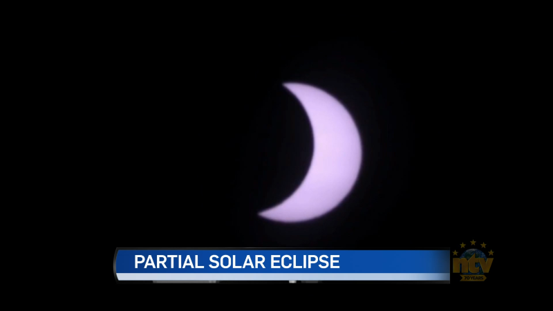
Weather doesn’t co-operate for local viewing of partial solar eclipse
The weather didn’t co-operate for viewing of the partial solar eclipse this weekend. But an…
-
Flurries in the forecast for the weekend
The weekend looks mostly quiet across the Province, but there are some flies in the…
