


Friday night thru this morning has seen some significant rainfall across the Island portion of the Province. Here are some rainfall totals from late Friday night thru early Sunday morning.
- St. John’s International Airport: 60.3 mm
- Gander International Airport: 48.1 mm
- Deer Lake: 35.7 mm
- Stephenville: 18.6 mm
- Argentia: 52.1 mm
- Winterland: 52.7 mm
- Badger: 38.4 mm
- Bonavista: 48.7 mm
- Millertown: 40.4 mm
The 36-hour radar loop, below, shows how the rain has propagated across the Island.
This is undoubtedly some much-needed rainfall, and more will fall on Sunday and into Monday. As you can see from the animation below which runs from this morning thru Tuesday evening.
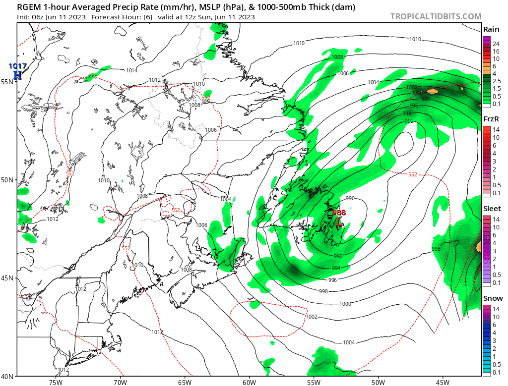
The RGEM model below (TropicalTidbits.com) shows the rain continuing across the eastern and central parts of the Island through the time frame. Although most of the heavy rain has fallen, we will add on to the totals above over the next 36 to 48 hours. Especially on the coast of Central and northeastern Newfoundland, where another 20+ mm is possible.
Temperatures will hover in the upper single digits to lower teens into Tuesday, in the onshore northerly flow, for a large part of the Island.
Western and Southern Newfoundland will see improving weather later today and especially on Monday. With even some sunshine making a return. Highs will climb into the teens to start the week. Much of Labrador will also see tranquil weather to close out the weekend and head into next week.
Check out your 5 days for each area on the NTV Weather Centre.
-

Hot and humid start to the weekend
The Island will see sunny skies to start today. There are a few fog patches…


