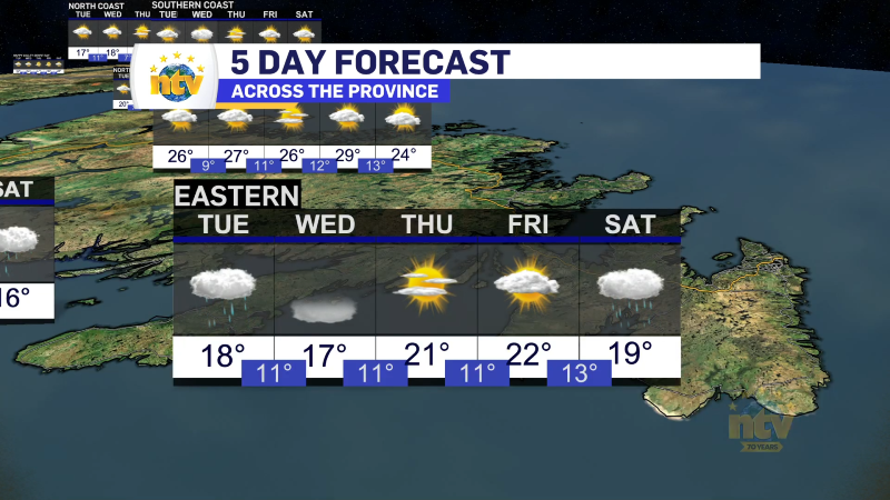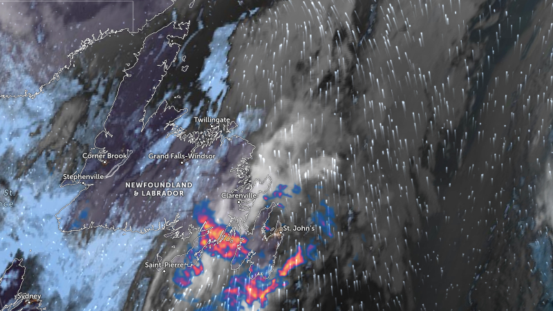
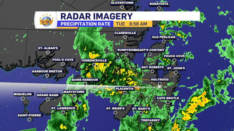
Periods of rain will continue to affect eastern areas of the Island today, tonight, and Wednesday. Some of the rain will be heavy at times. This morning, Radar indicates we are seeing some heavier pockets of rain over the Avalon and Burin Peninsulas and some adjacent areas.
The rain will be more showery in nature this morning before becoming more stratiform over the eastern two-thirds of the Island this afternoon and evening. The rain will taper to showers for most areas Wednesday morning. We will catch a short break, and the next weather-maker will arrive Thursday.
A slow-moving area of low pressure will interact with enough cold air on Thursday afternoon and evening to make wet snow likely across many areas of eastern and northeastern Newfoundland. Warmer air will then move in Thursday night, changing snow to rain for much of the area. Strong wind gusts as high as 100 km/h from the northeast are also possible.
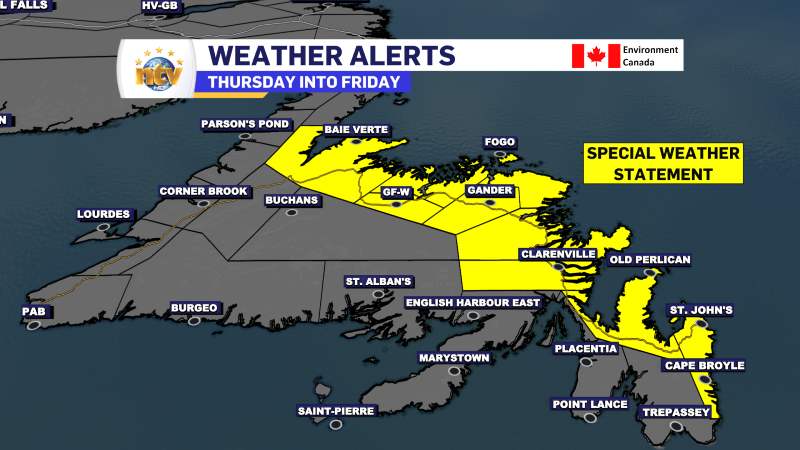
Ahead of this weather maker, the Environment and Climate Change Canada Weather Office in Gander has issued a Special Weather Statement from Thursday through Friday for the following areas:
- The Avalon Peninsula North
- St. John’s & vicinity
- Grand Falls-Windsor & vicinity
- Bay of Exploits
- Bonavista North
- Bonavista Peninsula
- Clarenville & vicinity
- Gander & vicinity
- Green Bay – White Bay
- Terra Nova
Significant mixed precipitation and strong winds are expected for northeastern Newfoundland and the northern Avalon Peninsula between Thursday and Friday. Wind gusts may be as high as 100 km/h from the north.
Precipitation will begin as snow on Thursday and intensify before transitioning to rain over some areas on Thursday night. Precipitation may mix with, or change to, freezing rain and ice pellets during the transition from snow to rain. Significant snowfall and rainfall amounts are both possible.
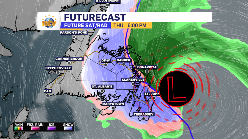
There is high uncertainty in the track of this system. Locations and values of highest precipitation are not yet clear at this time.
I’m tracking this system and will have more updates over the coming days.
-
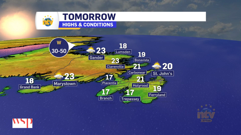
Nice start to the work week after some morning showers
It was a stormy weekend across Island portions of the province, with several areas seeing…