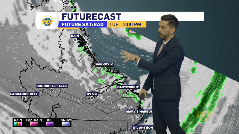
A multi-impact weather system is expected to affect parts of Newfoundland and Labrador from Wednesday night through Thursday. Rain, snow, and extended periods of freezing rain are all in the forecast, depending on the location. Here’s a breakdown of the expected conditions:
Heavy Rain and Localized Freezing Rain – Great Northern Peninsula
Regions Affected:
- Northern Peninsula East
- Parson’s Pond – Hawke’s Bay
- Port Saunders and the Straits
Timing: Late Wednesday through Thursday evening
Rainfall Totals: 40 to 60 mm
Rainfall will be heavy at times across the region. While most areas are expected to stay just above freezing, some higher elevations and northern coastal areas could briefly dip below zero, leading to localized freezing rain. By Thursday night, the precipitation is expected to transition to snow or ice pellets before ending. Snow and ice accumulation appears to be minor at this time.
Potential Impacts:
- Hazardous driving conditions
- Localized flooding in low-lying or poor drainage areas
- Utility outages due to heavy rain or ice
Significant Snowfall – Southeastern Labrador
Regions Affected:
- Norman Bay to Lodge Bay
- Eagle River
Timing: Wednesday night through Thursday evening
Snowfall Totals: 5 to 15 cm along the coast, 15 to 25 cm inland
Precipitation will begin as rain, then change to freezing rain and ice pellets before transitioning to snow. Inland areas are likely to see the highest snowfall totals.
Potential Impacts:
- Dangerous driving conditions
- School closures or delayed openings
- Travel disruptions and cancellations
Prolonged Freezing Rain – Southern Labrador Coast
Region Affected:
- Red Bay to L’Anse-au-Clair
Timing: Overnight Wednesday through Thursday evening
Freezing Rain Totals: 5 to 15 mm, possibly higher inland
Duration: 12 to 18 hours of freezing rain possible
Rain will change to freezing rain overnight Wednesday and continue through much of Thursday before transitioning to snow by evening. This may lead to significant ice accumulation, especially in inland areas.
Potential Impacts:
- Very slippery roads and surfaces
- Utility outages from ice buildup
- School or service disruptions
Stay Informed:
Conditions could change quickly. Monitor Environment Canada for alerts updates, and NTV for updated forecasts and warnings. Travel may be impacted, particularly in areas expecting freezing rain or heavy snow.


