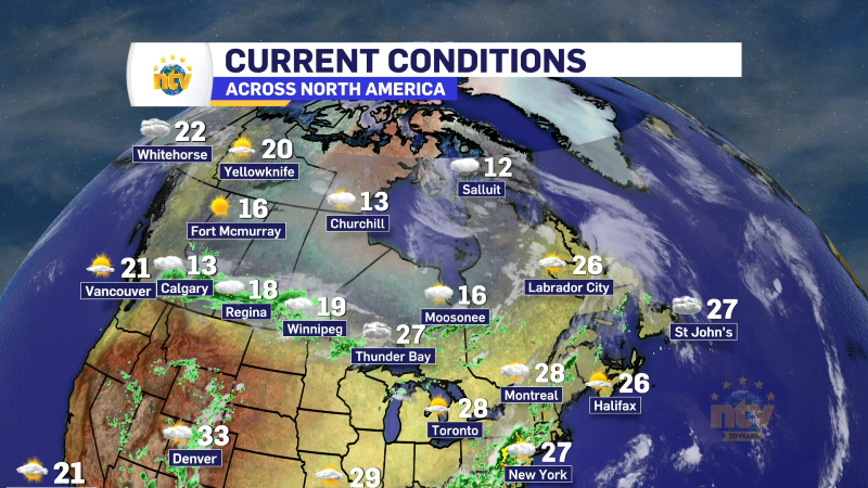
After a rainy and warm Saturday across many areas of the Island, the rain has shifted to to eastern areas of the Island this morning. Rodney Barney, a Meteorologist with the Environment and Climate Change Canada Weather Office in Gander, put together a list of warmest spots across the Province. Parts of the West Coast seemed to lead the way!
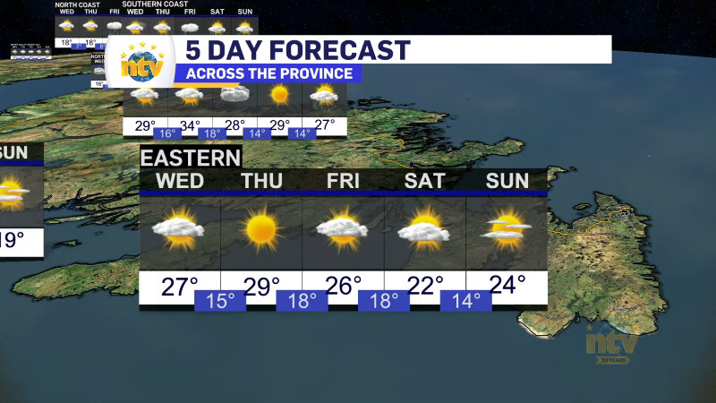
Today, mild temperatures will persist for much of the Province, but rain will shift into eastern areas. The area of rain we see over eastern regions will be quite narrow, affecting mainly the Burin and Avalon Peninsulas.
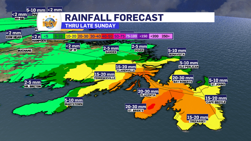
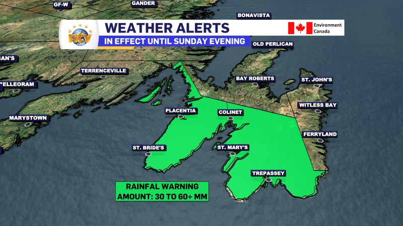
A Rainfall Warning remains in effect today for the Avalon Peninsula Southwest and the Avalon Peninsula Southeast. The alert calls for 30 to 60 mm of rain possible in that area by the end of the day.
Futurecast shows how the rain will progress today. As you’ll see in the movie below, it’s a pretty narrow area of rain that will affect the eastern two or three Peninsulas. The heaviest rain will be in the south, but areas farther north will see periods of heavy rain at times today.
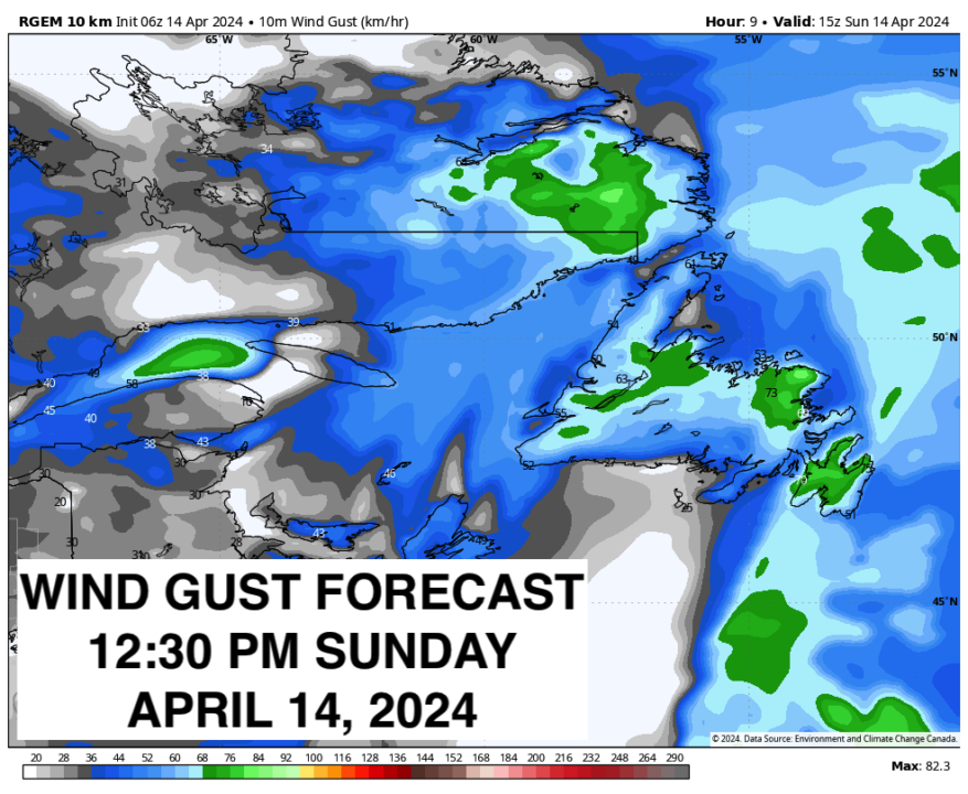
The wind will also be a factor today as strong southerlies will be found over much of the Island. While widespread Wind Warnings aren’t expected, a fair few locations will see gusts of 60 to 80 km/h. The wind speeds will come down this evening and overnight as the wind core moves away.
The weather will improve later this evening and tonight as the rain pushes offshore. Monday will start dry but that will not end as there will be another round of rain that arrives on the West Coast in the evening and will spread to the rest of the Island overnight into Tuesday morning.
I’ll have a more detailed update on this later today or Monday morning. Have a great Sunday!
/Eddie
-

Unsettled for most of the province today
There will be a risk of some morning showers along the west coast of the…