


Post 1 – 6:22 AM NST (5:52 AM AST)
Good Wednesday morning!
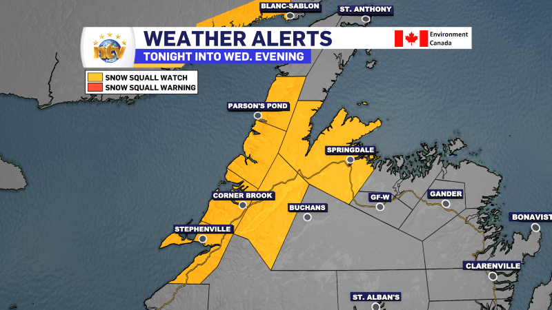
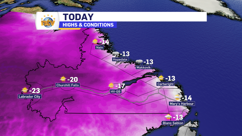
Today will be colder than yesterday, by quite a lot, across the Island portion of the Province. Highs range between -5 and -10, with wind chills into the minus teens and 20s. An area of snow squalls will be found on and near the West Coast. Some of the squalls will be intense, generating locally heavy snowfall, wind gusts to 70 km/h, and subsequent reduced visibilities.
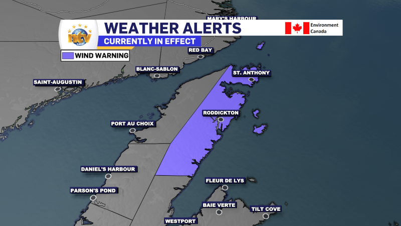
Outside of the squalls, expect a mix of sun and cloud across the Island. Today will also be breezy as an area of low pressure strengthens in the Labrador Sea. Some locations will be quite windy today, and wind warnings will be in effect for those areas, which include the Northern Peninsula and the North Coast of Labrador from Postville to Nain. Wind speeds in these areas will gust as high as 100 km/h today into tonight.


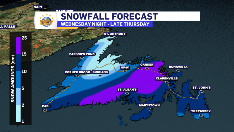
Outside of that, the next weather maker moves in tonight and promises to bring snow to much of central, southern, and eastern Newfoundland into Thursday. As it stands now, the Avalon will see snow start late this evening and will taper to drizzle in the pre-dawn hours of Thursday. Areas of the west will see the snow linger later into Thursday morning. At the moment ,my thoughts on snowfall amounts remain the same as yesterday.
However, I will have an update later today and on the news this evening. Stay tuned for details!
-

Hot and humid start to the weekend
The Island will see sunny skies to start today. There are a few fog patches…


