


Post 3 – 6:41 PM NST (6:11 PM AST)
A warmup moves in for the weekend and the start of next week as two lows move through the region. After Monday, we will see a full-scale pattern shift, which will result in the coldest air of the winter moving in.
Arctic air is set to push into Atlantic Canada early next week as the Polar Vortex will elongate. The elongation of the vortex (which is always spinning over the Pole) is what will displace the cold air into the region for the first time this season.
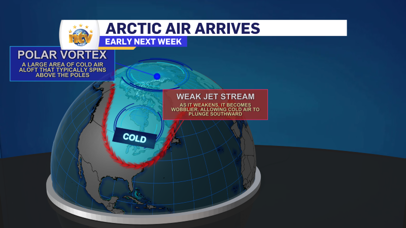
Temperatures after Monday of next week will be the coldest of the winter. Highs will be near -10 for much of the Island and -20s and almost -30s in Labrador. And that is before we factor in the wind chill. And speaking of wind chills, I expect them to dip into the -40s in Labrador by the middle part of the week.
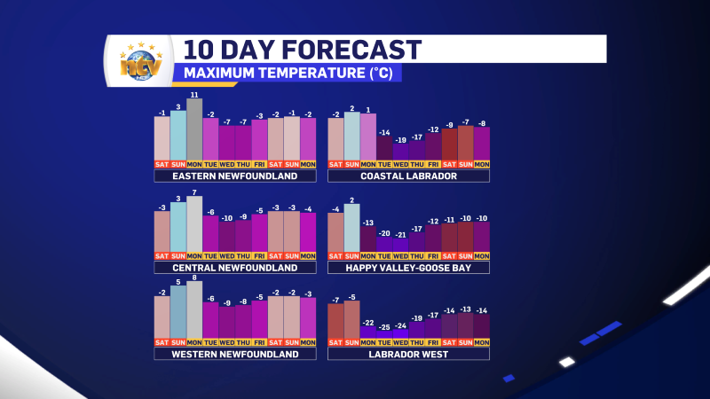
On top of that, intense snow squalls will fire up over the West Coast, South Coast, and possibly Burin and Avalon Peninsula on Tuesday and will continue into Wednesday and perhaps Thursday. Snowfall amounts will be locally significant, but at this point, it’s impossible to say how much will fall.
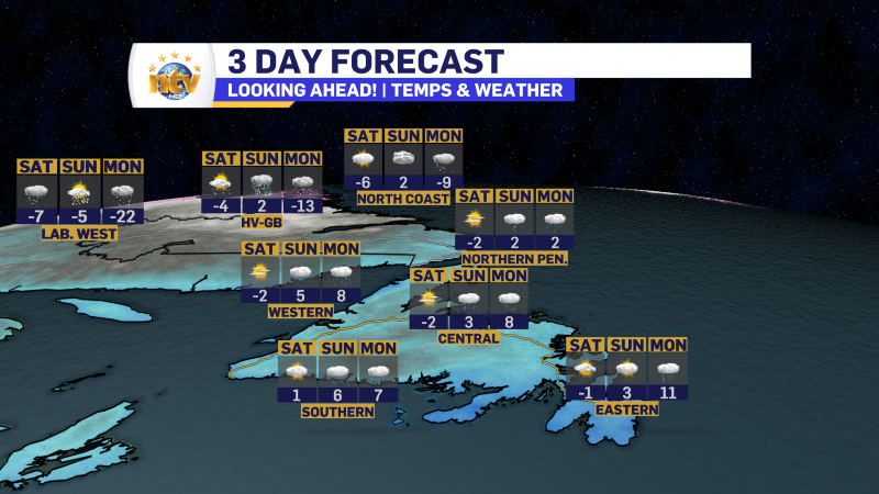
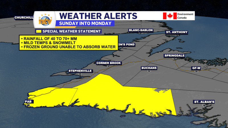
Before the cold air arrives, we will see two lows swing through. One Sunday and the next Monday. These will bring mild temperatures to the Island and the potential of heavy rain along the South Coast. Up to 70 mm is currently projected, and a Special Weather Statement from Environment and Climate Change Canada is in effect.
Post 2 – 12:46 PM NST (12:16 PM AST)
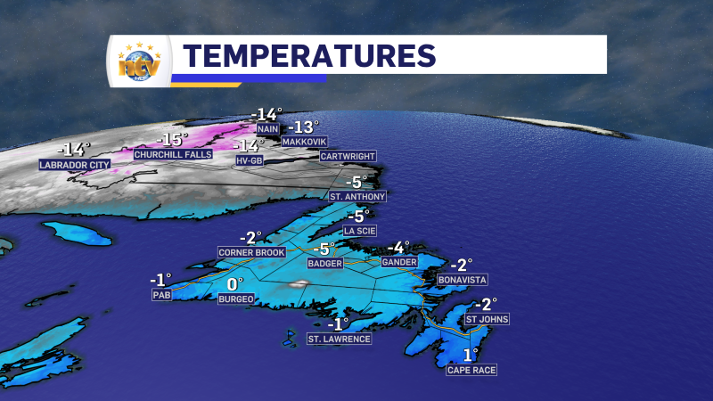
Temperatures are hovering near or a bit below the freezing mark early this afternoon across much of the Province. Wind speeds are lower than yesterday, so wind chills aren’t much less than air temperatures.
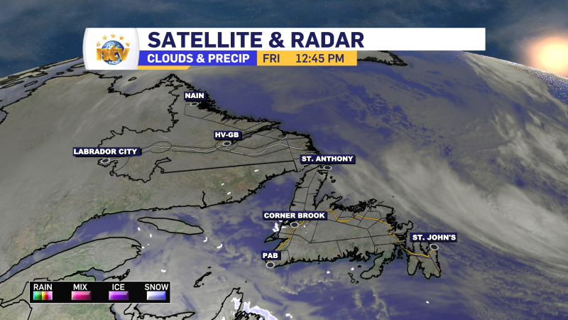
Satellite and radar imagery shows a storm is out in the North Atlantic, but it is departing, and in its wake, there’s not a whole lot ongoing other than some flurries over the Cape Breton Highlands. Saturday will be similar.
Post 1 – 6:00 AM NST (5:30 AM AST)
Good Friday morning!
The weather across the Province today will be pretty tranquil. Other than scattered flurries, we can expect partly cloudy skies on the island and mostly sunny skies for most of the Big Land. Now, we are off to a bit of a cold start in parts of central and western Newfoundland, where it’s close to -10 this morning. Its even colder in Labrador West, where readings are into the -20s. Highs today reach the single digits above and below freezing on the Island, generally minus teens in Labrador.
Today is also the first day of the season for skiers and riders at Marble Mountain! Expect partly cloudy skies on the hill throughout the day, with temperatures reaching -3° or so for the afternoon high. Winds will be light from the south.
-

Hot and humid start to the weekend
The Island will see sunny skies to start today. There are a few fog patches…


