Post 2 – 6:43 PM NST (6:13 PM AST)
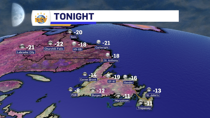
It’s shaping up to be a cold night across the Island, with lows forecast to be in the minus teens and perhaps minus 20s in some areas of central and the interior. Flurries will persist over the West Coast and South Coast. Labrador will be chilly and generally partly cloudy, with lows in the minus 20s.
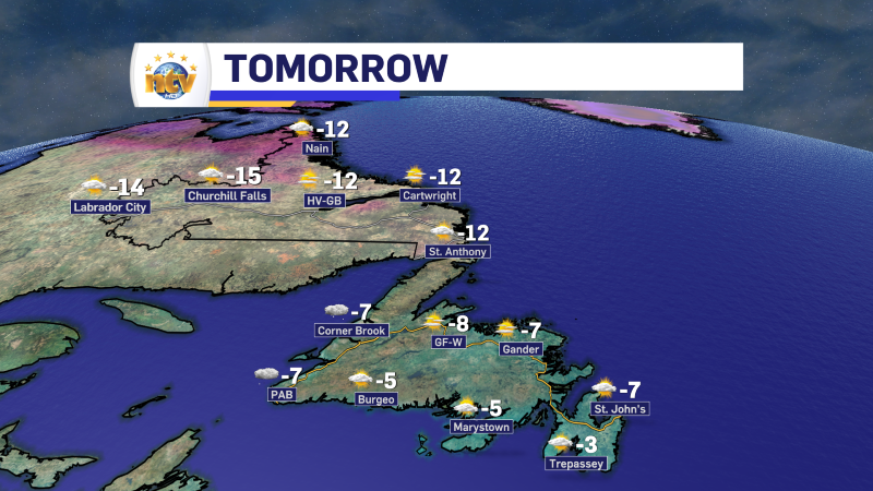
Thursday looks quiet across most of the board. The exception will be on the West Coast and near the South Coast where flurries will be flying through the morning. They should ease in the afternoon as warmer air starts to move in aloft ahead of our next weather maker.
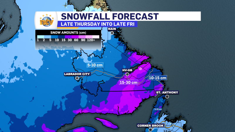
Friday will see an area of low pressure swing through which will bring snow to much of the Island during the first half of the day. The snow will then change to rain by midday from Rocky Harbour to St. John’s, point south. North of there it looks like it will remain snow through the day. Snow will also fly in Labrador through the day. While amounts don’t look overly significant for most, we are looking at a 2 – 5 cm over much of the Island, with the West Coast and GNP seeing up to 15 cm.
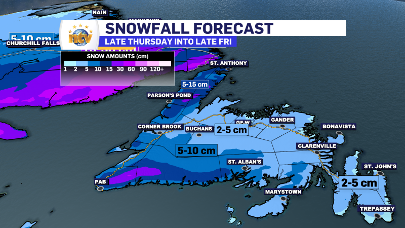
The snow in Southeast Labrador will arrive Friday and will not end until early Saturday. The amount looks to be 10 to 20 cm, with some spots showing up to 30 cm.
These forecasts may change slightly over the next day, so check back.
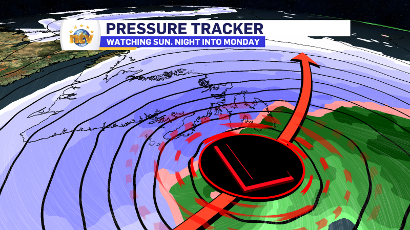
Once past Friday the weather is pretty quiet for the weekend. Then we look to Monday, which may bring the first actual winter storm of the season to the Avalon and some adjacent areas of eastern Newfoundland right now. While it’s too early to get into amounts, if the forecast remains similar to what I’m seeing today, expect significant disruption to travel on Monday due to snow and wind. Stay tuned for this one!
Post 1 – 9:43 AM NST (9:13 AM AST)
We are having a chilly day across the Province as arctic air arrived from the Big Land overnight. As of 9:30 AM NST, temperatures across the Island are near -10 with wind chills into the minus tees and 20s. Colder readings are being found in the Big Land.
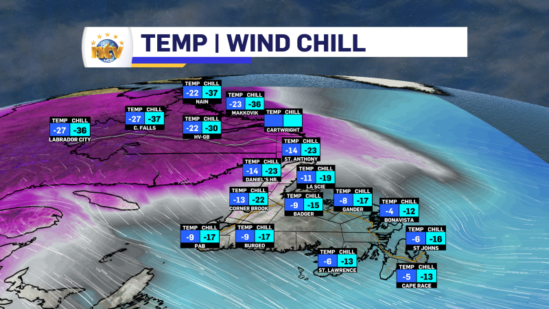
We are also seeing snow flurries and snow squalls over many areas, but they are most intense along and near the West Coast. The flurries and squalls will persist in that area through the day, and travel will remain challenging in some areas.

There is also a pocket of light snow and flurries currently north of much of the Avalon, and it is dipping south. This could bring some light snow to the Avalon North and Metro if it keeps drifting south. Amounts will be light, but anything that falls will stick with temperatures so cold.

Updates are to come throughout the day.
-
Hot weather continues across the province
It will be another nice day across the Island portion of the province with a…