Post 1 – 8:13 AM NST (7:43 AM AST)
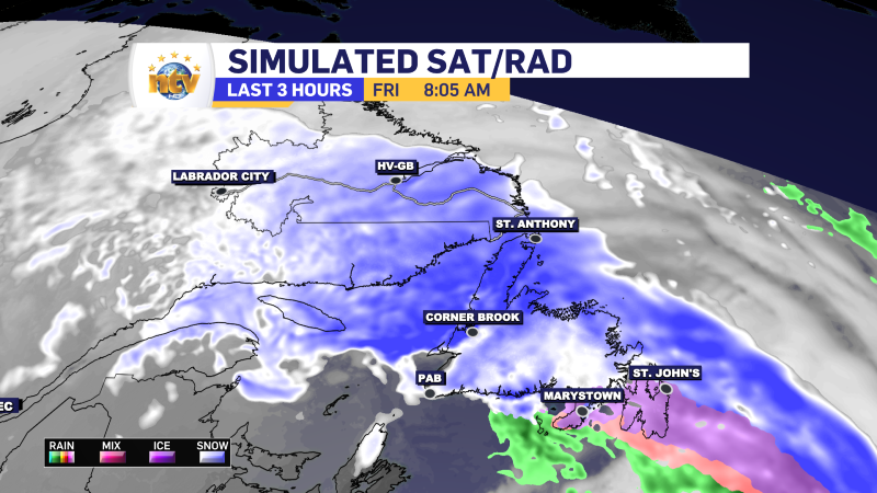
A winter storm arrived overnight, and most of the province is waking up to snowfall at varying rates and intensities this morning. Simulated radar imagery does a good job of showing you where the snow is most likely falling at this hour of the day. Temperatures for eastern areas should rise to near or above freezing for a short time later this morning or early afternoon before falling once more.
Winter Storm and Blizzard Warnings are in effect this morning, along with a Blowing Snow Advisory. Some of these alerts will be scaled back later this morning, particularly in the east, where the snow and blowing snow will ease before midday.
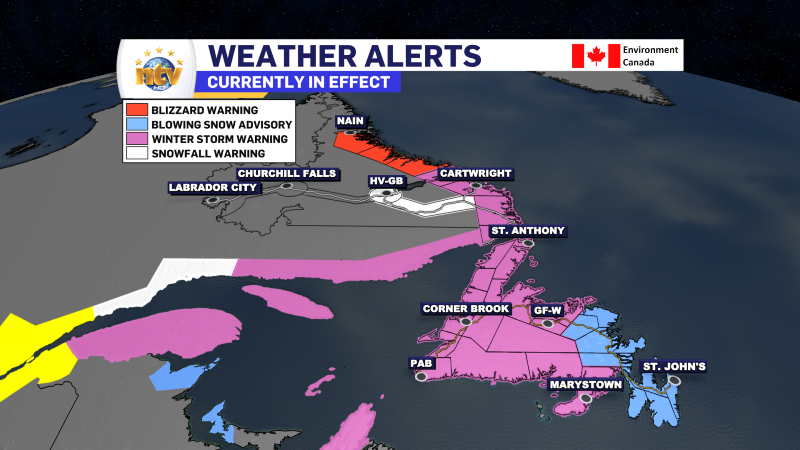
The Winter Storm and Blizzard Warnings for the West Coast and Labrador will likely remain in effect into Saturday or even Sunday, as heavy snowfall and high winds will continue in those areas through much of the weekend. Snowfall amounts in excess of 30 cm are likely through much of the area. Amounts will be much higher in the higher terrain.

Wind Warnings are also in effect for later today and Saturday for much of the Island and gusts are expected to peak near 100 km/h as the area of low pressure bringing today’s weather intensifies and stalls north of Newfoundland and east of Labraodr through Saturday.
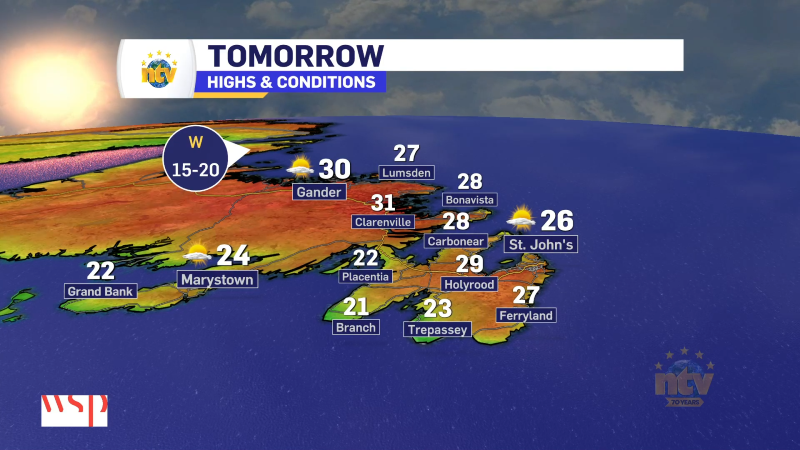
Forecast
Today will see the weather improve along the South Coast, Central and eastern Newfoundland while the West Coast, GNP and much of Labrador will remain in the snow. In fact, on the West Coast the snow will ease off this morning but will become more widespread and intense this afternoon. Coastal Labraodr will see the snow and wind increase in intensity later today and tonight, which will continue into tomorrow.
Details to follow later today.
-

Hot weather continues across the province
It will be another nice day across the Island portion of the province with a…