


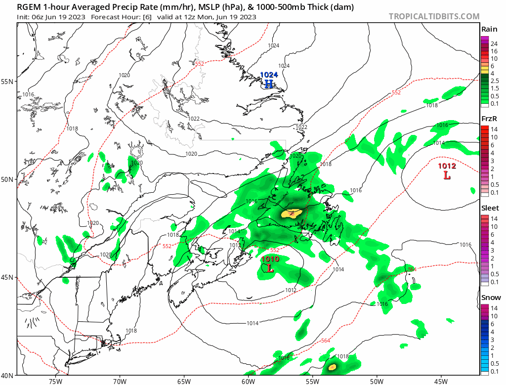
An area of low pressure is doing its thing south of the Island this morning. What’s the thing you ask? It’s driving clouds, drizzle, fog, and rain across much of the Island. Not all areas are experiencing everything mentioned previously, but most locations are experiencing one or more. The radar imagery, below, patins this picture well.
The area of low pressure will remain south of the Island today and will slowly move eastward. This track will keep the rain and drizzle and fog ongoing for a lot of areas through today and into tonight. The rain will end for much of southern and western Newfoundland by later this afternoon or early this evening. However, eastern and Central areas will see the rain, drizzle, and fog linger through Tuesday. Although the heaviest and steadiest rain will fall today into this evening. The animation below shows this nicely.
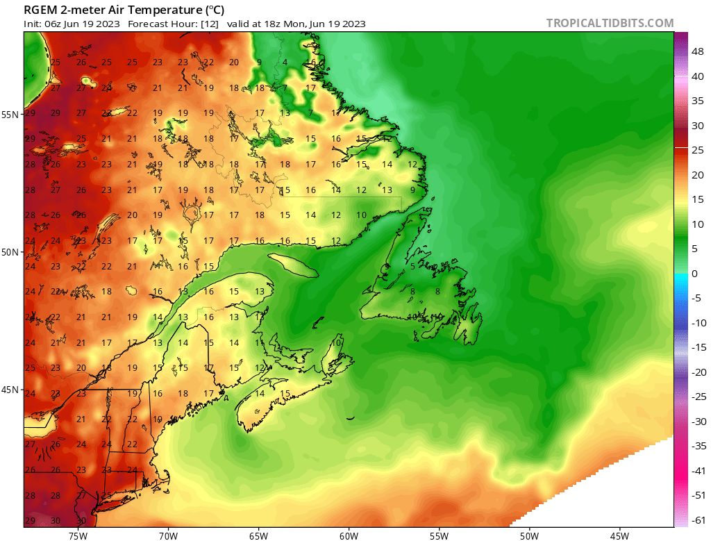
Due to the nature of this pattern, temperatures today will not be overly warm. We can expect highs on the Island to be in the 5 to 10 range. Labrador will see significantly warmer temperatures, and more sunshine, under a big ridge of high pressure. The chart below highlights this well! It’s the projected max temperature this afternoon.
Tuesday sees a slight improvement for much of the Island, except east and Central where the drizzle and clouds and fog and cool temps remain. However, after Tuesday, we should get a nice turn in the weather with lots of sunshine and warmer temperatures. There’s even the chance that St. John’s will see its first 20º+ day Thursday!
Have a great day!
Eddie
-

Hot and humid start to the weekend
The Island will see sunny skies to start today. There are a few fog patches…


