


Good Monday morning!
The weather across the Province is going to start on the quiet and cold side to begin the day, and subsequently, the work week. It’s also a cold start to the day, with temperatures in the Province a few ticks above or below freezing, and wind chills well below. Make sure you have that winter coat on the kiddos as they’re heading out the door to school this morning!
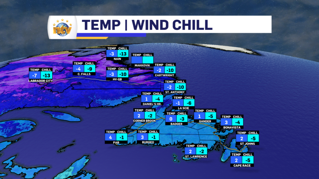
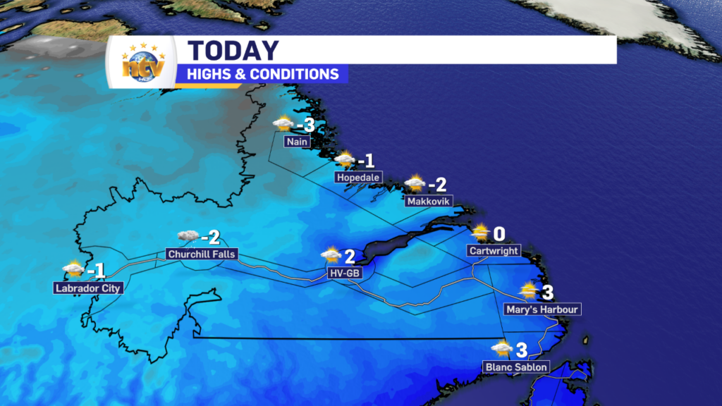
Today will generally be chilly and sunny in the Big Land, with highs reaching the single digits above and below freezing for highs this afternoon. There will also be some flurries in the west at times. The wind speeds will also be slower than yesterday, as the tight pressure gradient that caused the high speeds along the coast is relaxing.
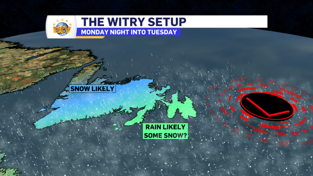
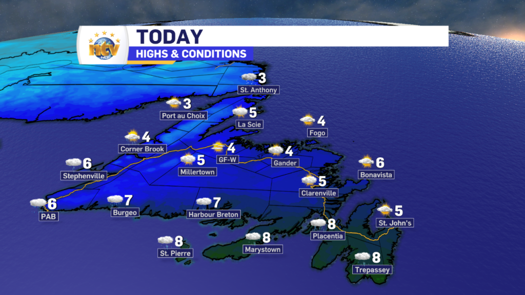
On the Island, most areas will start with sunshine this morning. However, the clouds will roll in between late morning and mid-afternoon. This will be followed by the arrival of rain and wet snow later this afternoon and this evening. Temperatures will peak in the mid to upper single digits before the precipitation arrives later today.
The rain and snow will spread across the Island from southwest to northeast and will affect almost every area south of the Great Northern Peninsula between late this afternoon and early Tuesday morning. At this point, it looks like most of the Island west of the Avalon Peninsula and north of the Burin Peninsula will see snow, or rain changing to snow, this afternoon or early this evening. On the Avalon and Burin Peninsulas, in my opinion, it will be too warm for any appreciable snow to fall. There may be some flakes mixed in, at times, but as of this writing that’s about all I see for those areas.
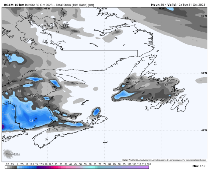
To the west, and I mean just to the west, from Clarenville and the Bonavista Peninsula to the West Coast and Southwest/South Coast, I expect a large area of wet snow late today and tonight. Amounts will not be overly significant, as much as 5 cm or so on grassy surfaces, but it will be enough to make roads slippery in some areas as temperatures will fall to near 0º by Tuesday morning. The exception will be right on the coastlines, where it will be sloppy wet snow mixed with rain. Future radar shows this well and times it out for you, hour by hour.
Note that the amounts here WILL NOT be significant, what is significant is that this will be the first widespread snowfall of the season… and we’re not even into November yet! Amounts will generally be 5 cm or less for areas west of the Avalon and north of the Buirn Peninsulas. On those two Peninsulas, there may be some light accumulation in the highest elevations, the Heart’s Content Barrens comes to mind.
The image below shows where the snow will likely accumulate late today and into the overnight. This is the RDPS model and it suggests the snow remaining north of the Burin/Avalon and south of the GNP. The highest amounts will probably be somewhere in the southwest, in the higher terrain. But even there, we’re only looking at maybe 10 cm in the highest in hills.
I’ll have an updated forecast for you this afternoon. Have a great day!
/Eddie
-

Hot and humid start to the weekend
The Island will see sunny skies to start today. There are a few fog patches…


