


THIS ALERT HAS BEEN ENDED
Updated at 6:57 AM NST on January 8, 2024 to reflect the changes to the alerts and the storm surge warning for St. Joh’ns & vicinity.
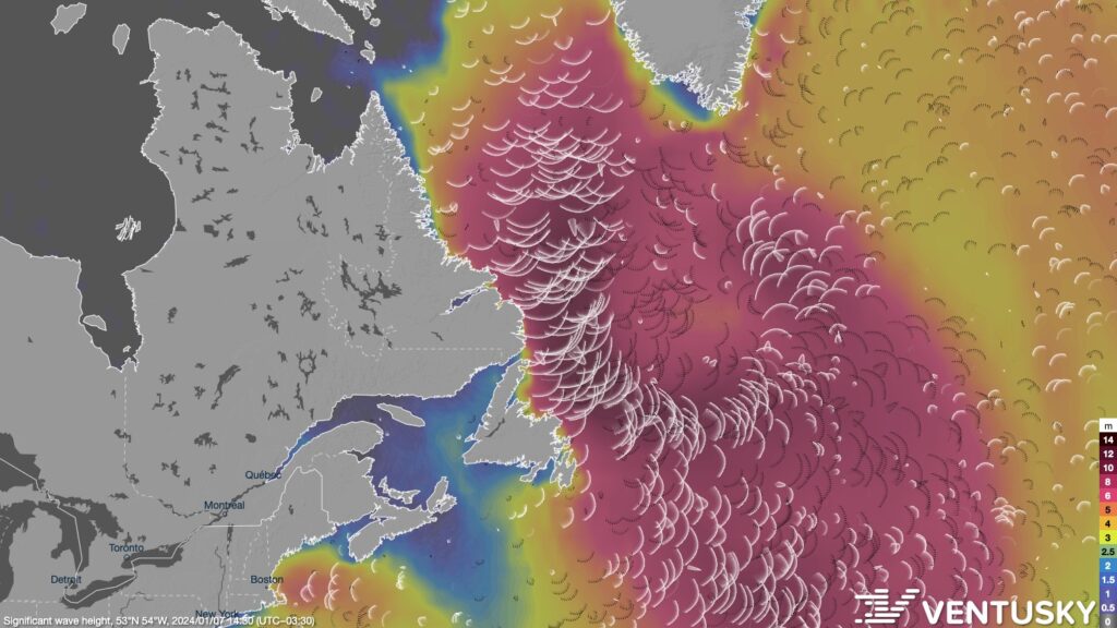
An intense storm will remain nearly stationary south of Greenland for the next several days. This system will produce long-period swells, with large breaking waves approaching the coast. Similar events in the past have caused coastal flooding, beach erosion, minor infrastructure damage, spread of coastal debris, and localized coastal road washouts.
A Storm Surge Warning is in effect for St. John’s and vicinity for north-facing shorelines exposed to northerly swell in Conception Bay through Tuesday morning. Maximum water levels may exceed high astronomical tide levels, with large breaking waves pushing water onto vulnerable sections of the coastline. Wave heights will be 6 to 8 metres, breaking upon approach to shore.
Highest risk of flooding is expected during high tide early this morning (near 4:30 am), and early Tuesday morning (near 5:30 am).
Environment and Climate Change Canada has issued a Special Weather Statement for coastal areas of Bonavista North, Terra Nova, the Bonavista Peninsula, and the Avalon Peninsula North for large waves and pounding surf through Tuesday morning.
Highest risk of flooding is expected during high tide early this morning (near 4:30 am), and early Tuesday morning (near 5:30 am).
Remember to keep a safe distance from the water, as water levels can quickly rise without warning when waves of this magnitude are breaking near the shoreline.
-

Hot and humid start to the weekend
The Island will see sunny skies to start today. There are a few fog patches…


